Information
City: BorgarnesCountry: Iceland
Continent: Europe
Borgarnes, Iceland, Europe
Borgarnes serves as the gateway to the Snæfellsnes Peninsula and the primary commercial hub for the Borgarfjörður region. It is characterized by its dramatic position on a peninsula jutting into the fjord, its deep ties to Icelandic sagas, and its role as a vital transit point for those traveling between Reykjavík and the North.
Historical Timeline
The area was settled in the 9th century by Skalla-Grímur Kveldúlfsson, the father of the warrior-poet Egill Skallagrímsson. The town itself began to form in the late 19th century when it was designated a trading port. The primary event shaping its modern infrastructure was the 1981 completion of the Borgarfjarðarbrú, the second-longest bridge in Iceland, which diverted the Ring Road directly into the town and ended the era of ferry transit across the fjord.
Demographics & Population
The population is approximately 2,200 (2026 estimate). The demographic is predominantly Icelandic, with a stable workforce engaged in regional administration, education (linked to the nearby Bifröst University), and the dairy industry. The median age is approximately 39 years.
Urban Layout & Key Districts
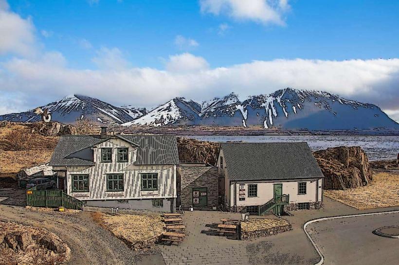
The town is built on a rocky promontory. Key areas include the Old Town (Gamli bærinn), located at the tip of the peninsula with preserved wooden buildings; the Commercial Strip along the Ring Road, housing major service stations and supermarkets; and the Residential Slopes, offering views over the fjord toward the Esja and Akrafjall mountains.
Top Landmarks
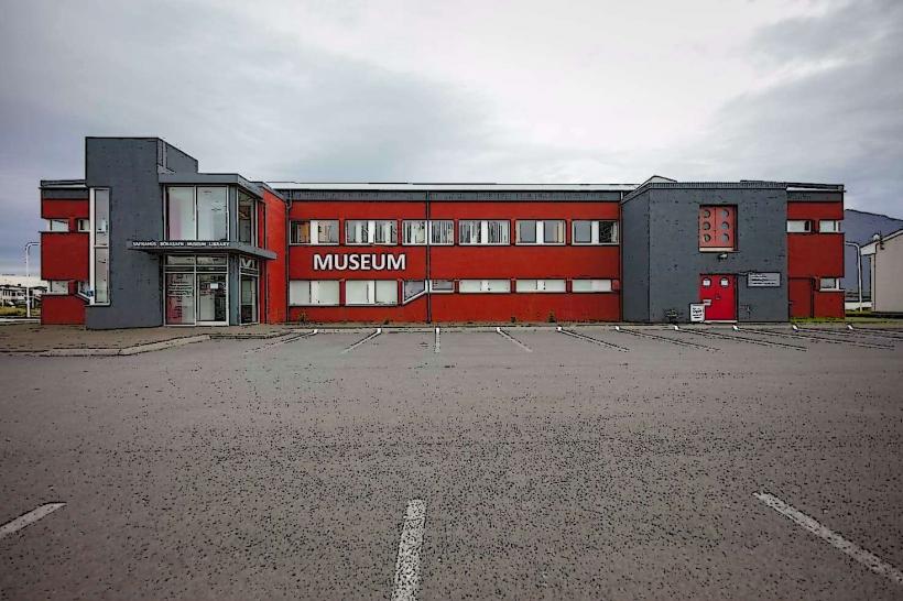
The Settlement Center (Landnámsssetur Íslands): An award-winning museum detailing the settlement of Iceland and Egils Saga.
Borgarfjarðarbrú: The iconic 520-meter bridge spanning the fjord.
Brakarey: A small island connected by a short bridge, named after a slave in the sagas.
Skallagrímsgarður: A public park containing the burial mound of Skalla-Grímur.
Borgarnes Swimming Pool: Renowned for its outdoor slides and views of the surrounding mountains.
Transportation Network
Movement is dictated by the Ring Road (Route 1). There is no rail transit. Public transport is provided by Strætó Route 57, which connects Reykjavík to Akureyri, with Borgarnes serving as a primary stop. Most travel is via private vehicle. The town serves as the junction for Route 54, the main artery into the Snæfellsnes Peninsula.
Safety & "Red Zones"
The safety level is extremely high. There are no "red zones." The primary risks are environmental: the bridge and the plains around Borgarnes are subject to extreme crosswinds that can be dangerous for high-profile vehicles (campers/vans). During winter storms, the Holtavörðuheiði mountain pass to the north frequently closes, often leaving travelers stranded in Borgarnes.
Digital & Financial Infrastructure
Average internet speed is 100–1000 Mbps via fiber-optic. Main carriers are Síminn and Nova. The town is 100% cashless. All museums, gas stations, and bakeries accept international credit cards and mobile payments. ATMs are located at the Arion Banki and Íslandsbanki branches.
Climate & Air Quality
Temperatures range from -3°C in winter to 14°C in summer. Borgarnes is known for its windiness due to its exposed coastal position. Air quality is exceptional.
Culture & Social Norms
Tipping is not required. The local culture is deeply intellectual, centered on the preservation of the Sagas. Respect for historical markers and burial mounds is mandatory. Social life revolves around the local bakery (Geirabakari) and the sports center.
Accommodation Zones
Stay in the Old Town for historic guesthouses and proximity to the Settlement Center.
Stay in the Ensku húsin (English Houses) area on the outskirts for fly-fishing heritage and river views.
Local Cost Index
1 Espresso: 600 – 800 ISK
1 Standard Lunch (Lamb Soup/Burger): 2,800 – 3,800 ISK
1 Settlement Center Entry: 3,000 ISK
Nearby Day Trips
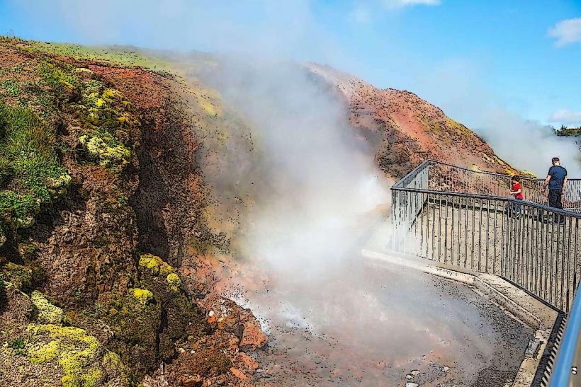
Deildartunguhver (Europe’s most powerful hot spring): 37 km (30 minutes)
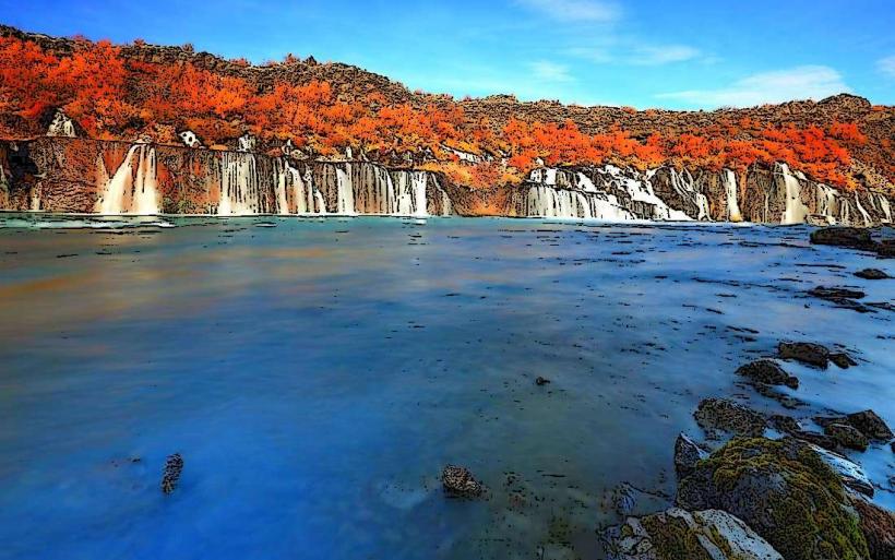
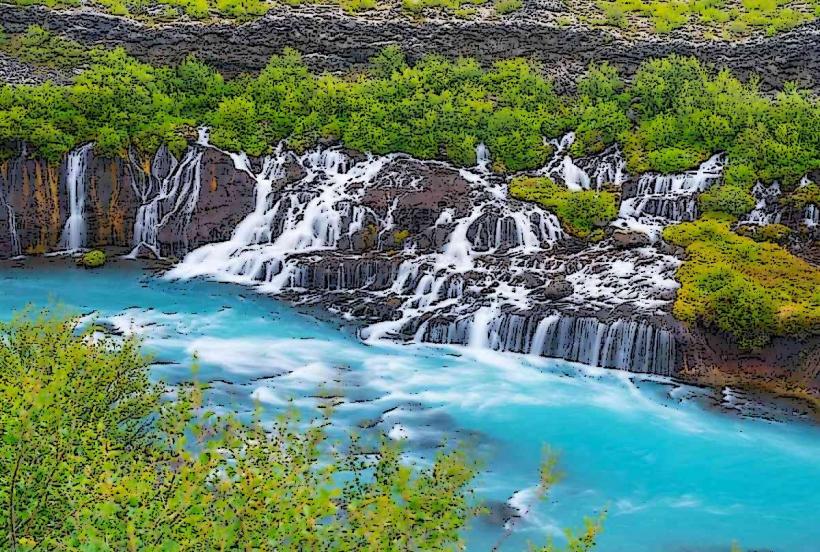
Hraunfossar & Barnafoss Waterfalls: 55 km (45 minutes)
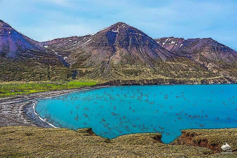
Snæfellsjökull National Park: 115 km (1.5 hours)
Reykholt (Historic site of Snorri Sturluson): 38 km (30 minutes)
Facts & Legends
Borgarnes is the primary setting for Egils Saga, one of the most famous pieces of medieval literature. Local legend claims that the rock formations around the town are petrified trolls, while a verified historical fact is that the town’s bakery, Geirabakari, was used as a filming location for "Papa John's" in the 2013 film The Secret Life of Walter Mitty.