Information
City: CanariesCountry: Saint Lucia
Continent: North America
Canaries, Saint Lucia, North America
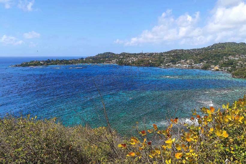
Canaries is a secluded coastal village on the west coast of Saint Lucia, situated between Anse La Raye and Soufrière. It is the smallest district in the country and is geographically defined by its location at the mouth of the Canaries River, nestled in a deep valley surrounded by steep, emerald-green ridges.
Strategic Context & Infrastructure (2026)
Road Network: As of January 2026, the section of the West Coast Highway passing through Canaries has been completely rehabilitated. This project is part of a massive national road modernization initiative worth $87 million XCD, which improved drainage and slope stability against landslides.
Resilience: The settlement is a priority zone within an urban resilience project aimed at protecting the low-lying parts of the village from flooding during river overflows.
Tourism: In 2026, Canaries is developing as a center for community tourism. Local initiatives focus on offering authentic experiences such as demonstrations of traditional cassava bread baking and cultural tours, serving as a quieter alternative to busy Soufrière.
Demographics & Population
The district's population in 2026 is approximately 2,100. The community is predominantly of African descent. The economy relies on artisanal fishing and agriculture in the fertile valley, with an increasing portion of the younger population engaging in tourism services and eco-guiding.
Key Landmarks
Canaries Waterfall: Located inland along the river's course, this waterfall offers privacy and natural pools amidst the tropical forest.
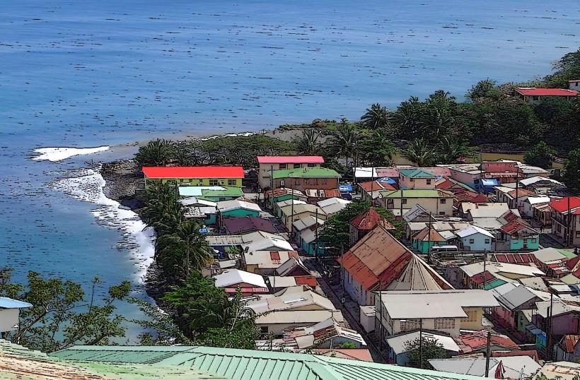
Belvedere Lookout: Located south of the village on the main road, it provides the most recognizable view of the Canaries rooftops against the Caribbean Sea.
St. Rose of Lima Church: A central historical and spiritual site in the village, reflecting French colonial influence.
Canaries Bay: A beach featuring unique dark volcanic sand, primarily used by local fishers for launching traditional wooden pirogues.
Transportation & Connectivity
Access: Accessible via the winding West Coast Road; approximately 45 minutes from Castries and 20 minutes from Soufrière.
Public Transit: Served by Route 3A minibuses.
Financials: There are no banks or ATMs in Canaries; cash must be obtained in Soufrière or Castries.
Facts & Legends
Legend says that the village was named after the Amerindian word for "cooking pot" (canari), referring to the traditional clay pots crafted by the original inhabitants using river clay. A geographic fact: Canaries is the most geographically isolated of Saint Lucia's coastal villages due to the extreme verticality of the surrounding mountain ranges. Historically, the village was a primary site for the production of charcoal, which was once the island's main source of cooking fuel.