Information
Landmark: Anse JambonCity: Canaries
Country: Saint Lucia
Continent: North America
Anse Jambon, Canaries, Saint Lucia, North America
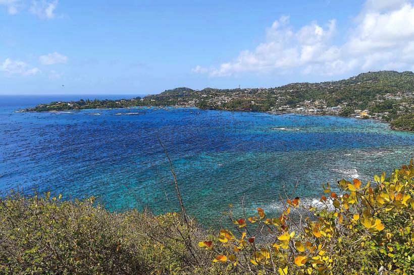
Anse Jambon is a coastal area located south of the town of Canaries in Saint Lucia.
This location is characterized by its undeveloped shoreline and surrounding tropical vegetation.
Visual Characteristics
The beach at Anse Jambon consists of dark volcanic sand. The water clarity varies, but it is generally a deep blue. The shoreline is backed by dense, green tropical foliage, including palm trees and various shrubs. No significant man-made structures are present directly on the beach.
Location & Access Logistics
Anse Jambon is situated approximately 3 kilometers south of Canaries. Access is primarily via the main coastal road, the A4 highway. The turn-off to Anse Jambon is an unpaved track, approximately 0.5 kilometers long, which can be navigated by most vehicles, though high clearance is recommended after heavy rain. Parking is informal and available along the track leading to the beach. Public transport to Canaries is available via bus routes 1A and 1B from Castries. From Canaries, local taxis or a significant walk (approximately 45 minutes) are required.
Historical & Ecological Origin
Anse Jambon is a natural formation, part of the volcanic geology of Saint Lucia. The dark sand is a result of eroded volcanic rock. The area is classified as a coastal tropical ecosystem, supporting a variety of local flora and fauna.
Key Highlights & Activities
Swimming is possible in the sea. Beachcombing along the shoreline is an available activity. Observation of local birdlife is possible within the adjacent vegetation.
Infrastructure & Amenities
There are no public restrooms or designated shade structures at Anse Jambon. Food vendors are not present at this location. Cell phone signal (4G/5G) is intermittent and generally weak.
Best Time to Visit
For photography, early morning or late afternoon provides softer light. The dry season, from December to May, offers the most favorable weather conditions with less rainfall. High tide can reduce the visible beach area.
Facts & Legends
Local folklore suggests that Anse Jambon was historically used as a clandestine landing point for small boats due to its relative seclusion. The name "Jambon" is believed to derive from a corruption of a French term related to the area's geography or past use.
Nearby Landmarks
- Anse Chastanet (1.5km North)
- Piton Viewpoint (2.0km North-West)
- Soufrière town center (10.0km South)
- Diamond Falls Botanical Gardens (12.0km South)
- Sulphur Springs Park (13.0km South)