Information
City: CappadociaCountry: Turkey
Continent: Asia
Cappadocia, Turkey, Asia
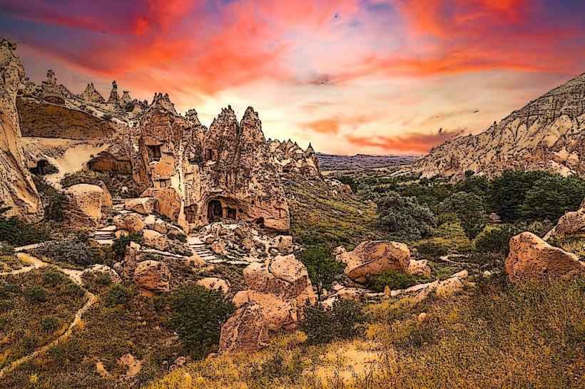
Cappadocia is a high-altitude historical region in Central Anatolia, defined by a surreal volcanic landscape of "fairy chimneys" (eroded tuff spires), troglodyte dwellings, and vast subterranean cities. It is a UNESCO World Heritage site and a global center for aerostatics.
Geography & Key Towns
Cappadocia is not a city but a region encompassing parts of Nevşehir, Kayseri, Aksaray, and Niğde provinces.
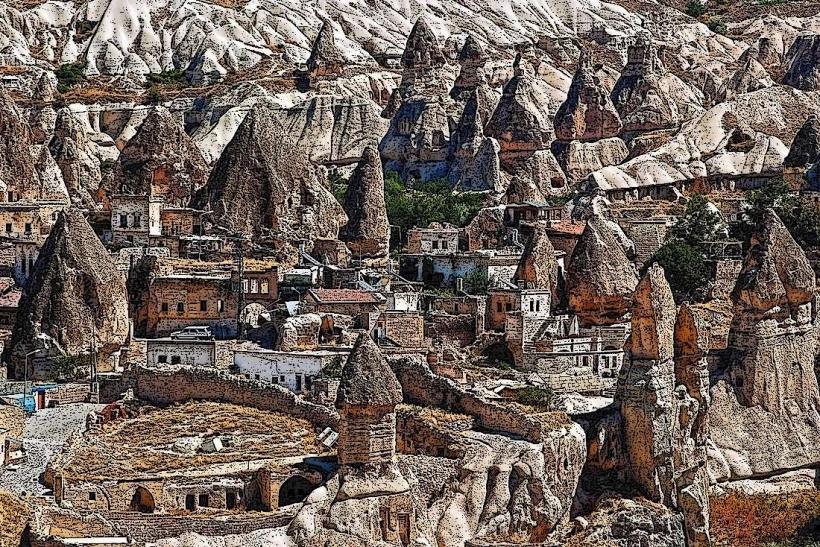
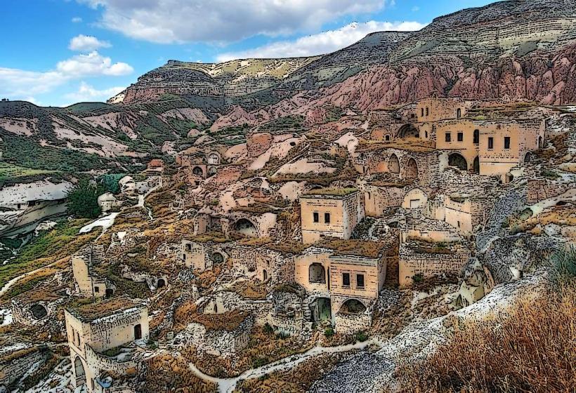
Göreme: The primary tourist hub and center of the National Park. Best for first-time visitors, walking access to valleys, and viewing sunrise balloons.
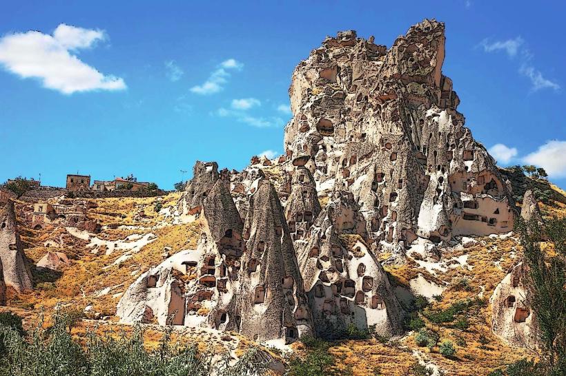
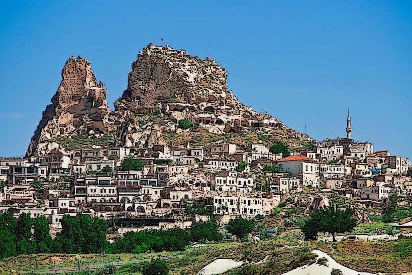
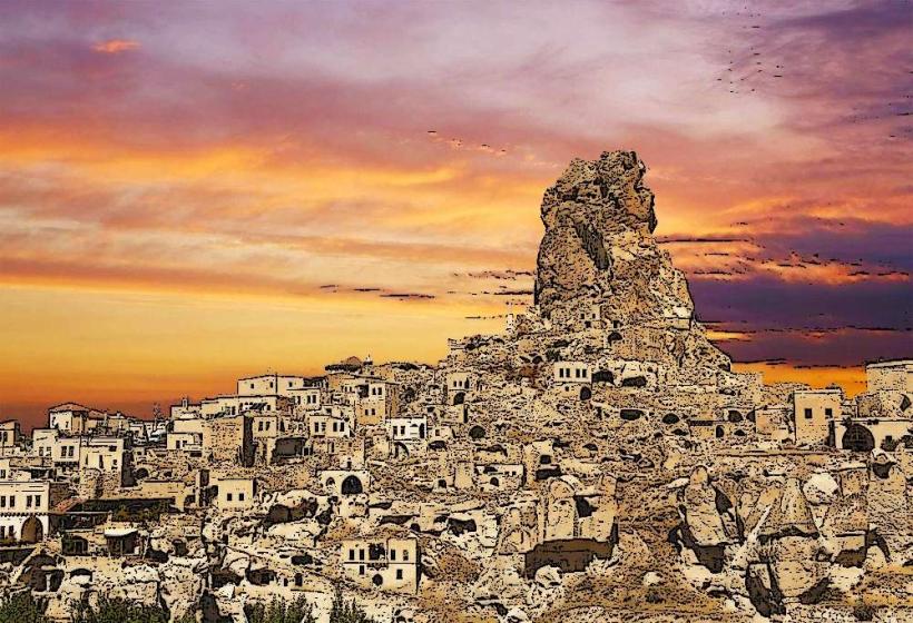
Uçhisar: The highest point in the region, centered around a massive rock citadel. Known for luxury cave hotels and panoramic views.
Ürgüp: A more sophisticated town with high-end boutique hotels, vineyards, and a vibrant nightlife scene.
Avanos: Situated on the Kızılırmak (Red River); famous for its 3,000-year-old pottery tradition using local river clay.
Mustafapaşa (Sinasos): A quieter village known for Greek Orthodox architecture and Cappadocia University.
Top Landmarks & Activities
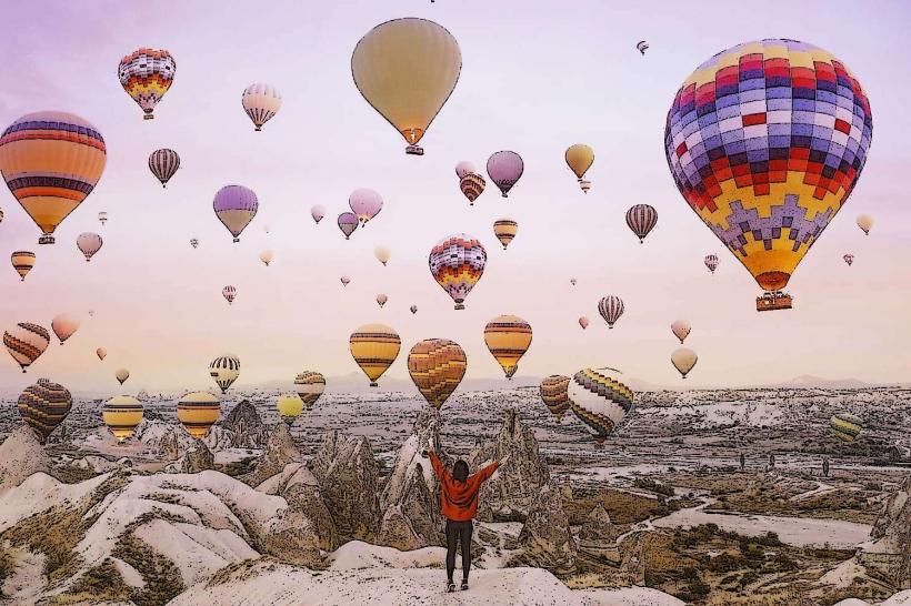
Hot Air Ballooning: The region’s signature experience. In 2026, standard 1-hour flights cost approximately €150–€250, while off-season winter rates drop to €90–€120.
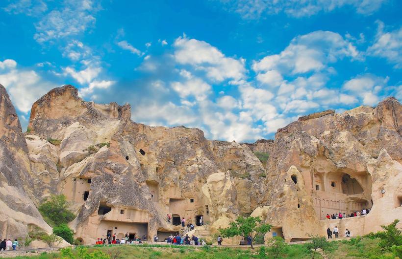
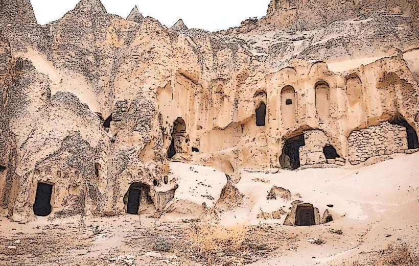
Göreme Open Air Museum: A monastic complex of rock-cut churches with well-preserved Byzantine frescoes (9th–11th centuries).
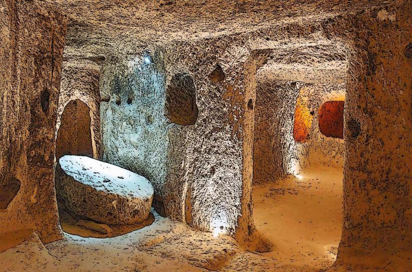
Underground Cities (Derinkuyu & Kaymaklı): Multi-level subterranean networks that once sheltered up to 20,000 people from invaders. Derinkuyu descends 85 meters.
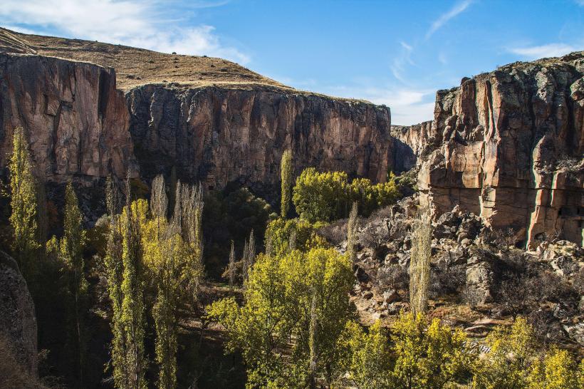
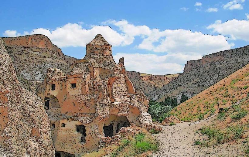
Ihlara Valley: A 14 km-long gorge containing hundreds of cave churches and a river-side hiking trail.
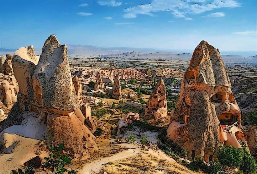
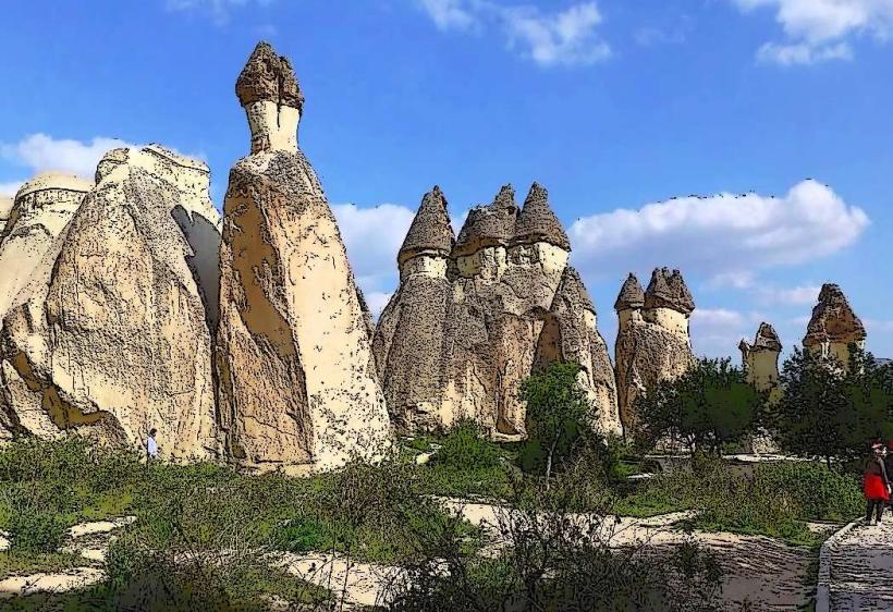
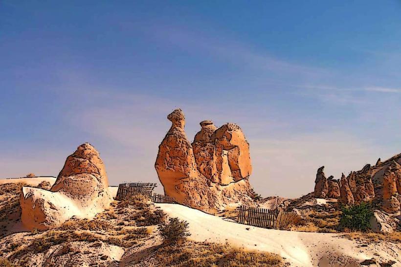
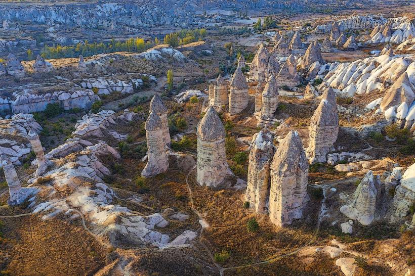
Fairy Chimney Valleys:
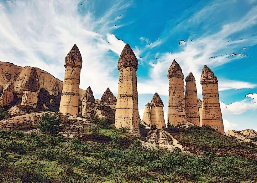
Love Valley: Famous for its tall, phallic rock formations.
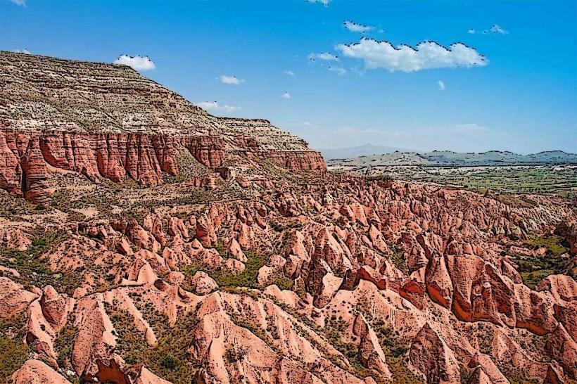
Rose & Red Valleys: Known for their distinct pinkish hue and premier sunset hiking.
Devrent (Imagination) Valley: Rock formations that resemble animals, including a famous "camel" rock.
Transportation Network
Airports: Served by Nevşehir Kapadokya (NAV) (closer to Göreme) and Kayseri Erkilet (ASR) (larger, more flight options).
Intercity: High-speed rail connects Istanbul/Ankara to Konya or Karaman, from where buses complete the journey.
Local Movement: The Dolmuş (minibus) network connects the main towns for 25–40 TL ($0.75–$1.10). Car rentals are highly recommended for exploring remote valleys and cost roughly €30–€50 per day.
Organized Tours: Most visitors utilize the "Color Tours":
Red Tour: Highlights of the central region (Göreme, Uçhisar, Avanos).
Green Tour: Southern sites (Derinkuyu, Ihlara Valley, Selime Monastery).
Safety & Travel Status
As of 2026, Cappadocia remains one of the safest regions in Turkey for international tourists. The area is heavily policed and economically dependent on tourism.
Earthquake Risk: Unlike the southeastern provinces, Cappadocia was not significantly affected by the 2023 seismic events and its infrastructure is fully operational.
Solo Travel: Very common and safe, including for solo female travelers.
Balloon Safety: Flights are strictly regulated by the Turkish Civil Aviation Authority; cancellations occur frequently due to wind-plan for at least a 3-night stay to ensure a flight window.
Climate & Seasonal Variation
Continental Climate: Hot, dry summers ($28^{\circ}\text{C}$ to $35^{\circ}\text{C}$) and cold, snowy winters ($−5^{\circ}\text{C}$ to $5^{\circ}\text{C}$).
Best Time to Visit: April–June or September–October for ideal hiking weather. Winter (January–February) offers the most dramatic scenery with snow-covered fairy chimneys and significantly lower prices.
Local Cost Index (2026 Estimates)
Budget (Hostel/Street Food): €35–€55/day.
Mid-Range (Cave Hotel/Tours): €80–€130/day.
Luxury (Suite/Private Tours): €250+/day.
Museum Pass (Cappadocia): Valid for 3 days, providing entry to all major state-run sites.
Facts & Legends
The name Cappadocia is derived from the Old Persian Katpatuka, meaning "The Land of Beautiful Horses." A prominent local legend claims that the fairy chimneys were built by underground fairies to protect themselves from the sun, and the "smoke" seen rising from them (mist) is from their subterranean kitchens. Historically, the "pigeon houses" carved into the cliffs were vital; pigeon droppings were the primary fertilizer for the region's famous vineyards.