Information
City: ChamarelCountry: Mauritius
Continent: Africa
Chamarel, Mauritius, Africa
Chamarel serves as a primary agricultural and ecological tourism hub in the southwestern uplands of Mauritius, primarily within the Black River District. It functions as the island's center for artisanal coffee production and is a critical site for geological and endemic forest conservation.
Historical Timeline
The village is named after Charles-Antoine de Chazal de Chamarel, who received a land concession in the area around 1786. It remained a remote agricultural estate throughout the 19th century, with the Saint Anna church established in 1876. The primary event that shaped the current urban form was the opening of the Seven Coloured Earth Geopark in the late 1960s, which transitioned the local economy from purely subsistence farming and sugar to international nature-based tourism.
Demographics & Population
The permanent population is approximately 780 residents, making it one of the least densely populated villages in Mauritius. The demographic is predominantly Creole (of African and Malagasy descent). The median age aligns with the national average of 37.8 years.
Urban Layout & Key Districts
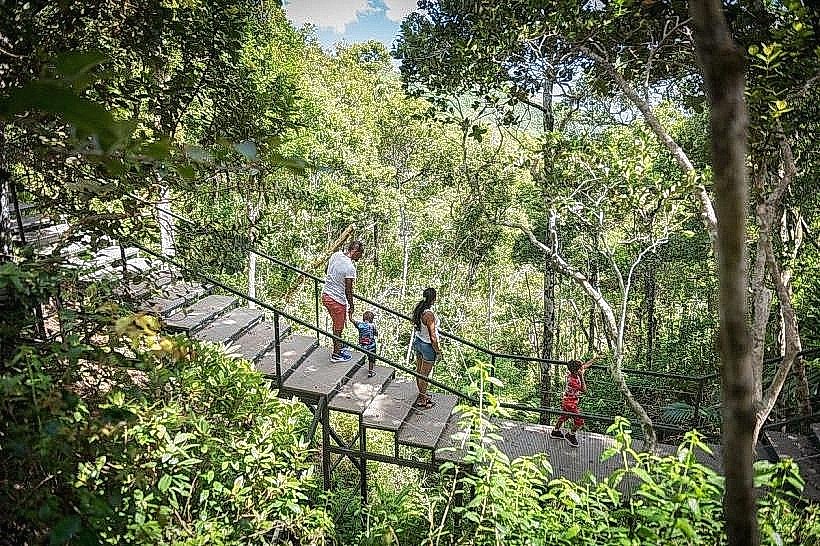
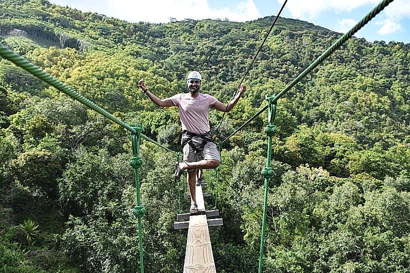
Chamarel is a wooded plateau situated at an average elevation of 260 meters. It is organized around a single main thoroughfare connecting the coastal Baie du Cap region to the central highlands. Key zones include the Village Center, characterized by small-scale residential dwellings and local eateries, and the Geopark/Endemic Forest zones, which encompass the vast majority of the surrounding land area.
Top City Landmarks
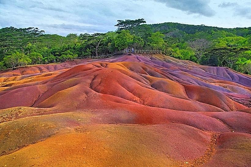
Seven Coloured Earth Geopark
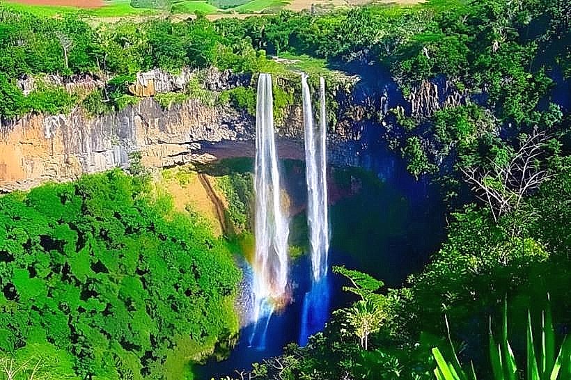
Chamarel Waterfall (Tallest single-drop fall in Mauritius)
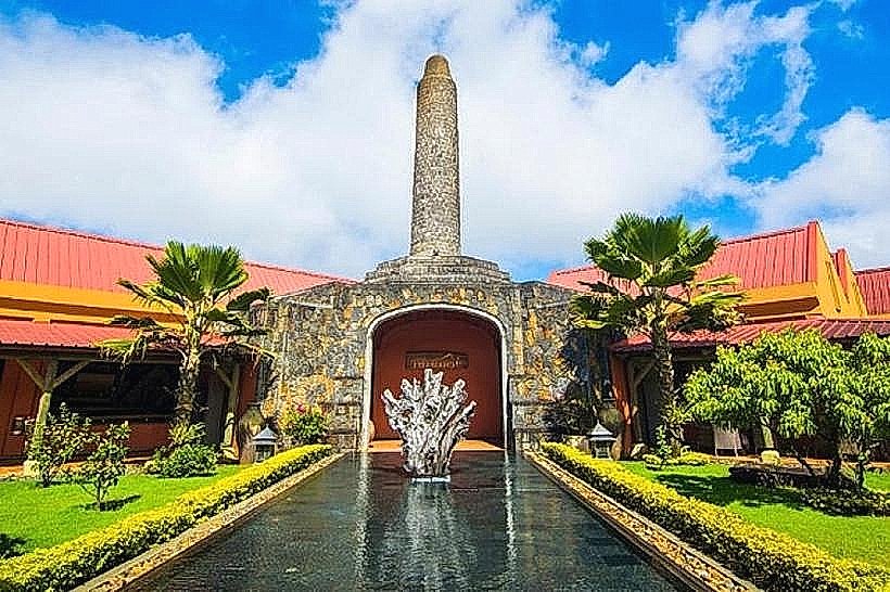
Rhumerie de Chamarel (Distillery)
Saint Anna Church
Transportation Network
Movement within the village and to neighboring regions requires a private vehicle; there is no Metro Express service in this region. Local bus service is irregular and typically requires multiple transfers at Baie du Cap or Choisi. Ride-sharing via the Yugo app is available but wait times are high due to the remote location. Official taxis are white with yellow signs and operate primarily on a pre-booked basis from coastal hotels. Traffic is light, consisting mainly of tourist coaches and agricultural vehicles.
Safety & "Red Zones"
The general safety level is very high due to the small, tight-knit community. There are no specific "red zones," but visitors should avoid hiking in the Black River Gorges or Ebony Forest after 17:00 to avoid becoming lost in the dense terrain. Theft from parked rental cars at isolated viewpoints is a reported risk.
Digital & Financial Infrastructure
Average internet speed is 20-40 Mbps, with speeds varying significantly due to the mountainous topography. Mobile carriers include my.t and Emtel. Card acceptance is high at major attractions (Geopark, Distillery) and upscale lodges; however, the village's small shops and local restaurants are strictly cash-only (Mauritian Rupees). There are no ATMs within the village limits; the nearest are in La Gaulette (6 km away).
Climate & Air Quality
Temperatures range from 16°C to 23°C in winter and 20°C to 28°C in summer. Chamarel experiences a cooler, more humid microclimate than the coast, with frequent localized rainfall and mist. Air quality is among the highest on the island due to the lack of industry and the presence of primary forest.
Culture & Social Norms
Tipping of 10% is common in established restaurants. Handshakes are the standard greeting, often accompanied by "Bonjour." Dress code is casual, but a light jacket is necessary for the cooler highland evenings. Conservatism is expected when visiting the Saint Anna church. Smoking is prohibited in the Geopark and Ebony Forest to prevent wildfires.
Accommodation Zones
Stay in the Highlands (e.g., Lakaz Chamarel) for secluded luxury and panoramic mountain views.
Stay in the Village Farms (e.g., La Vieille Cheminée) for agro-tourism and proximity to hiking trails.
Local Cost Index
1 Espresso (Local Chamarel Coffee): 120 MUR ($2.60 USD)
1 Standard Lunch (Creole Set Menu): 800 MUR ($17.50 USD)
1 Bus Ticket: 35 MUR ($0.75 USD)
Nearby Day Trips
Le Morne Brabant: 14 km (25 minutes)
Black River Gorges National Park: 5 km (10 minutes to entrance)
La Vanille Nature Park: 32 km (50 minutes)
Baie du Cap Macondé Viewpoint: 8 km (15 minutes)
Facts & Legends
A unique geological fact is that the sands of the Seven Coloured Earth never erode despite heavy tropical rainfall, and the distinct colors will naturally separate into layers even if mixed together in a container. Local legend refers to the region as the "Valley of Blacks," reflecting its history as a sanctuary for maroons (escaped slaves) who utilized the dense, inaccessible forests and caves of the plateau to evade colonial authorities.