Information
City: Columbia MOCountry: USA Missouri
Continent: North America
Columbia MO, USA Missouri, North America
Columbia is an independent city and the seat of Boone County, situated in Central Missouri. Known as "Collegetown USA" and "CoMo," it is defined by its tripartite academic foundation-the University of Missouri (Mizzou), Stephens College, and Columbia College-and its status as a high-growth regional hub for healthcare, insurance, and the arts.
Historical Timeline
Inhabited by the Mississippian culture and later the Osage and Missouri peoples. Primary governance eras include its 1818 founding as "Smithton" and its 1821 relocation/renaming to Columbia due to water availability. A critical historical event was the 1839 establishment of the University of Missouri, secured by local citizens who raised triple the funds of any competing city. While largely physically untouched by the Civil War, the city was a Union garrison in a pro-Southern county. The 20th century saw its evolution into a "Research and Information" hub with the arrival of major insurance headquarters (State Farm, Shelter) and the growth of its medical complexes.
Demographics & Population
The population is approximately 127,000 (Metro area ~215,000). The demographics are White (74%), Black or African American (12%), Asian (6%), and Hispanic or Latino (4%). The median age is exceptionally low (29.2) due to the massive student population. The economy is anchored by education (Mizzou is the top employer), healthcare, and a significant professional-services sector.
Urban Layout & Key Districts
Columbia is organized around a vibrant, historic downtown and expanded suburban clusters.
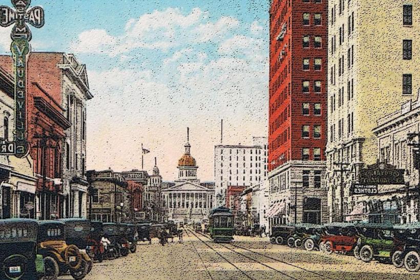
The District (Downtown): The 50-block commercial and cultural core, featuring the "Avenue of the Columns" (8th Street) connecting the courthouse to the university.
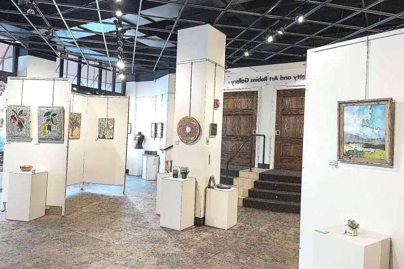
North Village Arts District: A former industrial zone now defined by artist studios, galleries, and "First Friday" art crawls.
Old Southwest: A premier historic residential neighborhood featuring established tree canopies and varied early 20th-century architecture.
The Strollway: The area around Broadway and 9th Street, traditionally the city’s primary promenade and current center for upscale dining and retail.
Flat Branch: A revitalized area on the western edge of downtown featuring the Flat Branch Park and the trailhead for the MKT Trail.
Top City Landmarks
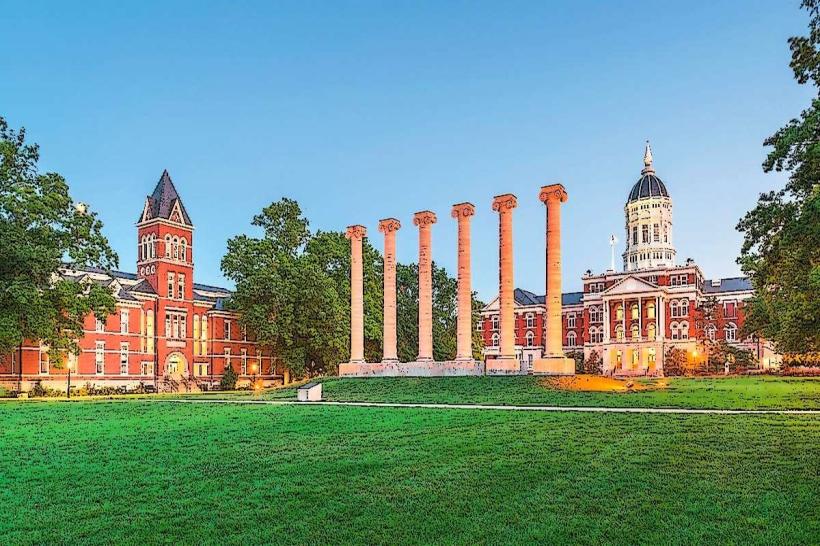
Francis Quadrangle: The historic heart of Mizzou, featuring the iconic six stone columns (remnants of the original Academic Hall) and Jesse Hall.
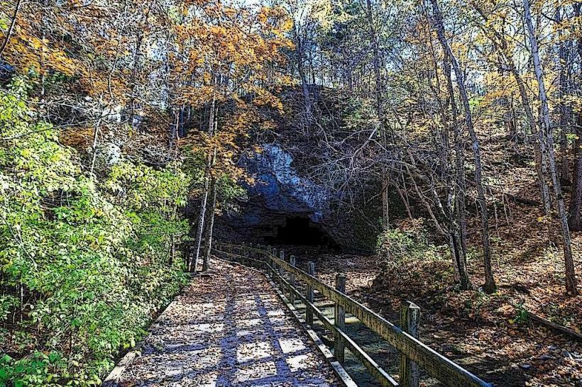
Rock Bridge Memorial State Park: Located 8 km south, featuring the Devil’s Icebox (a double-sinkhole cave) and a natural rock bridge.
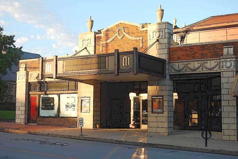
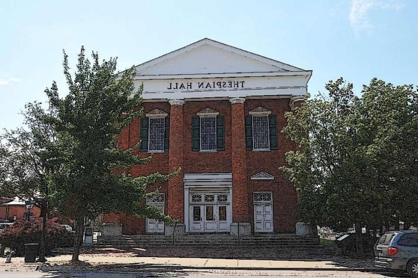
The Blue Note: A legendary 1920s-era theater and premiere live music venue in the heart of the District.
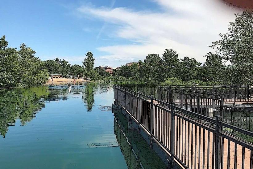
Stephens Lake Park: The city's "crown jewel" park featuring an 11-acre lake, amphitheater, and festival grounds.
Shelter Gardens: A 5-acre botanical garden featuring a one-room schoolhouse and a sensory garden.
MKT Nature and Fitness Trail: A 14-km rail-trail connecting downtown to the statewide Katy Trail.
Transportation Network
Movement is automotive-dependent but uniquely supported by the GO COMO transit system, which utilizes electric buses. The city is a major junction for I-70 and US-63. Commercial air service is via Columbia Regional Airport (COU), 16 km south. The city is one of the most bicycle-friendly in the Midwest, featuring over 220 km of bike lanes and trails. Traffic density is moderate but peaks sharply during Mizzou football home games and student move-in/out weeks.
Safety & "Red Zones"
The general safety level is moderate. Property crime (specifically bicycle theft and theft from motor vehicles) is the primary concern. Statistically, crime rates are higher than the Missouri average. Caution is advised at night in parts of the First Ward (central/north-central) and specific areas near the business loop due to localized narcotics activity and occasional violent incidents. There are no officially designated "red zones." Environmental hazards include seasonal severe thunderstorms and the occasional high-wind events typical of the prairie-Ozark transition zone.
Digital & Financial Infrastructure
Internet speeds are high, averaging 600+ Mbps with fiber availability via Metronet, Spectrum, and Brightspeed. Main mobile carriers are Verizon and AT&T. Card acceptance is universal. ATMs are concentrated in The District and along the Stadium Boulevard retail corridor.
Climate & Air Quality
Temperatures range from -5°C to 4°C in winter and 21°C to 31°C in summer. The city sits on the edge of the great prairies, leading to significant wind and rapid weather shifts. Air quality is high, supported by the extensive "greenbelt" of parks and conservation areas surrounding the city.
Culture & Social Norms
The standard tipping percentage is 20–25%. A casual "Collegetown" greeting is the standard. Dress codes are "Academic-Casual" or "Outdoors-Technical." The city is culturally defined by its "Mizzou" identity, its vibrant "indie" arts scene (exemplified by the True/False Film Fest), and its status as a progressive oasis in central Missouri.
Accommodation Zones
The District / Downtown: Recommended for walkable access to nightlife, the university, and boutique hotels.
I-70 / US-63 Interchange: Recommended for national hotel chains and suburban convenience.
Local Cost Index
1 Espresso: $4.50 (USD)
1 Standard Lunch: $17.00 (USD)
1 Booches Burger: $3.50 (Note: Cash only tradition).
Nearby Day Trips
Rocheport, MO: (20 km west; historic town on the Katy Trail with bluff-top wineries).
Jefferson City, MO: (50 km south; the state capital).
Warm Springs Ranch: (35 km west; the breeding farm for the Budweiser Clydesdales).
Facts & Legends
Columbia was the site of the first agricultural fair in Missouri (1835). Historically, the "Missouri Method" of journalism was pioneered here. A local legend involves the "Gray Lady" of Columbia College, rumored to be the ghost of a student separated from her lover during the Civil War. Another legend concerns Cynthia Jewell, rumored to haunt the Waffle House that was built over part of the historic Jewell Cemetery. One of the city’s most persistent "academic" legends is that if a student walks through the columns on Francis Quadrangle, they are destined to graduate from the university.