Information
City: CurepipeCountry: Mauritius
Continent: Africa
Curepipe, Mauritius, Africa
Curepipe serves as the residential and commercial highland hub of Mauritius, situated on the central plateau at an elevation of approximately 560 meters. It functions as a key transit point and a center for the island's textile and high-end craftsmanship industries.
Historical Timeline
The town was established in the mid-19th century as a refuge for the elite fleeing malaria outbreaks in Port Louis. It was formally incorporated in 1890 and saw significant development during the British colonial administration as a cool-climate residential retreat. The primary event shaping the current urban form was the mid-20th century transition from a colonial hill station to a dense commercial center, exacerbated by the recent arrival of the Metro Express light rail system.
Demographics & Population
The population within the town limits is approximately 78,000. The metropolitan area, merging with Vacoas-Phoenix, exceeds 180,000. The demographics are roughly 65% Indo-Mauritian, 25% Creole, and 10% Franco-Mauritian or Sino-Mauritian. The median age is 37 years.
Urban Layout & Key Districts
Curepipe is organized around a central commercial core near the Jan Palach bus station. Key districts include the City Center, which contains the main retail and administrative buildings; Forest Side (South), an industrial and residential zone; and Floréal (West), the upscale residential and diplomatic district.
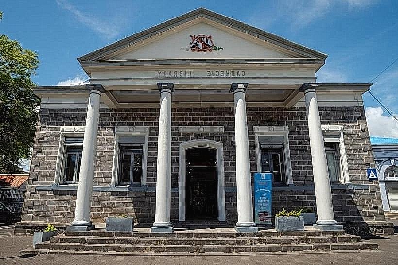
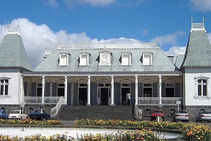
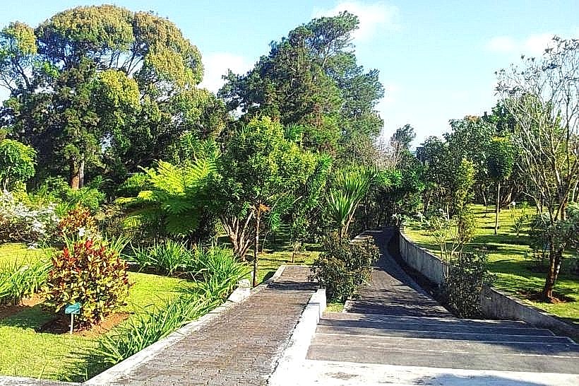
Top City Landmarks
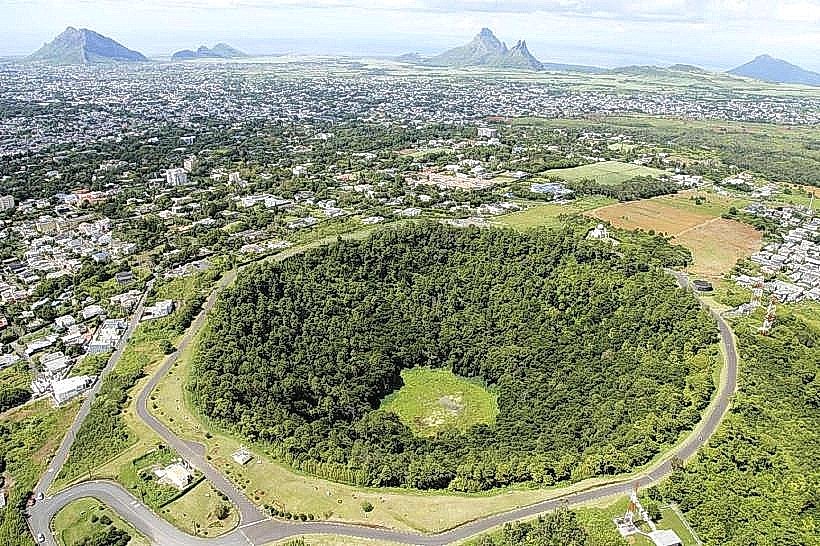
Trou aux Cerfs (Dormant volcanic crater)
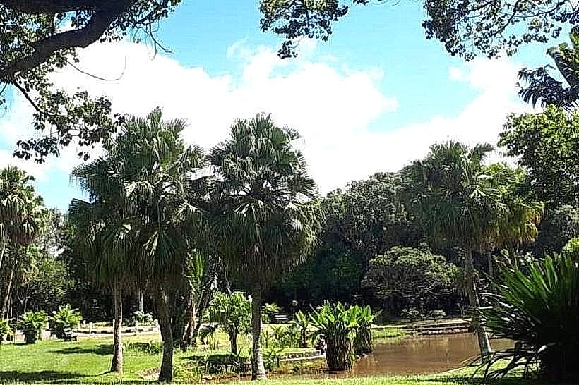
Curepipe Botanical Garden
Saint Thérèse Church
Hotel de Ville (Town Hall)
Transportation Network
Movement is serviced by the Metro Express light rail Terminal, connecting the town to Port Louis. The Jan Palach North and South bus stations serve as major hubs for cross-island routes. The primary ride-sharing app is Yugo. Official taxis are white with yellow signage. Traffic density is high in the center due to narrow colonial-era street layouts and heavy rainfall slowing vehicle flow.
Safety & "Red Zones"
The town is generally safe during business hours. Avoid the bus terminal areas and poorly lit side streets after 19:00, when commercial activity ceases. Pickpocketing occurs in the crowded central market area.
Digital & Financial Infrastructure
Average internet speed is 30-50 Mbps. Primary carriers are my.t and Emtel. Card acceptance is high in shopping malls like Manhattan and Cascavelle (nearby) but low in traditional street-side shops. ATMs are concentrated around the Royal Road and the metro station.
Climate & Air Quality
Temperatures range from 12°C to 20°C in winter and 18°C to 26°C in summer. Curepipe is the wettest town in Mauritius, experiencing frequent mist and micro-showers. Air quality is excellent due to high elevation and constant wind, though humidity levels remain high year-round.
Culture & Social Norms
Tipping of 10% is standard in cafes and restaurants. Handshakes are the common greeting. Dress code is more formal and layered than coastal regions due to the cooler climate. Public smoking is prohibited in the town center and transport hubs. Conservative attire is required for religious sites.
Accommodation Zones
Stay in Floréal for high-end boutique lodgings and proximity to embassies.
Stay in the City Center for logistical access to the Metro Express and bus networks.
Local Cost Index
1 Espresso: 100 MUR ($2.20 USD)
1 Standard Lunch: 300 MUR ($6.55 USD)
1 Metro/Bus Ticket: 30-55 MUR ($0.65 - $1.20 USD)
Nearby Day Trips
Tamarind Falls (Sept Cascades): 7 km (20 minutes)
Grand Bassin (Ganga Talao): 14 km (25 minutes)
Black River Gorges National Park: 12 km (20 minutes)
Mare aux Vacoas Reservoir: 6 km (15 minutes)
Facts & Legends
The name "Curepipe" is localized legend; it is widely believed to originate from the Napoleonic era when travelers and soldiers would stop to "cure" (clean) their pipes while resting at the midway point between the harbor and the south. Historically, it was the first town in Mauritius to be lit by electricity in 1889.