Information
City: DahabCountry: Egypt
Continent: Africa
Dahab, Egypt, Africa
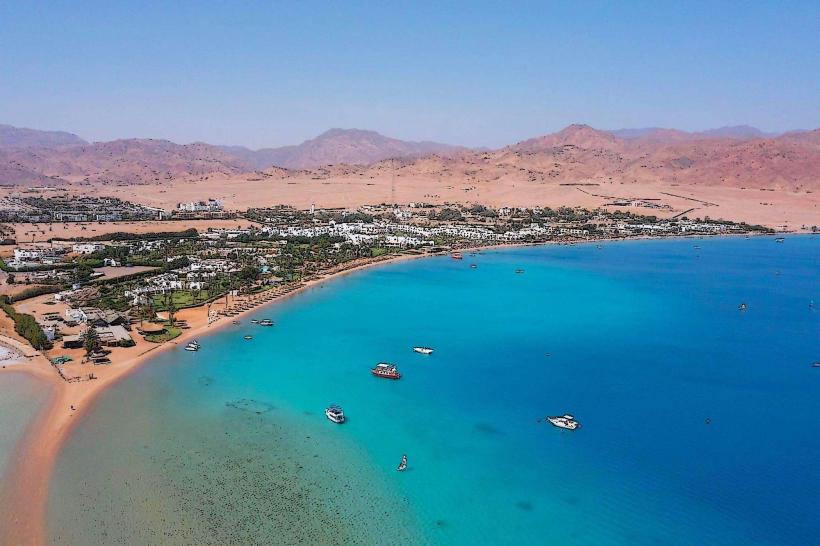
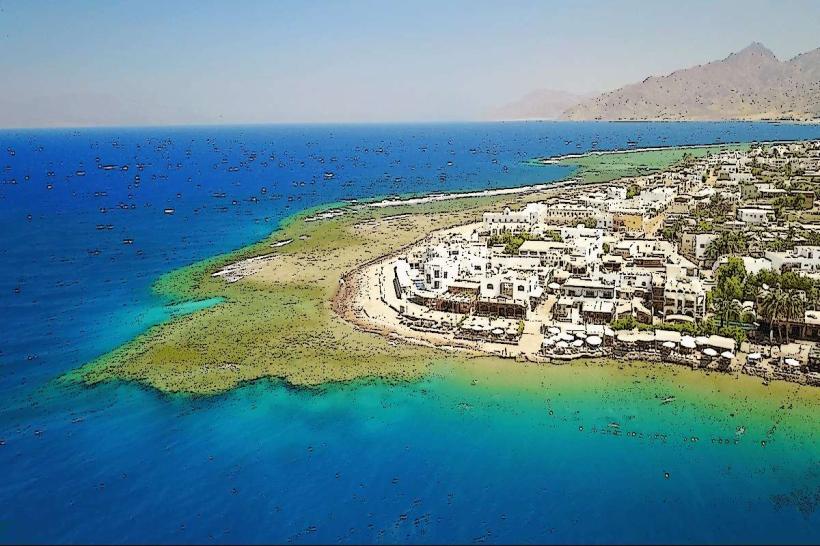
Dahab serves as a strategic tourism and maritime center in the South Sinai Governorate, functioning as a global hub for world-class diving and windsurfing. It is situated on the southeast coast of the Sinai Peninsula along the Gulf of Aqaba, approximately 80 kilometers north of Sharm El Sheikh.
Historical Timeline
Dahab was originally established as a seasonal Bedouin fishing settlement by the Muzeina tribe. It remained a remote outpost through the Roman and Byzantine eras, serving as a minor port for Nabatean trade routes. The city was under Israeli occupation from 1967 until the 1982 Sinai return under the Camp David Accords. The most significant architectural and infrastructure development occurred in the late 1990s and early 2000s when the Egyptian government formalized its tourism zoning. The shift from a nomadic camp to a permanent urban center was primarily driven by the discovery of the Blue Hole as a premier international diving site.
Demographics & Population
The permanent population is approximately 15,000 residents, though this number doubles during peak tourism seasons. The population consists of roughly 60% Egyptian nationals (including Nile Valley migrants), 30% indigenous Bedouin (predominantly Muzeina), and 10% international expatriates (primarily from Europe and Russia). The median age is approximately 28 years.
Urban Layout & Key Districts
The city follows a coastal linear layout divided into two primary zones. To the North lies the "Old City" area of Masbat and Mashraba, which contains the main pedestrian bay and commercial tourist activity. To the South is the Medina (City Center) and Assalah, which houses the administrative buildings, residential Bedouin quarters, and the "Laguna" area characterized by high-end resorts.
Top City Landmarks
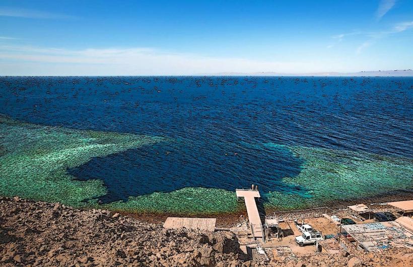
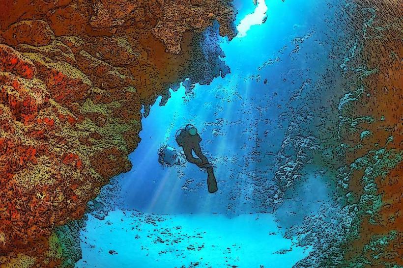
The Blue Hole (12km North of town)
Lighthouse Reef (Masbat Bay)
Canyon Dive Site (North Dahab)
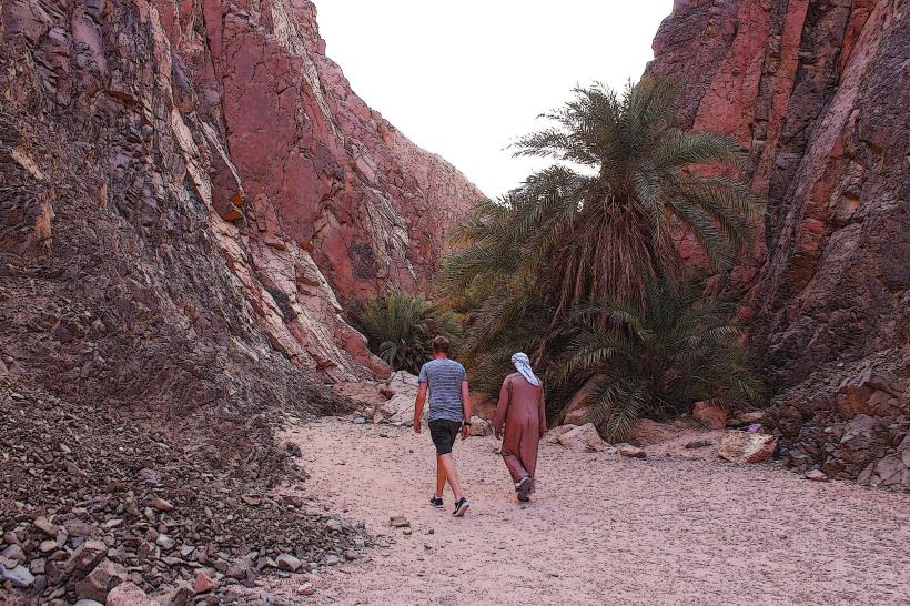
Al-Asala Bedouin District
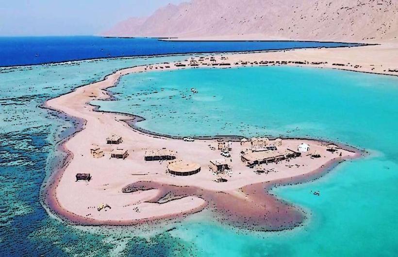
King Island (South Coast)
Transportation Network
Internal movement relies on unmetered "Dahab Taxis" (white pickup trucks with bench seating) and private tricycles. There is no metro or tram system. While Uber is not operational, Careem provides limited service. The primary mode of transport for tourists within the Masbat area is walking or cycling. Traffic density is low, though the main access road to the Blue Hole is frequently congested with 4x4 vehicles.
Safety & "Red Zones"
Dahab is considered one of the safest destinations in Egypt. There are no designated "red zones" within the city limits. Petty theft is rare, though visitors should exercise caution in unlit areas of Assalah at night. The most significant safety risk is environmental, specifically regarding unlicensed dive guides at the Blue Hole and dehydration during summer months.
Digital & Financial Infrastructure
Average internet speeds are 30–50 Mbps, though fiber-optic expansion is ongoing in the Medina. Primary mobile carriers are Vodafone, Orange, and WE; Vodafone generally offers the strongest signal in the Masbat area. Card acceptance is moderate in large hotels and dive centers but low in local restaurants and markets. ATMs are located in the Ghazala market area and along the Mashraba coastline.
Climate & Air Quality
Temperatures range from 14°C to 23°C in winter and 26°C to 38°C in summer. Air quality is high due to consistent northern winds, though "Khamasin" sandstorms in April and May can significantly reduce visibility. The city experiences a high UV index year-round; water temperatures fluctuate between 21°C in February and 28°C in August.
Culture & Social Norms
Tipping (Baksheesh) of 10% is expected in restaurants and for dive boat crews. Handshakes are the standard greeting. While the dress code is more relaxed than in Cairo, modesty (covered shoulders and knees) is required when entering the Assalah residential district or administrative offices. Public consumption of alcohol is restricted to licensed beachfront venues; smoking is common in all outdoor spaces.
Accommodation Zones
Masbat/Mashraba: Stay here for immediate walking access to dive centers, cafes, and the central bay.
The Laguna: Stay here for high-end resorts, windsurfing schools, and a quieter environment away from the pedestrian center.
Local Cost Index
1 Espresso: 65 EGP ($1.35)
1 Standard Lunch: 350 EGP ($7.25)
1 Local Taxi (internal): 50 EGP ($1.05)
Nearby Day Trips
Saint Catherine’s Monastery/Mount Sinai: 130 km (2 hours)
Blue Lagoon / Ras Abu Galum: 15 km (North, reachable by boat or camel)
Sharm El Sheikh: 80 km (1 hour)
Nabq Protectorate: 65 km (1 hour)
Facts & Legends
Local Bedouin legend speaks of the "Golden Sands" (the meaning of Dahab in Arabic), which were said to be washed down from the mountains during rare flash floods. A recurring urban legend among the diving community involves the "Blue Hole Bells," a phenomenon where divers claim to hear ringing sounds at depth, often attributed to gas narcosis or thermal shifts within the limestone chimney.