Information
City: East CoastCountry: Dominica
Continent: North America
East Coast, Dominica, North America
The East Coast of Dominica, or the Windward Coast, is the island's primary ecological and indigenous heritage corridor. It spans the parishes of Saint David and Saint Patrick, serving as the front line for Atlantic trade winds and housing the only organized indigenous territory in the Caribbean.
Historical Timeline
The East Coast remained a stronghold for the Kalinago people long after the West Coast was colonized, due to its rugged Atlantic cliffs and dense rainforest. Formal British colonial administration intensified in the late 18th century with the establishment of estate agriculture. In 1903, the Carib (Kalinago) Territory was officially delineated by the British Crown. The most significant architectural reconstruction followed the near-total devastation caused by Hurricane Maria in 2017. The primary event shaping the current urban form was the 1978 transition to independence, which prioritized the "East Coast Road" to integrate these isolated agricultural communities into the national economy.
Demographics & Population
The total population of the East Coast districts is approximately 10,200. The top three ethnic demographics are Afro-Dominican (65%), Kalinago (31%), and Mixed (3.8%). The median age of the population is 31.2 years.
Urban Layout & Key Districts
The region is organized along the primary Windward Highway, which contours the Atlantic cliffs. The Northern District (Kalinago Territory) is a semi-autonomous zone comprised of eight hamlets. The Central District (Castle Bruce) serves as the regional agricultural and logistical hub. The Southern District (La Plaine/Delices) is characterized by high-elevation plateaus and river systems. Settlements are generally clustered on "flats" or ridges above the sea.
Top City Landmarks
Kalinago Barana Autê (Cultural Village)
L'Escalier Tête-Chien (Volcanic rock formation)
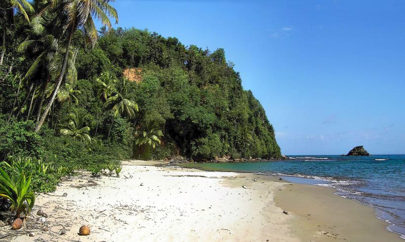
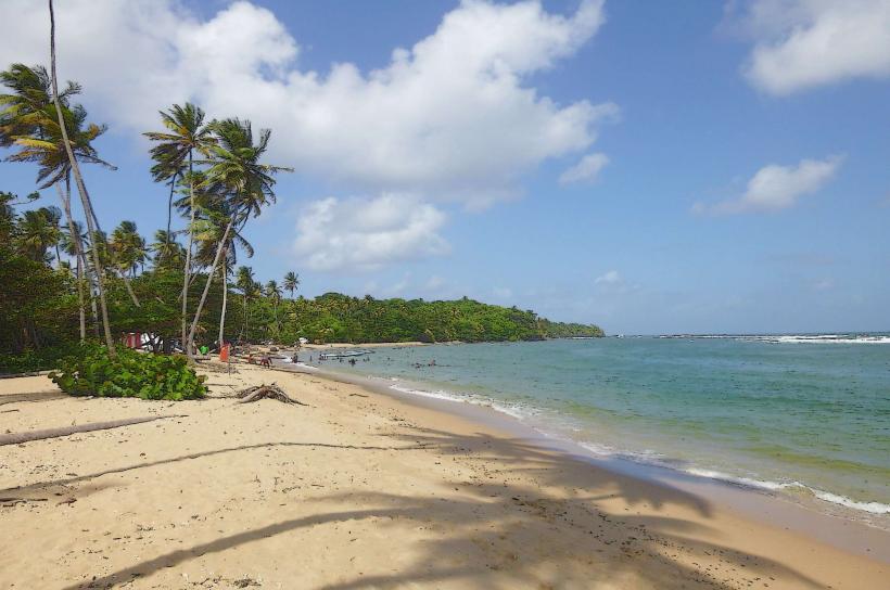
Pagua Bay
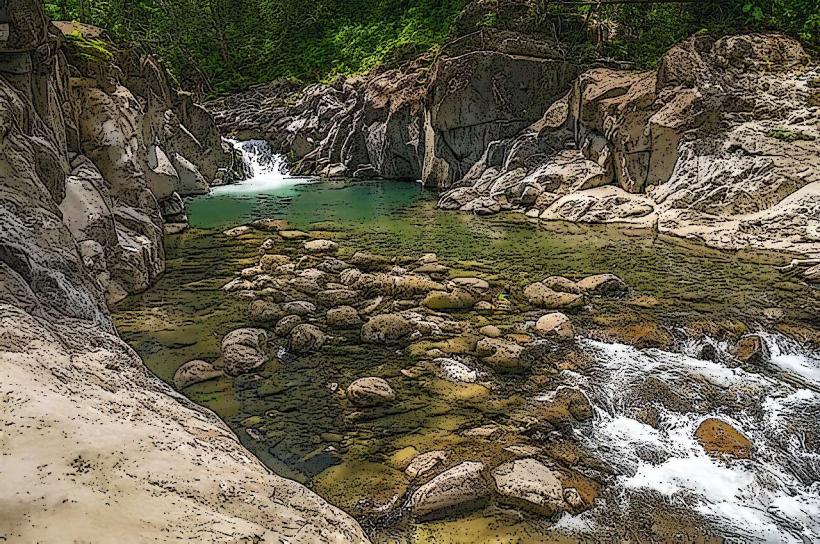
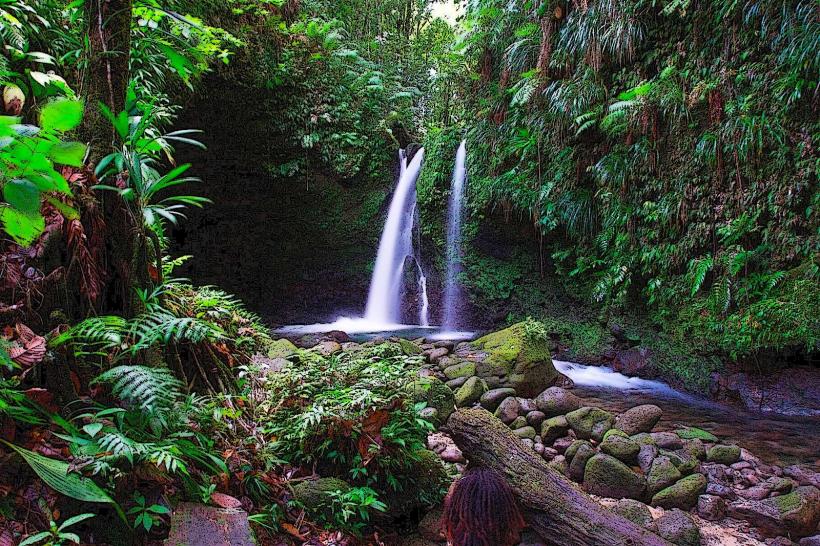
Sari-Sari Falls
Emerald Pool (Located at the transition to the interior)
Transportation Network
Transit is dependent on the East Coast minibus network, which connects villages to Roseau via the Pont Cassé inland junction. There are no metro or rail systems. Ride-sharing apps do not operate in this region. Official taxis are marked with "TX" license plates but are less frequent than on the West Coast; pre-booking is standard. Traffic density is very low, though roads are prone to closures from landslides or heavy swells.
Safety & "Red Zones"
Safety levels are high across all East Coast communities. There are no specific "red zones." The primary hazard is environmental; the Atlantic side of the island has extremely dangerous undercurrents and rogue waves. Swimming is strictly discouraged at most East Coast beaches except in designated sheltered bays like Batibou.
Digital & Financial Infrastructure
Internet speeds average 20–40 Mbps, with satellite and fiber-optic options expanding. Flow and Digicel provide 4G LTE coverage, though signal "dead zones" exist in deep valleys. Card acceptance is very low; the economy is almost entirely cash-based. There are no ATMs on the East Coast; the nearest machines are at Douglas-Charles Airport or Roseau.
Climate & Air Quality
Temperatures range from 21°C to 29°C. This is the wettest region of Dominica, receiving significantly higher annual rainfall than the leeward side. Air quality is pristine, characterized by constant oxygen-rich Atlantic breezes. Weather risks include hurricanes and flash flooding of the numerous river systems.
Culture & Social Norms
Tipping is expected for guides in the Kalinago Territory (10–15%). Social greetings are a critical local protocol; silence when passing others is perceived as hostility. Photography of indigenous people or their property requires explicit verbal permission. Dress code is conservative; camouflage is prohibited.
Accommodation Zones
Stay in the Kalinago Territory (Salybia) for cultural immersion and traditional eco-lodges.
Stay in Castle Bruce or Pagua Bay for central logistics and proximity to the main highway.
Local Cost Index
1 Espresso (Instant coffee is the norm): 5.00 XCD ($1.85 USD)
1 Standard Lunch (Local provisions and stew): 22.00 XCD ($8.15 USD)
1 Minibus Ticket to Roseau: 8.00 XCD ($3.00 USD)
Nearby Day Trips
Douglas-Charles Airport: 15 km (25 minutes)
Morne Trois Pitons National Park: 10 km (20 minutes)
Freshwater Lake: 20 km (45 minutes)
Rosalie Bay: 12 km (20 minutes)
Facts & Legends
The East Coast is the site of the legend of the "Snake Staircase" (L'Escalier Tête-Chien), a massive rock formation at the sea's edge. Kalinago lore states it was created by a giant boa constrictor that emerged from the Atlantic to climb the mountains, and its presence still guards the territorial waters from invaders.