Information
City: Enewetak AtollCountry: Marshall Islands
Continent: Australia
Enewetak Atoll, Marshall Islands, Australia
Enewetak Atoll is a large coral atoll of 40 islands in the Ralik Chain of the Marshall Islands. It is defined by its history as a major World War II battlefield and its subsequent role as the second primary site for United States nuclear testing in the Pacific. In 2026, it serves as a critical site for radiological monitoring and the focal point of the Runit Dome containment controversy.
Historical Timeline
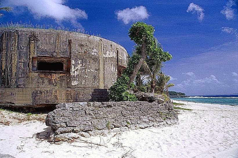
Inhabited by the Enewetakese people for centuries. A critical historical event occurred in February 1944 during Operation Catchpole, when U.S. forces captured the atoll from Japan in a violent amphibious assault. In 1947, the population was relocated to Ujelang Atoll to facilitate nuclear testing. Between 1948 and 1958, the U.S. conducted 43 nuclear tests at Enewetak, including Ivy Mike (1952), the world's first hydrogen bomb, which completely vaporized Elugelab Island. In the late 1970s, a massive cleanup operation was conducted, and residents were allowed to return to the southern islands in 1980.
Demographics & Population
The 2026 population is approximately 850. The residents are predominantly Enewetakese Marshallese. The economy is heavily dependent on U.S. Trust Fund payments, Government employment, and Subsistence Fishing.
Urban Layout & Landmarks
The atoll surrounds a 1,000-square-kilometer lagoon.
Enewetak Island: The primary population center and administrative hub located on the southeastern rim.
Medren Island: A major residential and storage islet.
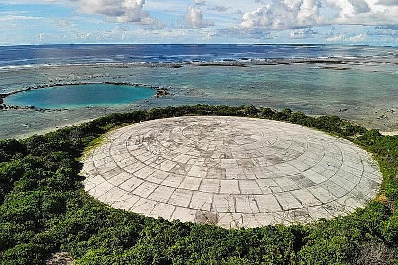
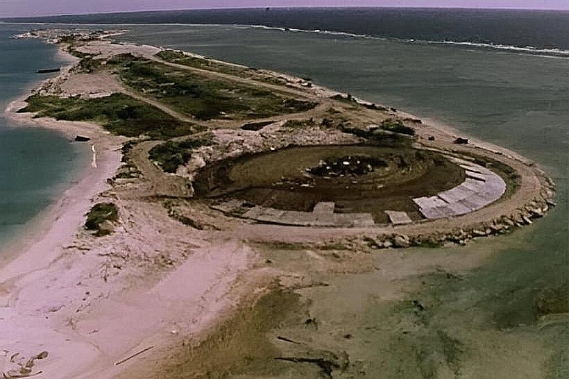
Runit Island: The site of the Runit Dome (Cactus Crater), a massive concrete cap containing 73,000 cubic meters of radioactive debris and soil.
Ivy Mike Crater: A massive underwater crater on the northern reef where Elugelab Island once stood.
Transportation Network
Movement between islets is facilitated by small motorboats. Enewetak Auxiliary Airfield (EWI) provides irregular domestic service via Air Marshall Islands to Majuro and Kwajalein. There are no paved roads beyond the remnants of military-era tracks. Inter-island transport depends on private vessels or the national supply ship.
Safety & Radiological Protocol
General safety is governed by strict environmental restrictions. Runit Island is a "Red Zone" and is off-limits to unauthorized visitors due to surface contamination. While the southern islands are safe for habitation, residents must follow dietary restrictions: locally grown crops like coconuts and pandanus from certain islands may contain high levels of Cesium-137. Imported food is the primary source of nutrition. Environmental hazards include sea-level rise, which threatens the structural integrity of the Runit Dome.
Digital & Financial Infrastructure
Connectivity is negligible. No 5G or standard cellular data exists; communication is via VHF radio and limited satellite-based Wi-Fi. U.S. Dollars (USD) are the official currency. The economy is cash-only; there are no ATMs or credit card facilities.
Climate & Air Quality
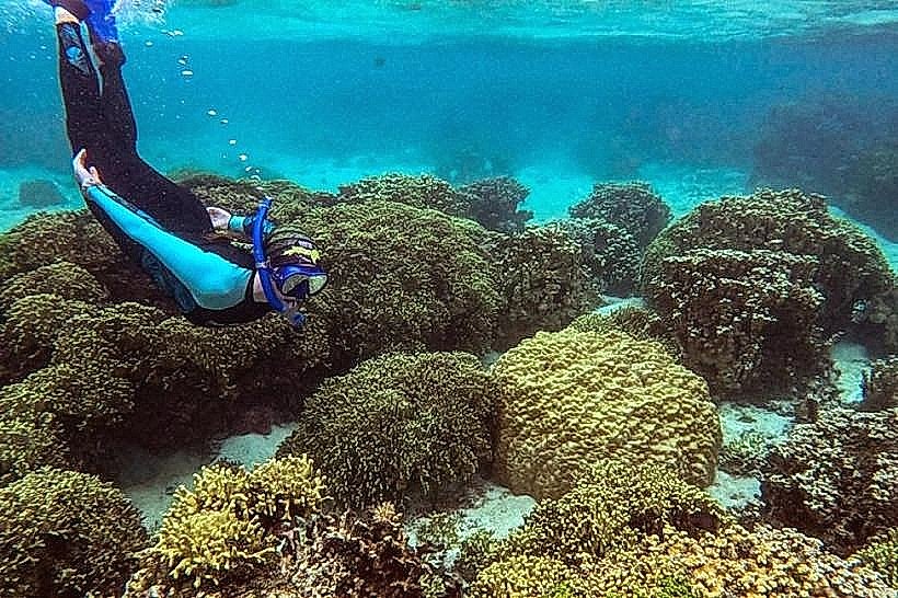
Tropical marine climate. Air quality is pristine. In 2026, the atoll is a global focal point for studying oceanic overwash and its effects on radioactive containment sites.
Culture & Social Norms
Tipping is not customary. The "Iokwe" greeting is standard. Dress codes are Strictly Modest. The culture is defined by Resilience, Nuclear Displacement History, and Traditional Land Stewardship.
Local Cost Index
1 Standard Meal: $8.00–$12.00 USD (mostly imported canned goods and local fish).
Accommodation: Limited to government guest houses or family stays ($50–$90 USD).
Facts & Legends
The Runit Dome is often referred to as "The Tomb" by international media due to its contents. Historically, the Ivy Mike test was so powerful it created a crater 1.9 km wide and 50 meters deep. A local legend involves the spirits of the vaporized islands, who are said to haunt the northern reef where the land was destroyed. Another fact: the Enewetakese people maintain a unique dialect of Marshallese that was preserved during their long exile on Ujelang Atoll.