Information
City: KribiCountry: Cameroon
Continent: Africa
Kribi, Cameroon, Africa
Kribi serves as the primary deep-sea port and principal maritime resort of Cameroon. It is located in the South Region on the Gulf of Guinea, situated at the mouth of the Kienké River.
Historical Timeline
The city was established as a colonial trading post in the late 19th century under German rule. Primary eras of governance include the German colonial period, the French mandate, and the post-independence era. The most significant infrastructural reconstruction occurred between 2011 and 2018 with the development of the Kribi Deep Sea Port. The primary event shaping its current urban form was the construction of the Chad-Cameroon Petroleum Pipeline terminus and the subsequent industrialization of the Mboro area.
Demographics & Population
The total population is approximately 95,000 residents, with a significant increase during peak tourist seasons. The top three ethnic demographics are the Batanga, Mabi, and Pygmy (Bagyeli) groups. The median age is 19 years.
Urban Layout & Key Districts
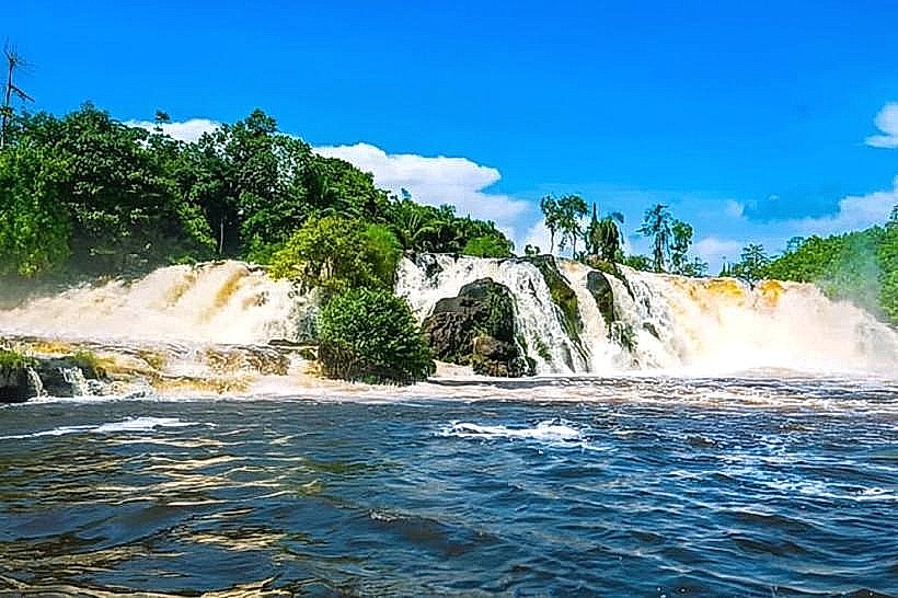
The city is organized along a north-south coastal axis. Key districts include the Center Ville (Commercial and Administrative hub) and the Chutes de la Lobe area (Tourist district) located 7 km to the south. The industrial zone is concentrated in Mboro, situated 35 km south of the city center.
Top City Landmarks
Lobe Waterfalls (Chutes de la Lobe)
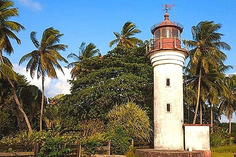
Kribi Lighthouse (Phare de Kribi)
Grand Batanga Museum
Kienké River Bridge
Cathedral of Saint Joseph
Transportation Network
Movement within the city relies on motorcycle taxis (Benskins) and yellow shared taxis. There is no metro or rail system. "Clandos" (unlicensed taxis) operate on peripheral routes. Official taxis are yellow. Traffic density is low in the center but heavy on the single-lane highway leading to the deep-sea port.
Safety & "Red Zones"
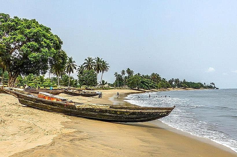
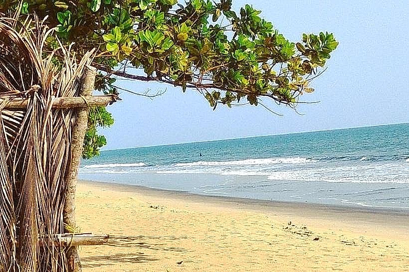
The general safety level is moderate. Petty theft and bag snatching occur on public beaches after dark. Explicitly avoid walking alone on isolated sections of Ngoyè Beach at night. Common scams involve fraudulent "tours" to Pygmy villages or overcharging for seafood at the "Débarcadère" (fish market).
Digital & Financial Infrastructure
Average internet speed is 10-25 Mbps (4G/LTE). Main mobile carriers are MTN, Orange, and Camtel. Card acceptance is low, limited to high-end resorts. ATMs are available at bank branches (BICEC, SG) in the city center.
Climate & Air Quality
Temperatures range from 23°C to 31°C year-round. Humidity is consistently high, exceeding 80%. The city experiences heavy rainfall from September to November. Air quality is high due to coastal breezes, except near the industrial port zones where particulate matter is higher.
Culture & Social Norms
Tipping is expected in tourist restaurants (approx. 5-10%). Handshakes are the standard greeting. Dress code is informal; however, swimwear is strictly for the beach and not permitted in the city center or shops. Public smoking is common in outdoor areas.
Accommodation Zones
Tara Plage / Lobe: Recommended for quiet, upscale resort access and proximity to the waterfalls.
Center Ville (Ngoyè): Recommended for logistical access to banks, markets, and the main bus agencies.
Local Cost Index
1 Espresso: 1,200 XAF ($1.96)
1 Standard Lunch: 5,500 XAF ($8.98)
1 Metro/Bus Ticket: 250 XAF ($0.41) - (Standard shared taxi fare)
Nearby Day Trips
Campo Ma'an National Park (75 km)
Ebodjé Turtle Sanctuary (50 km)
Pygmy Settlements (15-30 km)
Londji Fishing Village (15 km)
Facts & Legends
A verified historical oddity is the Kribi Lighthouse, built by the Germans in 1906, which remains operational and serves as a primary navigational aid for the Bight of Biafra. Local legend speaks of the Miengu (water spirits) of the Lobe Falls; it is believed that these spirits protect the Batanga people and that the falls are the only place in the world where a river empties into the ocean via a series of waterfalls, a phenomenon locals attribute to the intervention of these ancestral spirits.