Information
City: MelliehaCountry: Malta
Continent: Europe
Mellieha, Malta, Europe
Mellieħa functions as the primary resort and rural-heritage pivot of northern Malta. Situated on a prominent ridge, it serves as a specialized node for large-scale sandy beach logistics, Marian pilgrimage, and family-oriented theme park entertainment. It is defined by its commanding views over the Comino channel, its status as a designated "European Destination of Excellence," and its 2026 role as a finalized hub for northern region shuttle integration and sustainable coastal monitoring.
Historical Timeline
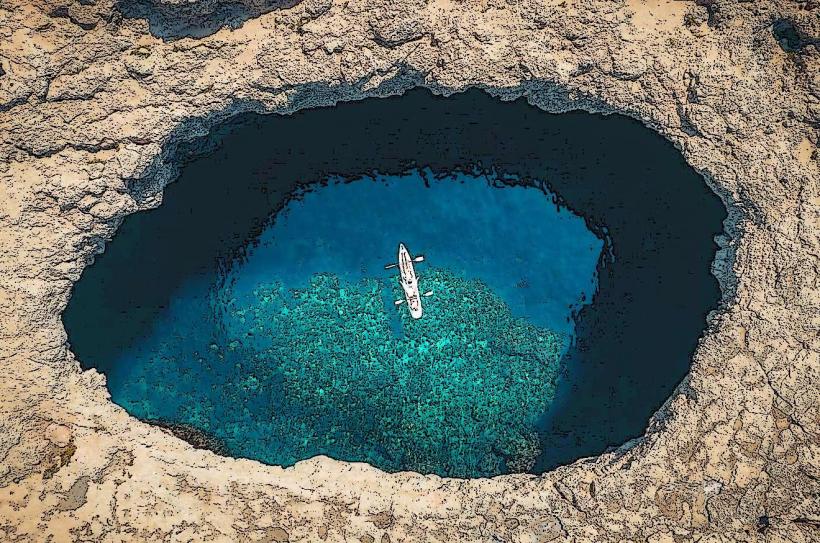
3000 BC: Initial occupation during the Neolithic period; site of the Għajn Żejtuna megalithic remains.
1436: Established as one of the original ten parishes of Malta, but later abandoned for centuries due to vulnerability to North African corsair raids.
1844: Re-established as a permanent village under British rule through land-lease incentives to encourage northern settlement.
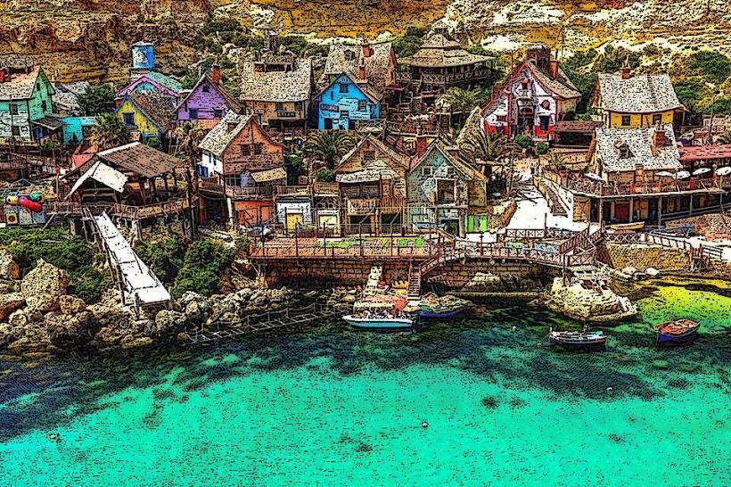
1980: Selection of Anchor Bay as the primary set for the Disney/Paramount production Popeye, creating a permanent cultural landmark.
2026 Context: On January 7, 2026, Malta Public Transport launched a specialized Mellieħa Shuttle Service to bypass long-term road rehabilitation projects, ensuring 20-minute frequency connectivity throughout the village and coastal zones.
Demographics & Population
The urban population is approximately 11,400 (2026 estimate). The demographic is a specialized blend of traditional Maltese agricultural families and a high concentration of British and European expatriates. In 2026, the city maintains its identity as a "quiet retreat" compared to the central urban sprawl, though it absorbs over 200,000 day-visitors during peak summer months.
Urban Layout & Key Districts
Mellieħa Heights: The specialized upper residential district; contains high-value real estate with panoramic views of the bay and Gozo.
The Village Core: A specialized religious and commercial center focused on the Parish Church and the historic pilgrimage sanctuary.
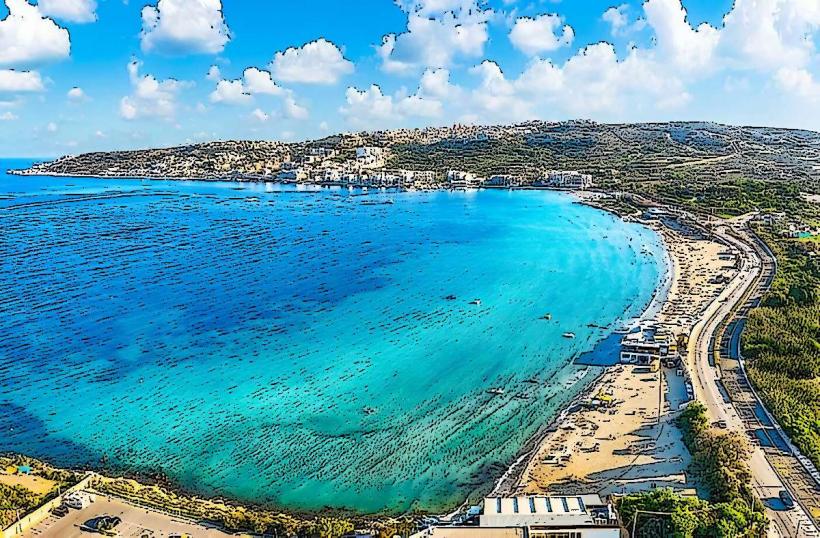
Għadira (Mellieħa Bay): The specialized maritime district; contains Malta’s largest sandy beach and a high concentration of lido infrastructure.
Santa Maria Estate: A specialized luxury enclave in the valley, known for its high-density "villa-only" zoning and botanical diversity.
Manikata: A specialized satellite hamlet to the west; home to Malta’s most modern ecclesiastical architecture and the island's primary potato-exporting farmlands.
Top City Landmarks
Sanctuary of Our Lady of Mellieħa: A specialized pilgrimage site since the 16th century; contains a Byzantine-style fresco of the Virgin Mary believed to have been consecrated by St. Luke.
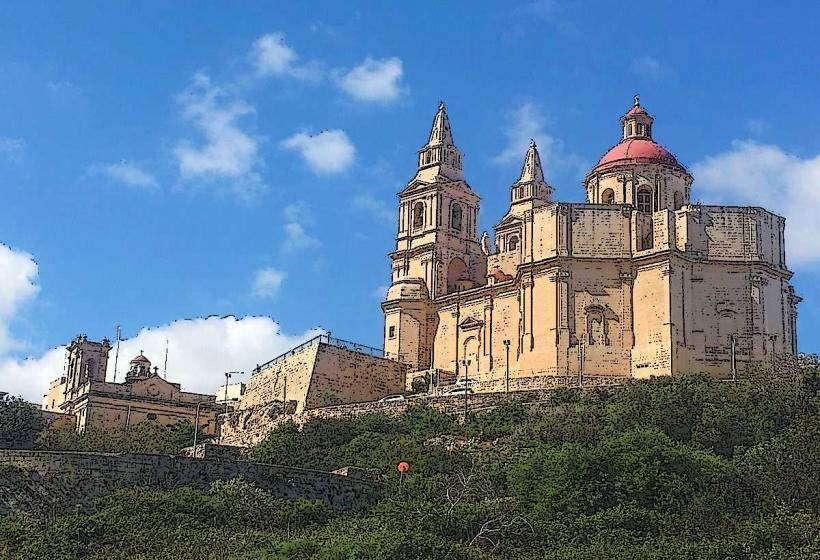
Mellieħa Parish Church: A specialized 19th-century Baroque structure built from locally quarried limestone; its twin bell towers serve as the primary navigational landmark for the northern region.
Popeye Village: A specialized film-set-turned-theme park at Anchor Bay; in 2026, it operates as a multi-modal family destination with specialized 4D filming experiences and inflatable water circuits.
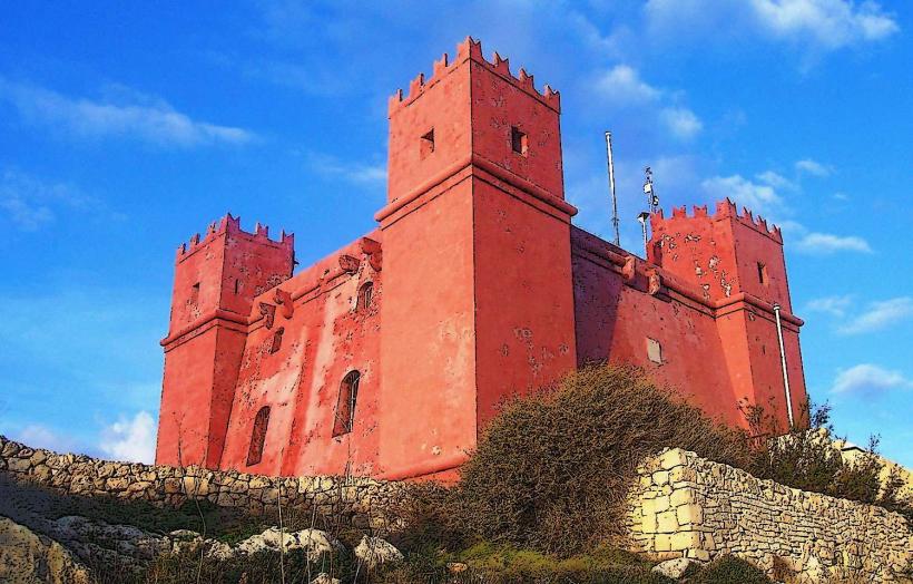
The Red Tower (St. Agatha’s Tower): A specialized 1649 Knightly watchtower; following its 2020s restoration, it offers the primary vantage point for observing maritime traffic in the Comino Channel.
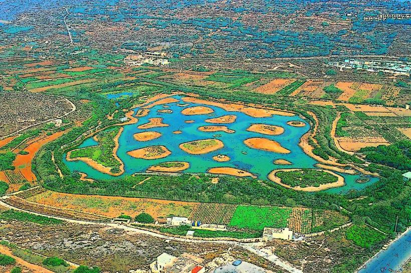
Għadira Nature Reserve: A specialized 7-hectare brackish wetland; Malta’s primary site for observing migratory birds, managed by BirdLife Malta.
Mellieħa Air Raid Shelters: Among the largest in Malta, providing a specialized underground tour of 500 meters of manually excavated WWII tunnels.
Transportation & 2026 Logistics
Bus Network: Primary node for the 40 and 220 series connecting Valletta and Sliema to the Ċirkewwa Ferry Terminal.
2026 Shuttle: Under the January 2026 mandate, Route A and Route B Shuttles provide free-of-charge transit between the village core (Triq il-Kbira) and the coastal resorts.
Maritime Link: Served by the Ċirkewwa Terminal (5 km north), the primary 2026 logistics pivot for the Gozo Channel ferries and the Comino "fast-shuttle" network.
Tallinja Bike: 2026 saw the installation of specialized electric bike docking stations at Għadira Bay to promote zero-emission transit to the Marfa Ridge.
Safety & Environment
The general safety level is very high. Warning: The "Għadira Current" can be deceptive during northwest (Majjistral) winds; in 2026, the Għadira Smart-Buoy system provides live rip-current alerts via a mobile app. In 2026, Mellieħa is a pilot for the "Blue-Flag Digital Monitoring", tracking sand erosion and water turbidity across the northern bays.
Local Cost Index (2026 Estimates)
1 Espresso (Village Square): €1.50 – €2.20
Seafood Pasta (Għadira): €14.00 – €19.00
Popeye Village Entry: €15.00 – €22.00 (seasonal)
Return Ferry to Gozo (via Ċirkewwa): €4.65
Tourist Eco-Contribution (Nightly): €1.50 (2026 rate)
Facts & Legends
Mellieħa is the site of the "Our Lady of the Grotto" shrine, where a natural spring is said to have miraculously appeared in the 17th century; devotees still leave votive offerings (crutches, baby clothes) on the walls as thanks for perceived healings. Legend states that the Red Tower was painted its distinct ochre color specifically to intimidate Ottoman scouts by making it appear larger and more formidable at sunrise. A verified fact is that Mellieħa’s Għadira Bay remains shallow for nearly 50 meters from the shore, making it the safest bathing site for children in the Mediterranean. Historically, the village name is derived from the Semitic word m-l-ħ, signifying the specialized salt pans that once dominated the bay area.