Information
City: MykonosCountry: Greece
Continent: Europe
Mykonos, Greece, Europe
Mykonos is an island in the Cyclades group of the Aegean Sea. It is defined by its granite geology, high-velocity winds, and a transition from a modest 1950s fishing community to a global luxury and nightlife destination.
Historical Timeline
In antiquity, Mykonos was a poor neighbor to the sacred island of Delos. It was colonized by Ionians and later fell under Roman, Byzantine, and Venetian rule. Following a period of Ottoman governance, the island played a vital role in the 1821 Greek War of Independence, led by the local heroine Manto Mavrogenous. The modern era of tourism began in the 1960s when it became a refuge for artists and the international jet set.
Geomorphology & Urban Layout
The island is predominantly arid and rocky, with a total area of 85.5 $km^2$.
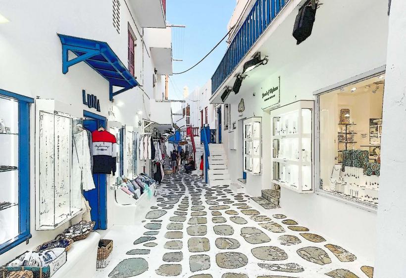
Chora (Mykonos Town): The main port and capital; a labyrinthine pedestrian settlement designed to confuse pirates and mitigate wind force.
Ano Mera: The only significant inland village, centered around the 16th-century Panagia Tourliani Monastery.
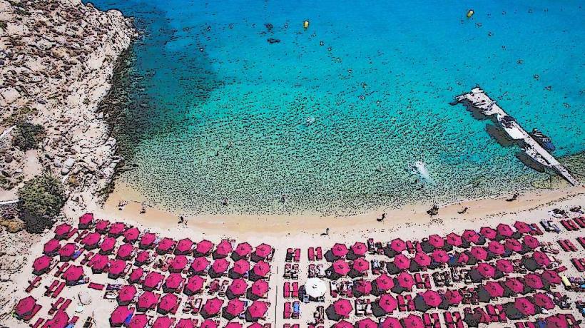
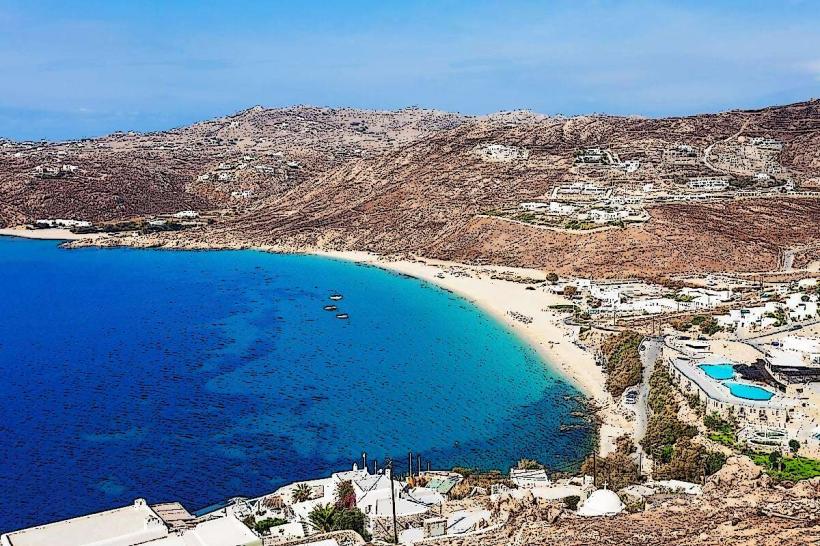
The Southern Coast: Home to the most famous "party" beaches, including Psarou, Super Paradise, and Paraga.
The Northern Coast: Characterized by rugged terrain and wind-exposed beaches like Ftelia and Panormos.
Top Landmarks
Kato Milli (The Windmills): A row of seven iconic 16th-century windmills overlooking Chora, formerly used to grind wheat using the island's strong winds.
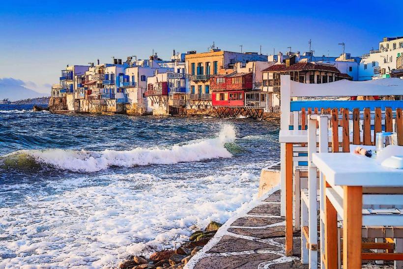
Little Venice (Alefkandra): A district where 18th-century sea captains' houses are built directly on the water's edge with overhanging balconies.
Panagia Paraportiani: A unique architectural complex of five white-washed churches merged into a single asymmetrical structure.
Delos (Archaeological Site): A 30-minute boat ride away; the mythological birthplace of Apollo and Artemis and one of the most important panhellenic sanctuaries.
Armenistis Lighthouse: A 19th-century structure on the northwestern tip offering views of the strait between Mykonos and Tinos.
Transportation Network
Air: Mykonos International Airport (JMK) handles high volumes of seasonal international charters and domestic flights.
Sea: Most ferries now arrive at the New Port (Tourlos), 2 km from Chora. The Old Port serves excursion boats to Delos.
Land: Public buses (KTEL) operate two main hubs (Fabrika and Old Port). Taxis are extremely scarce (approx. 35 for the island); private transfers and the Aegean Taxi app are standard.
Sea Bus: A water taxi service connects the New Port to the center of Chora.
Safety & Social Infrastructure
Mykonos is safe regarding violent crime. The primary concerns are:
Petty Theft: Occurs in crowded beach clubs and the narrow alleys of Chora.
Transportation Scams: High prices for private transfers; always confirm rates in advance.
ZTL (Traffic): Chora is entirely pedestrian; parking outside the perimeter is mandatory and often difficult.
Digital & Financial Infrastructure
Average fixed broadband speed is 85 Mbps. 5G coverage is excellent in Chora and the southern beach clubs via Cosmote and Vodafone. Card acceptance is universal, even for small purchases. The currency is the Euro (€).
Climate & The "Meltemi"
The climate is Mediterranean. It is known as "The Island of the Winds" due to the Meltemi, a strong, dry northern wind that blows throughout the summer. This wind provides natural cooling but can disrupt ferry schedules and make northern beaches unsuitable for swimming.
Local Cost Index (High Season)
1 Espresso (Freddo): €5.00–€9.00
1 Souvlaki/Gyros: €5.00–€7.50
1 Sunbed Rental: €30.00–€500.00+ (depending on the beach club)
1 Standard Dinner: €60.00–€150.00 per person
Facts & Legends
Legend says the island was formed from the petrified bodies of giants killed by Hercules during the Gigantomachy. A verified local icon: Petros the Pelican was the island's official mascot for decades; today, several pelicans (descendants or successors) continue to roam the waterfront of Chora.