Information
City: NadiCountry: Fiji
Continent: Australia
Nadi, Fiji, Australia
Nadi serves as the primary international gateway to Fiji and the commercial center of the country’s western division. It is situated on the western coast of Viti Levu, positioned between the Nadi River to the south and the Sabeto Range to the north.
Historical Timeline
Nadi was established as a township in 1947, though its development was significantly accelerated by the construction of the Nadi Aerodrome by the New Zealand government in 1939 and its subsequent expansion by the United States Army Air Forces in 1941. The city transitioned from a small agricultural village to Fiji’s aviation hub following the 1946 decision by the South Pacific Air Transport Council to use Nadi as the main regional airport. The primary event shaping the current urban form was the 1940s airport construction, which shifted the economic focus from the Qeleloa sugarcane estates toward the northern Martintar and Namaka corridors.
Demographics & Population
The total population within the Nadi town limits is approximately 42,000. The wider metropolitan area, incorporating the tourism and airport corridors, reaches approximately 71,000. The top three ethnic demographics are Indo-Fijian at 52%, iTaukei (Indigenous Fijian) at 44%, and smaller populations of Chinese and Europeans. The median age of the population is 27.8 years.
Urban Layout & Key Districts
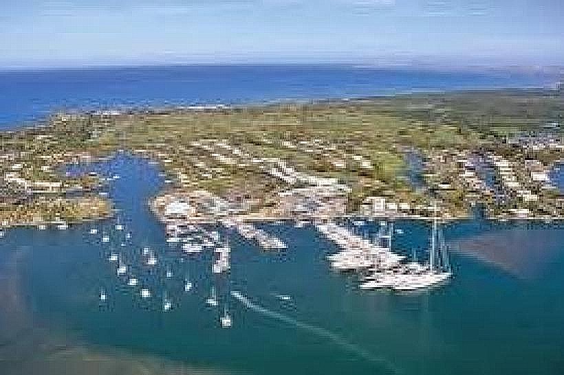
The city is organized along a linear north-south axis following the Queens Road. Nadi Town (the southern end) serves as the traditional commercial and market center. Martintar is the primary entertainment and nightlife district located mid-way, while Namaka functions as the industrial and airport-adjacent hub. Denarau Island, located 6 km west of the town center via a causeway, is the segregated resort and marina district.
Top City Landmarks
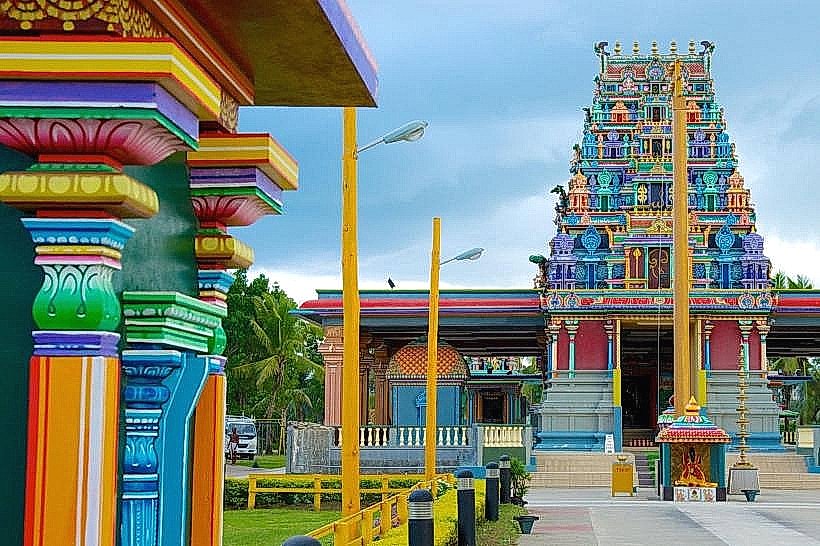
Sri Siva Subramaniya Swami Temple: A massive Dravidian-style Hindu temple located at the southern end of Nadi Town.
Garden of the Sleeping Giant: A vast botanical collection specialized in orchids, situated at the base of the Sabeto Range.
Denarau Marina: The primary maritime transit point for the Mamanuca and Yasawa island chains.
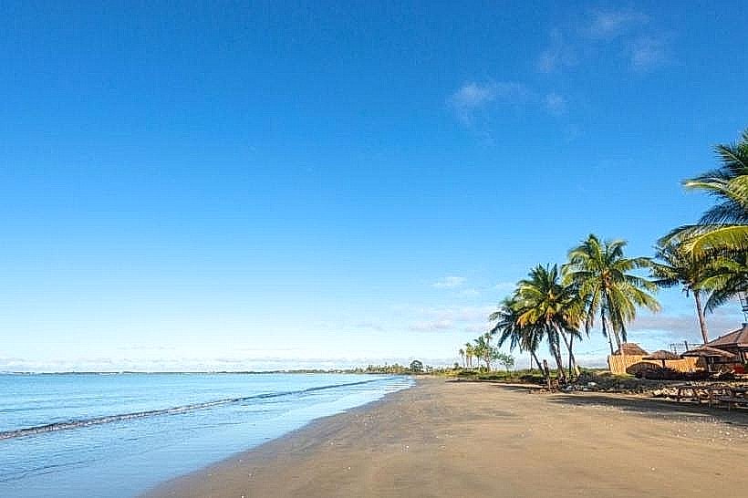
Wailoaloa Beach: A 3 km stretch of coastline serving as the city's secondary tourism and recreational zone.
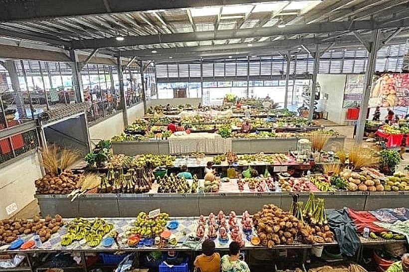
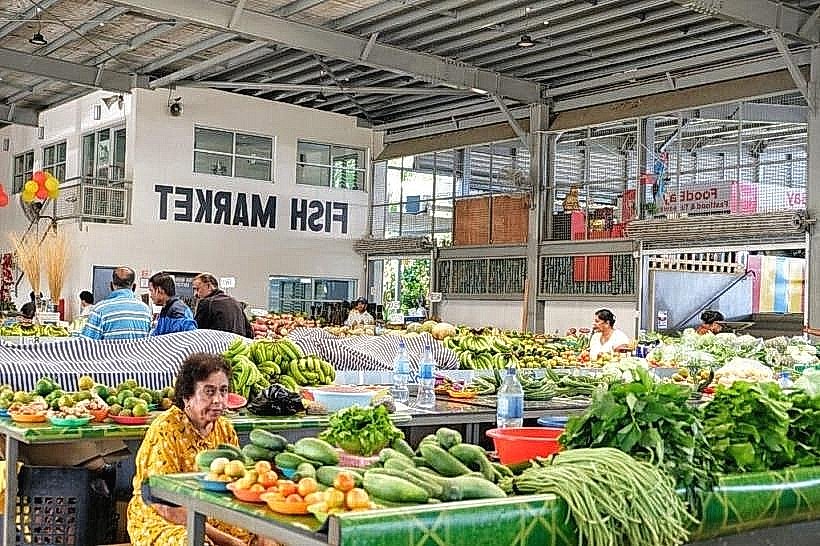
Nadi Produce Market: The logistical center for Western Division agriculture and kava trade.
Transportation Network
Internal movement is dominated by the "Nadi Bus" network and private minibuses that traverse the Queens Road. Official taxis are white and must use meters; they are clustered at Namaka, Martintar, and the airport. Ride-sharing is restricted, though the Bondwell app is used for private bookings. Traffic density is severe at the Nadi Bridge and through Namaka during school drop-off (08:00) and evening commute (17:00).
Safety & "Red Zones"
The general safety level is moderate during daylight hours. Avoid walking the unlit sections of Queens Road between Martintar and the Town Center at night. Specific "red zones" include the back alleys of the Nadi bus station and the informal settlements in the Navakai area. Common scams include "shoe-shining" solicitations and aggressive touts at the airport claiming hotels are closed to divert passengers to different accommodations.
Digital & Financial Infrastructure
Internet speeds average 20–35 Mbps. Primary mobile carriers are Vodafone Fiji and Digicel, with 4G coverage being reliable across the urban corridor. Card acceptance is high in Namaka and Denarau but low in the Nadi Town markets. ATMs are located at the airport, Namaka center, and the main street of Nadi Town (Westpac, ANZ, BSP).
Climate & Air Quality
Nadi has a tropical savanna climate, significantly drier than Suva. Daytime temperatures range from 28°C in July to 32°C in January. Air quality is high, though dust levels increase during the sugarcane harvesting season (June to December). The primary weather risk is flash flooding, particularly at the Nadi Bridge, during the monsoon season from December to March.
Culture & Social Norms
Tipping is not required but customary in Denarau resorts (10%). Removal of shoes is mandatory when entering any private home or temple. Public displays of affection are culturally discouraged in Nadi Town. Kava ceremony etiquette dictates that the bowl (bilo) be received with cupped hands and drained in a single draught, followed by three rhythmic claps.
Accommodation Zones
Martintar: Recommended for logistics, providing walking access to the highest concentration of dining and supermarket infrastructure.
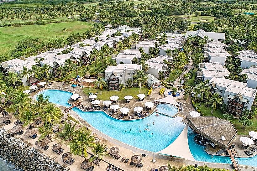
Denarau Island: Recommended for secure, high-end transit logistics and direct access to island ferry departures.
Local Cost Index
1 Espresso: 6.50 FJD ($2.90 USD)
1 Standard Lunch: 12.00–22.00 FJD ($5.35–$9.80 USD)
1 Bus Ticket (Local): 1.15 FJD ($0.51 USD)
Nearby Day Trips
Sabeto Hot Springs and Mud Pool: 12 km (20-minute drive).
Viseisei Village: 10 km (15-minute drive).
Momi Battery Historical Park: 30 km (45-minute drive).
Natadola Beach: 50 km (1-hour drive).
Facts & Legends
Nadi is the site of the legend of the "Sleeping Giant," a mountain range that resembles the profile of a reclining man. Local indigenous oral history suggests this giant was a protector who turned to stone while waiting for the return of the first ancestors of the iTaukei people. Historically, Nadi’s airport runway was the only one in the South Pacific capable of handling jet aircraft in the early 1960s, making it the indispensable refueling stop for all "Coral Route" flights between North America and Australia.