Information
City: NazcaCountry: Peru
Continent: South America
Nazca, Peru, South America
Nazca is a city located in the Ica Region of Peru’s southern coast. Situated in a hyper-arid desert environment, it is world-renowned for the Nazca Lines, a series of massive geoglyphs etched into the desert floor by the Nazca culture between 500 BC and 500 AD.
Historical Timeline
The Nazca culture flourished in this river valley, developing advanced irrigation systems to survive one of the driest climates on Earth. The geoglyphs remained largely unknown to the modern world until the rise of commercial flight in the 1920s. Maria Reiche, a German mathematician, dedicated 50 years to the study and protection of the lines, theorizing they served as an astronomical calendar.
Demographics & Population
The population is approximately 30,000. The economy is primarily supported by tourism related to the geoglyphs and archaeology, along with small-scale mining and agriculture (grapes, cotton, and citrus) enabled by ancient underground aqueducts.
Urban Layout & Key Districts
City Center: Compact and centered around the Plaza de Armas, where most hotels, tour agencies, and restaurants are located.
Maria Reiche Airport: A small regional airfield used exclusively for tourist overflights of the Nazca Lines.
Cantalloc: A suburban area east of the city housing the famous spiral aqueducts.
Top Landmarks
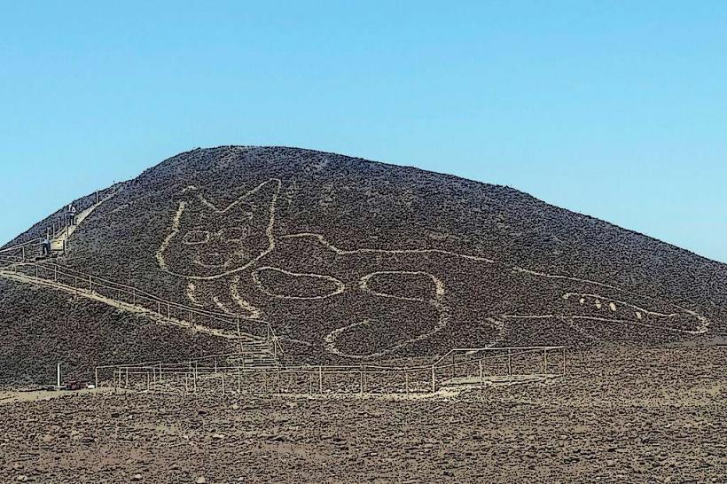
Nazca Lines: UNESCO World Heritage site featuring figures such as the Hummingbird, Spider, Monkey, and Astronaut, some measuring over $200$ m in length.
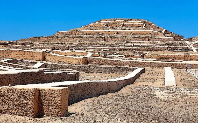
Cahuachi: The world’s largest known ceremonial center made of adobe, consisting of several pyramids built by the Nazca people.
Cantalloc Aqueducts: A system of 40 underground channels, many of which still function today, featuring unique spiral "windows" for cleaning and access.
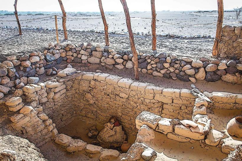
Chauchilla Cemetery: An open-air archaeological site featuring well-preserved mummies, textiles, and pottery in their original tombs.
Maria Reiche Museum: The former home and laboratory of the researcher, located 27 km north of the city.
Transportation Network
Air: Overflights depart from the Maria Reiche Airport. No commercial passenger flights connect Nazca to Lima; it is a dedicated tourism airfield.
Road: Situated on the Pan-American Highway South. It is a major transit point between Lima ($7$ hours), Ica ($2.5$ hours), and Arequipa ($9$–$10$ hours).
Bus: Served by premium coach lines like Cruz del Sur and Ormeño.
Safety & Health
Flight Safety: Overflights involve sharp banking turns to view the lines. Motion sickness is extremely common; passengers are advised to avoid eating before flight. Ensure the operator is licensed and following DGAC (Civil Aviation) safety protocols.
Climate: Heat exhaustion and dehydration are risks. Daytime temperatures frequently exceed $30^\circ\text{C}$ with $0\%$ humidity.
Seismic Activity: The region is highly prone to earthquakes.
Digital & Financial Infrastructure
4G coverage is stable in the town center but drops immediately in the desert. The currency is the Peruvian Sol (PEN). ATMs are available around the Plaza de Armas. Contactless payment is accepted in major hotels but cash is required for airport taxes and smaller vendors.
Climate & Air Quality
Subtropical desert climate. It virtually never rains. Air quality is generally high, though wind-blown sand and dust are constant.
Culture & Social Norms
Preservation: Walking or driving on the Nazca Lines is a federal crime in Peru, punishable by imprisonment. The desert varnish is so fragile that a single footprint can last for centuries.
Cuisine: Specialized in Pachamanca (meat and vegetables cooked underground with hot stones) and local pisco and wine.
Local Cost Index (PEN)
Nazca Lines Overflight: $80$–$120$ USD (approx. S/ 300.00–S/ 450.00)
Airport Tax: S/ 30.00 (Standard fee not included in flight price)
Taxi (City to Airport): S/ 10.00–S/ 15.00
Nearby Day Trips
Palpa Lines: Located 35 km north, these geoglyphs are older (Paracas culture) and often depicted on hillsides rather than flat plains.
Cerro Blanco: One of the highest sand dunes in the world ($2,078$ m), popular for sandboarding and trekking.
Facts & Legends
A geographic fact: The Nazca Lines have survived for 2,000 years because the region receives less than $4$ mm of rain per year and lacks significant wind at the ground level. A popular legend, popularized by Erich von Däniken, suggests the lines were alien landing strips, a theory dismissed by archaeologists who have proven the lines were used for ritual processions related to water and fertility. Historically, Maria Reiche was known to the locals as "the lady who sweeps the desert," as she spent decades clearing dust from the lines with a household broom.