Information
Landmark: Nazca LinesCity: Nazca
Country: Peru
Continent: South America
Nazca Lines, Nazca, Peru, South America
The Nazca Lines are a collection of geoglyphs etched into the desert plains of Peru's Nazca Desert. They are located approximately 400 kilometers south of Lima, near the town of Nazca.
Visual Characteristics
The geoglyphs consist of large-scale designs created by removing the reddish-brown iron-oxide coated pebbles that cover the surface of the Nazca Desert. This exposes the lighter-colored earth beneath. Designs include geometric shapes (lines, trapezoids, spirals), animal figures (hummingbird, monkey, spider, lizard), and plant forms. The scale of these figures is significant, with some extending hundreds of meters.
Location & Access Logistics
Access to the Nazca Lines is primarily from the Pan-American Highway (Carretera Panamericana Sur). The town of Nazca is situated directly on this highway. From Nazca, local tour operators offer transport to viewing points and flights over the geoglyphs. There is a dedicated viewing tower along the Pan-American Highway, approximately 20 kilometers north of Nazca, offering a limited perspective. Parking is available at the viewing tower and at the small airport in Nazca. Public transport to Nazca is via intercity bus services from Lima and other major Peruvian cities.
Historical & Ecological Origin
The Nazca Lines were created by the Nazca culture, which flourished in the region between 200 BCE and 600 CE. The exact purpose of the geoglyphs remains a subject of scholarly debate, with theories ranging from astronomical calendars to ritualistic pathways. Ecologically, the Nazca Desert is an arid coastal desert characterized by a lack of vegetation and minimal erosion, which has preserved the geoglyphs for centuries.
Key Highlights & Activities
The primary activity is viewing the geoglyphs. This is best achieved through aerial tours, typically conducted by small aircraft departing from the Nazca airport. Ground viewing is possible from the Pan-American Highway viewing tower and from elevated points along the highway, though these offer restricted perspectives. Walking among the lines is generally prohibited to preserve the geoglyphs.
Infrastructure & Amenities
The viewing tower on the Pan-American Highway has basic restroom facilities. Food vendors are typically present near the viewing tower and at the Nazca airport. Cell phone signal (4G/5G) is generally available in the town of Nazca and along the Pan-American Highway, but may be intermittent in more remote viewing areas.
Best Time to Visit
The best time of day for aerial viewing is generally in the morning, between 9:00 AM and 12:00 PM, when the sun is at an angle that casts shadows, enhancing the visibility of the lines. The dry season, from May to October, offers clearer skies and more stable weather conditions for flights. There are no tide requirements as the site is inland.
Facts & Legends
One persistent theory suggests the lines were part of an ancient water-finding ritual, with certain lines pointing towards underground water sources. Another notable fact is the discovery of the "Spider" geoglyph, which is over 45 meters long and is best viewed from above.
Nearby Landmarks
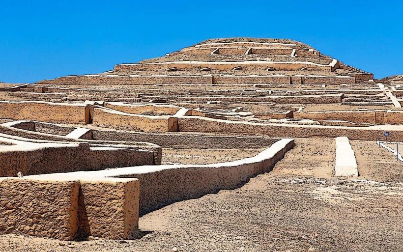
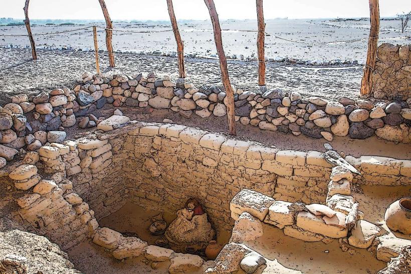
- Cahuachi Archaeological Site (3km Southwest)
- Chauchilla Cemetery (15km Southwest)
- Pampa Colorada (10km North)
- Acari Valley (30km Southeast)