Information
City: Ngorongoro RegionCountry: Tanzania
Continent: Africa
Ngorongoro Region, Tanzania, Africa
The Ngorongoro Region is located in the Crater Highlands of northern Tanzania, centered on the Ngorongoro Conservation Area (NCA). It is a UNESCO World Heritage site and a unique protected area where the indigenous Maasai people live in coexistence with wildlife. The centerpiece of the region is the Ngorongoro Crater, the world’s largest inactive, unbroken, and unfilled volcanic caldera.
Geological & Ecological Framework
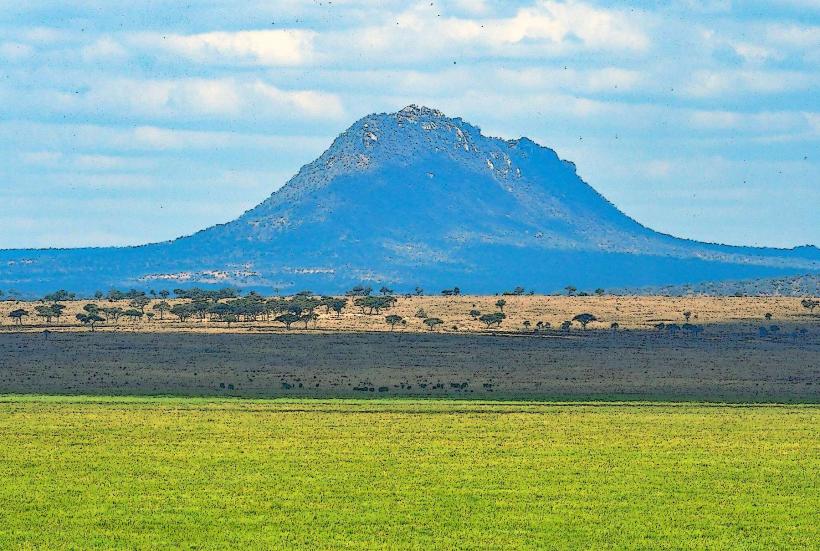
The region was formed approximately 2.5 million years ago when a massive volcano, once thought to be as high as Mount Kilimanjaro, collapsed inward.
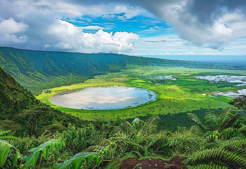
The Crater: Measures 19.2 km in diameter and covers 260 $km^2$. The floor sits 610 m below the rim.
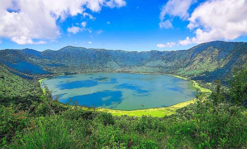
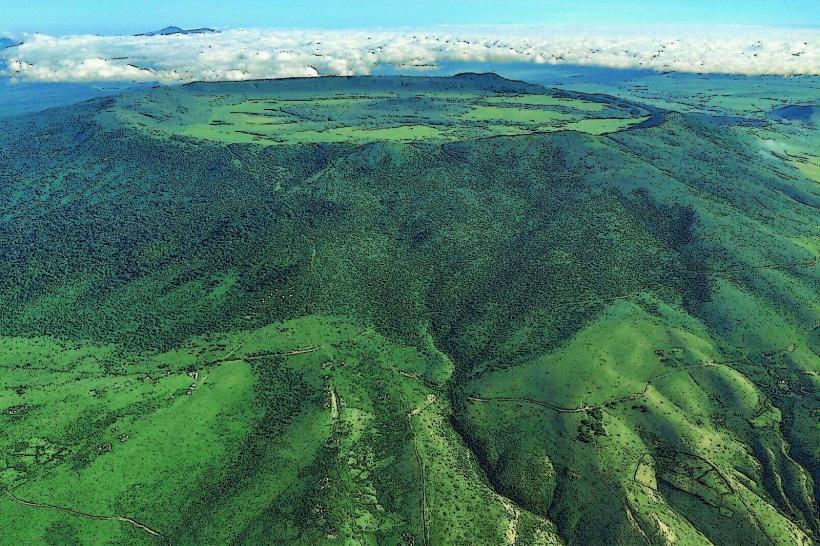
The Highlands: Features several other volcanic peaks, including Olmoti and Empakaai craters, the latter containing a deep alkaline lake.
Biodiversity & Wildlife
The crater floor acts as a natural enclosure, supporting over 25,000 large mammals.
The Big Five: It is one of the few places in Africa where the Black Rhino can be reliably seen in the wild.
Predators: Hosts one of the highest densities of lions in the world.
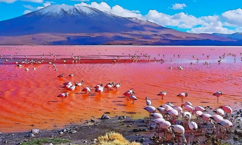
Birdlife: Lake Magadi, the soda lake on the crater floor, attracts thousands of flamingos.
Resident Population: Unlike the Serengeti, most wildlife in the crater does not migrate, remaining in the caldera year-round due to the permanent water supply and lush grazing.
Top Landmarks
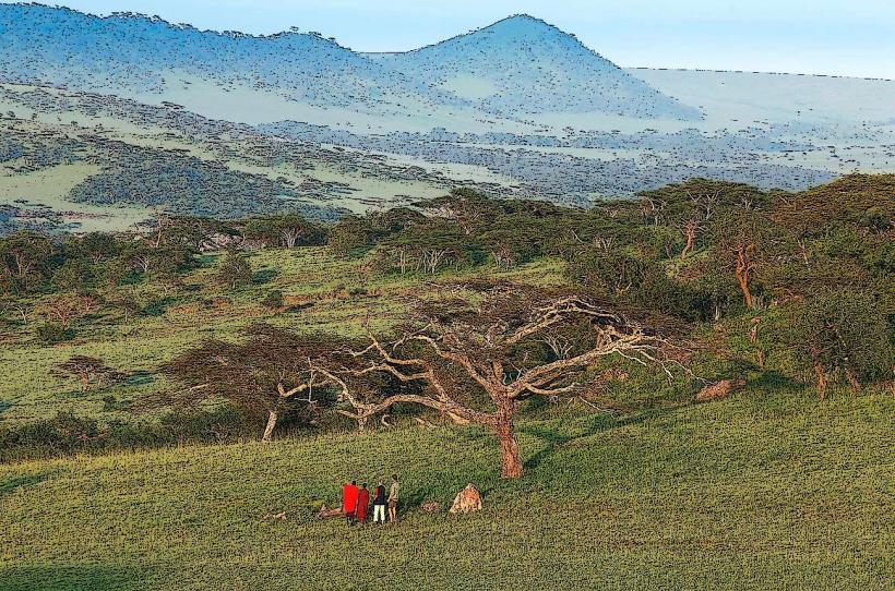
Ngorongoro Crater Floor: A diverse ecosystem of grasslands, swamps, and the Lerai Fever Tree forest.
Olduvai Gorge: Situated within the NCA; a 48 km long ravine known as the "Cradle of Mankind" for its fossilized remains of early hominids like Homo habilis.
Shifting Sands: A crescent-shaped dune of black volcanic ash that moves approximately 17 meters per year across the desert plains near Olduvai.
Empakaai Crater: A remote caldera known for its emerald-green lake and hiking trails.
Laetoli Footprints: 3.6-million-year-old hominid footprints preserved in volcanic ash.
Transportation Network
Air: No airstrips are allowed inside the crater. The Manyara Airstrip (LKY) is the nearest hub, located 45 km away.
Road: Accessed via a paved road from Arusha ($3.5$ hours). The descent into the crater is strictly restricted to 4x4 vehicles via steep, one-way access roads.
Access Control: Vehicles are permitted on the crater floor for a maximum of six hours per day to minimize environmental impact.
Safety & Health
Human-Wildlife Conflict: Walking is strictly prohibited on the crater floor. In the highland areas where hiking is allowed, armed rangers are mandatory.
Temperature: At the crater rim ($2,300$ m elevation), temperatures can drop below $10^\circ\text{C}$ at night; warm clothing is essential.
Malaria: Risk is low on the high-altitude rim but present on the crater floor and in the lower-lying areas toward Lake Eyasi.
Digital & Financial Infrastructure
4G signal is available at the major lodges on the crater rim but absent on the crater floor. The region uses USD/TZS. All conservation fees (approx. $71$ USD per person + $295$ USD per vehicle entry fee) must be prepaid via an electronic smart card; cash is not accepted at the gates.
Climate & Seasons
Dry Season (June–October): Thinner vegetation makes spotting rhino and predators easier.
Wet Season (November–May): The landscape turns bright green; the "short rains" in November attract migratory birds and fill the alkaline lakes.
Fog: The crater rim is frequently shrouded in thick mist during the early morning hours.
Culture & Social Norms
Maasai Coexistence: The NCA is a "multiple land-use" area. Maasai pastoralists are permitted to graze cattle on the crater floor during the day but must return to their bomas (villages) on the rim by nightfall.
Photography: Asking permission before photographing Maasai people or their livestock is a critical social norm.
Conservation Ethos: Off-road driving is strictly forbidden and monitored by patrols.
Local Cost Index (USD)
24-hour Conservation Fee (Non-Resident): $71.00
Crater Service Fee (Per Vehicle per entry): $295.00
Guided Maasai Village Visit: $20.00–$50.00
Facts & Legends
Legend says that the Ngorongoro Crater was named by the Maasai after the sound of the cowbell (ngoro-ngoro) worn by the lead cattle of the first herders to enter the caldera. A geographic fact: Because of the steep walls, the crater floor has its own microclimate, often staying cooler and wetter than the surrounding Serengeti plains. Historically, the area was part of the Serengeti National Park until 1959, when it was separated to allow the Maasai to continue their traditional way of life.