Information
City: North CoastCountry: Antigua and Barbuda
Continent: North America
North Coast, Antigua and Barbuda, North America
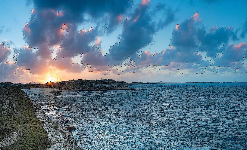
The North Coast of Antigua is the island’s primary corridor for luxury residential estates, high-end hospitality, and critical infrastructure. It spans the coastline from the western edge of Dickenson Bay eastward to the Hodges Bay and Dutchman’s Bay areas.
Historical Timeline
The region transitioned from colonial-era sugar plantations and defensive outposts to a high-value residential zone in the post-WWII era. Governance has remained under the central Antiguan administration, with significant commercial development following the 1949 opening of the V.C. Bird International Airport. Major reconstruction occurred after the 1974 earthquake and Hurricane Luis in 1995, necessitating modern reinforced concrete standards. The primary event shaping the current urban form was the mid-century establishment of the United States Air Force and Navy bases (now largely deactivated or integrated), which brought the first modern road and telecommunications infrastructure to the district.
Demographics & Population
The permanent population of the North Coast districts is approximately 4,500 residents. The area features a high concentration of the island’s upper-middle class and expatriate community. Demographics are primarily Afro-Antiguan, supplemented by significant British, American, and Italian minorities. The median age is approximately 36.2 years.
Urban Layout & Key Districts
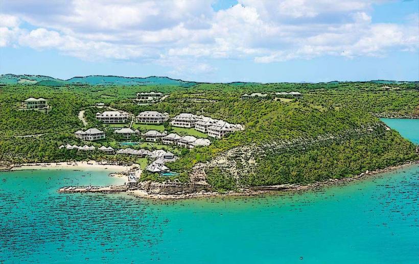
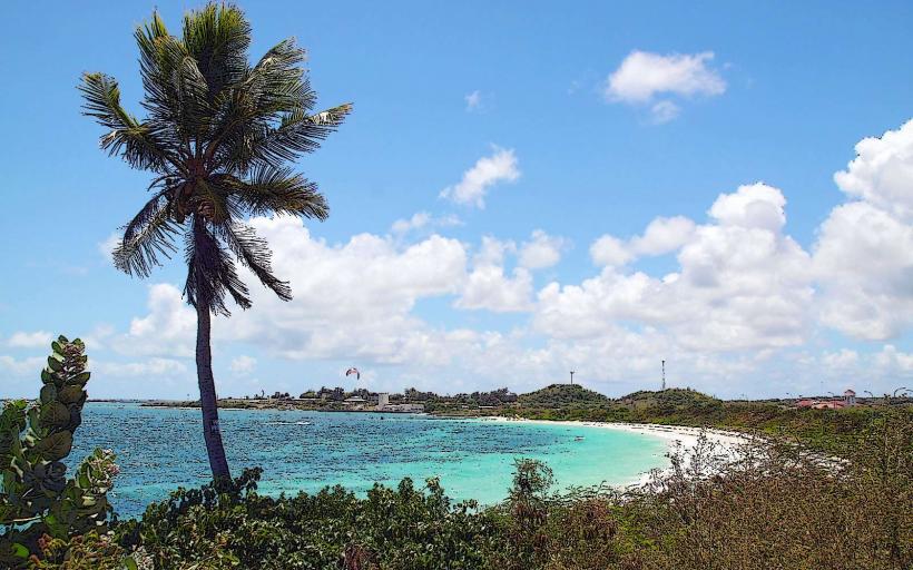
The North Coast is organized along the Friars Hill Road and Blue Waters/Hodges Bay coastal corridors. The 2 most important districts are Friars Hill (the commercial and banking hub, located South-Central) and Hodges Bay (the primary luxury residential and hotel district, located East). The area is characterized by low-density housing and sprawling resort properties.
Top City Landmarks
V.C. Bird International Airport
American University of Antigua (AUA)
Cedar Valley Golf Course
Blue Waters Resort
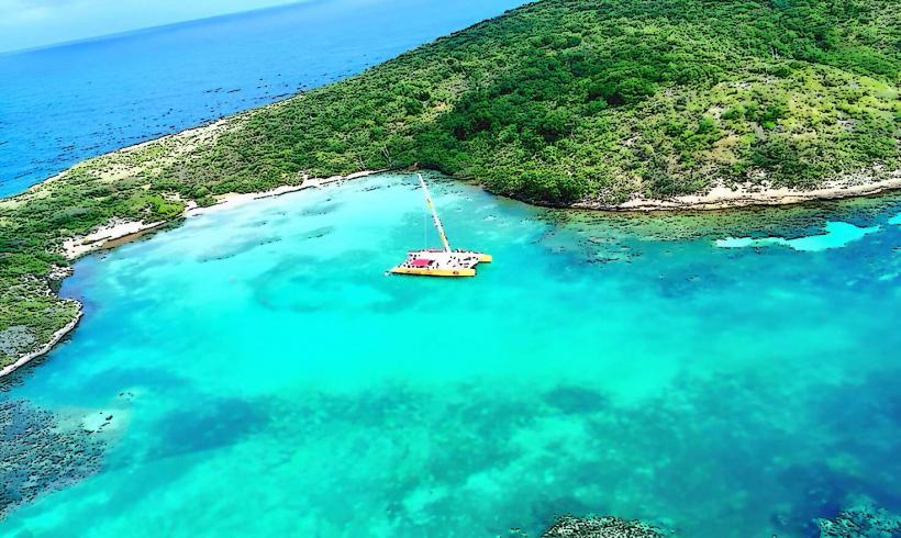
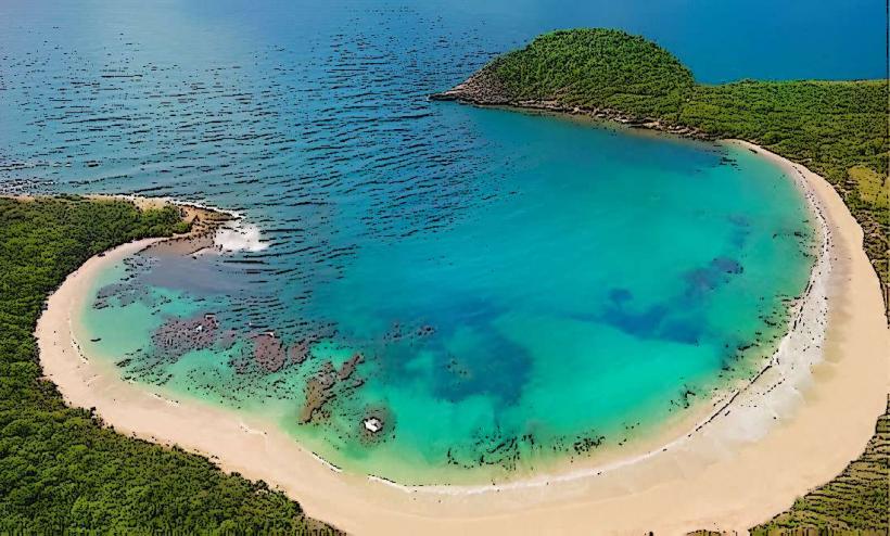
Prickly Pear Island (offshore)
Transportation Network
Movement is almost exclusively dependent on private vehicles. There is no metro or rail system. Public transportation is limited to Route 40 and 42 mini-vans serving the western edge (Dickenson Bay/Cedar Grove), while the eastern North Coast (Hodges Bay) lacks frequent bus service. Ride-sharing apps do not operate; transport relies on official "TX" taxis stationed at the airport and resorts, which use fixed government-mandated rates. Traffic density is high at the Friars Hill and Anchorage Road junctions during school and work commute hours.
Safety & "Red Zones"
The general safety level is high. There are no specific "red zones" or dangerous neighborhoods. Risks are primarily limited to opportunistic residential burglary and petty theft from vehicles at beach access points. Visitors should exercise caution on unlit coastal roads after midnight.
Digital & Financial Infrastructure
Internet speeds average 50–100 Mbps, with the highest concentration of fiber-optic connectivity on the island due to the proximity of the university and airport. Main mobile carriers are Flow and Digicel. Card acceptance is universal in the Friars Hill commercial district and all hotels. The most reliable ATMs are located at the Epicurean Supermarket and Woods Centre.
Climate & Air Quality
Temperatures range from 23°C to 28°C in winter and 25°C to 31°C in summer. Air quality is exceptionally high due to constant exposure to the Atlantic trade winds. Specific weather risks include high-velocity winds and coastal swells during the hurricane season from June to November.
Culture & Social Norms
Tipping of 10–15% is standard. Formal greetings (e.g., "Good morning") are a strict social requirement. Dress codes are conservative in commercial areas; swimwear is prohibited in supermarkets and banks. Camouflage patterns are illegal for civilian wear. The presence of the American University of Antigua has introduced a more North American student culture to the Friars Hill area.
Accommodation Zones
Hodges Bay: Stay here for luxury resort access and proximity to the airport.
Blue Waters/Crosbies: Stay here for secluded, high-end residential quiet and sea views.
Local Cost Index
1 Espresso: 12.00 XCD ($4.45 USD)
1 Standard Lunch: 50.00 XCD ($18.50 USD)
1 Bus Ticket (to St. John's): 2.50 XCD ($0.95 USD)
Nearby Day Trips
Prickly Pear Island: 1 km (10-minute boat ride from Hodges Bay)
St. John’s (Capital): 5 km (10 minutes by car)
Stingray City: 12 km (25 minutes by car)
Devil’s Bridge: 18 km (35 minutes by car)
Facts & Legends
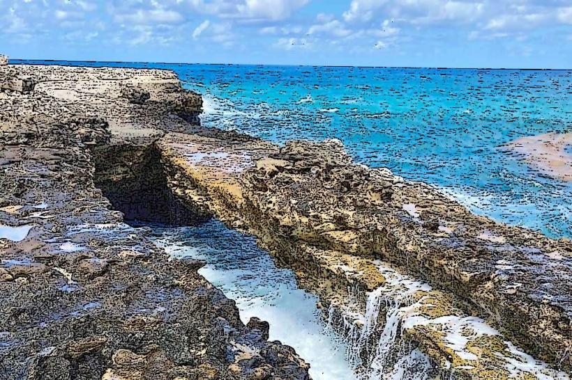
The North Coast is home to the "Boiling Pot," a local geological oddity where the Atlantic surf crashes into hollowed-out limestone, creating a pressurized spray resembling a boiling cauldron. A local historical legend suggests that tunnels exist beneath the deactivated U.S. base at Coolidge, connecting the coast to secret underground bunkers, though most of these are verified only as standard WWII-era munitions storage facilities.