Information
City: OdesaCountry: Ukraine
Continent: Europe
Odesa, Ukraine, Europe
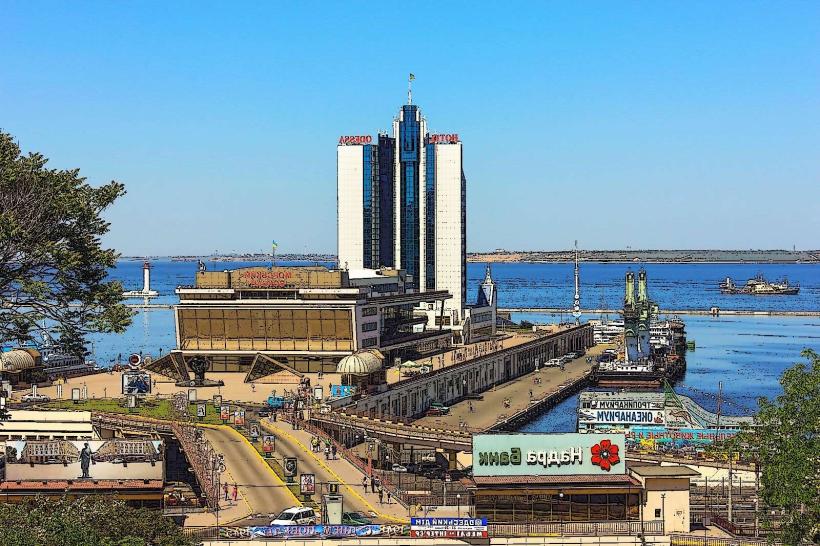
Odesa serves as the primary maritime gateway for Ukraine and a critical export hub for global trade, housing the country's largest commercial seaport. It is situated on the northwestern shore of the Black Sea, built on a high coastal steppe overlooking the Gulf of Odesa.
Historical Timeline
Odesa was officially founded in 1794 by a decree of Catherine the Great on the site of the captured Ottoman fortress Khadjibey. Primary governance eras include the Imperial period (1794–1917), the Soviet era (1921–1991), and the period of Ukrainian independence. The city underwent massive reconstruction following the Axis occupation in WWII, specifically between 1944 and 1953. The implementation of the Porto Franco (free port) status in 1819 is the primary event that shaped the current urban form, attracting a diverse international population that built the city's signature Neoclassical center.
Demographics & Population
The population within city limits is approximately 1.01 million. The top three ethnic demographics are Ukrainian (62%), Russian (29%), and Bulgarian (1.3%). The median age of the population is 41.5 years.
Urban Layout & Key Districts
The city is organized on a strict grid plan that terminates at the coastal cliffs and the port. Prymorskyi (Central) is the historic and administrative heart of the city, located on the plateau above the harbor. Arcadia to the south is the primary resort and entertainment district, while Suvorovskyi to the north is the largest residential and industrial zone.
Top City Landmarks
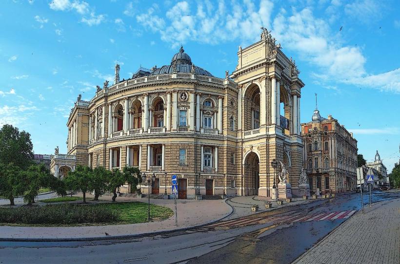
Odesa National Academic Opera and Ballet Theatre
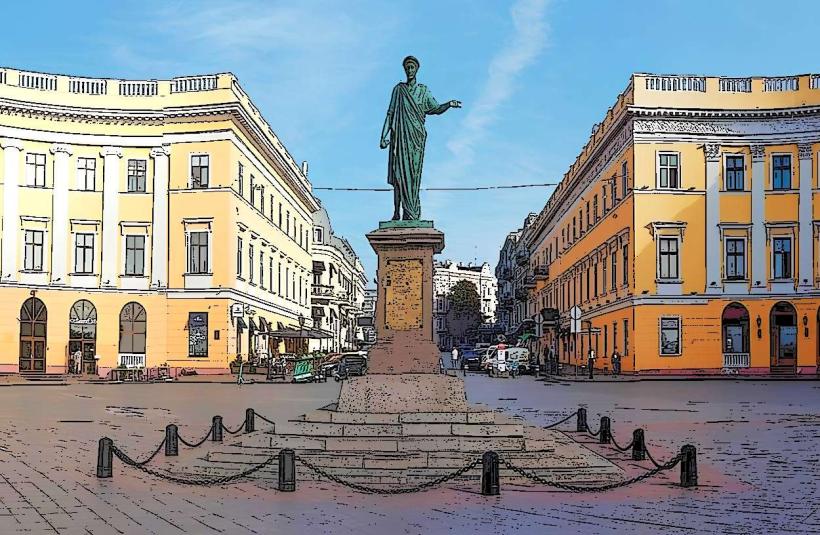
Primorsky Boulevard
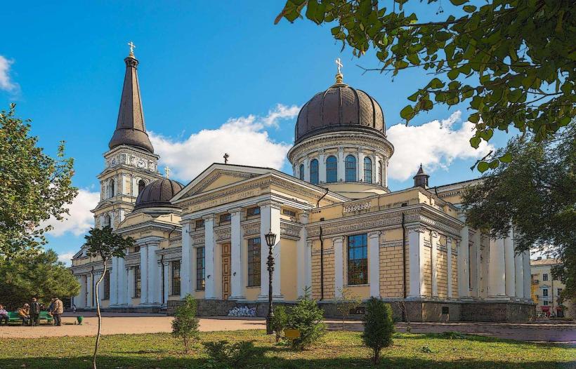
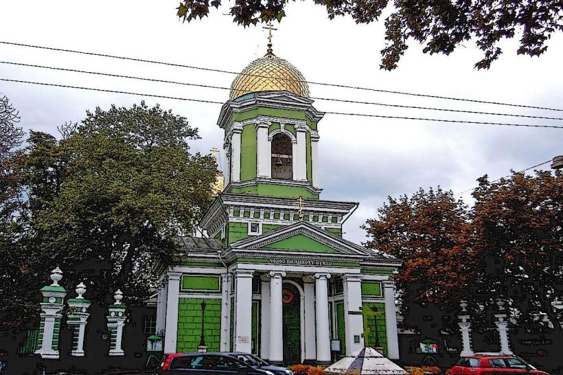
Spaso-Preobrazhensky Cathedral
Transportation Network
Movement within the city relies on a dense network of trams, trolleybuses, and private minibuses (marshrutkas). There is no metro system. Ride-sharing is dominated by Uklon, Bolt, and Uber. Official taxis use the Uklon app as the primary dispatch standard and are identified by roof signs rather than a specific car color. Traffic density is high in the city center and along the French Boulevard.
Safety & "Red Zones"
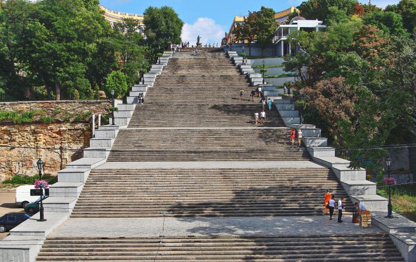
The general safety level is currently subject to national security protocols and curfews. Caution is advised at night in the suburban residential blocks of the Kotovsky Settlement (North) and the industrial Peresyp area. Common scams involve "fixed-price" tourist menus in central cafes that exclude mandatory service fees and aggressive street photography touts near the Potemkin Stairs.
Digital & Financial Infrastructure
Internet speeds average 180 Mbps with widespread fiber-to-the-building (FTTB) coverage. Main mobile carriers are Kyivstar, Vodafone, and lifecell. Card and NFC acceptance (Apple/Google Pay) is universal in the city center. ATMs are ubiquitous in bank branches (PrivatBank, Oschadbank) and all major supermarkets.
Climate & Air Quality
Temperatures range from -2°C to 4°C in winter and 20°C to 30°C in summer. Air quality is generally moderate, though particulate levels increase near the port and industrial zones in the north. Weather risks include seasonal sea fogs in spring and occasional heavy snowstorms (burans) in late winter.
Culture & Social Norms
The standard tipping percentage is 10%. Handshakes are the standard greeting; men should wait for a woman to offer her hand first. Dress codes in the city center are stylish and often formal for evening dining. Smoking is prohibited in all public indoor spaces; alcohol consumption is restricted to licensed outdoor terraces and private property.
Accommodation Zones
Prymorskyi (Historic Center): Recommended for walking access to the Opera House, museums, and historic architecture.
Arcadia: Recommended for proximity to the beach, modern high-rise apartments, and the primary nightlife corridor.
Local Cost Index
1 Espresso: ₴45 ($1.10)
1 Standard Lunch: ₴300 ($7.30)
1 Tram/Trolleybus Ticket: ₴8 ($0.20)
Nearby Day Trips
Bilhorod-Dnistrovskyi / Akkerman Fortress (80 km)
Shabo Wine Culture Center (70 km)
Kuyalnik Liman (10 km)
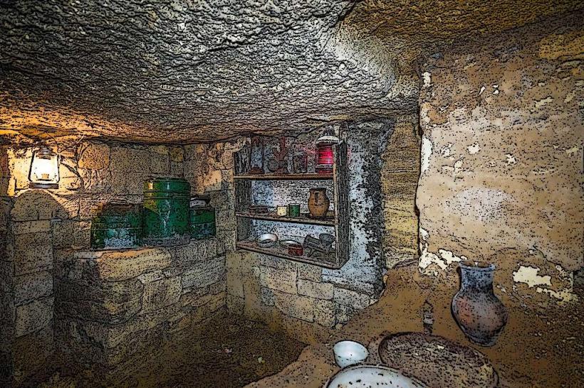
Nerubayske Catacombs (15 km)
Vylkove (200 km)
Facts & Legends
Odesa sits atop one of the world's largest labyrinthine networks of catacombs, spanning over 2,500 kilometers of mapped tunnels. A local urban legend claims that a solid gold model of a ship (The Golden Titanic) was hidden deep within these tunnels by a wealthy merchant during the 1917 Revolution; despite numerous expeditions, the artifact has never been recovered.