Information
City: PamplemoussesCountry: Mauritius
Continent: Africa
Pamplemousses, Mauritius, Africa
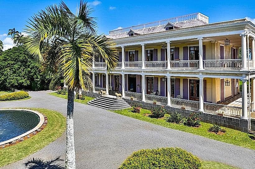
Pamplemousses serves as a primary historical and botanical center in the Pamplemousses District of northwest Mauritius, approximately 11 kilometers from Port Louis. It functions as an agricultural and cultural hub, housing the nation's premier botanical research facilities and remnants of the colonial sugar industry.
Historical Timeline
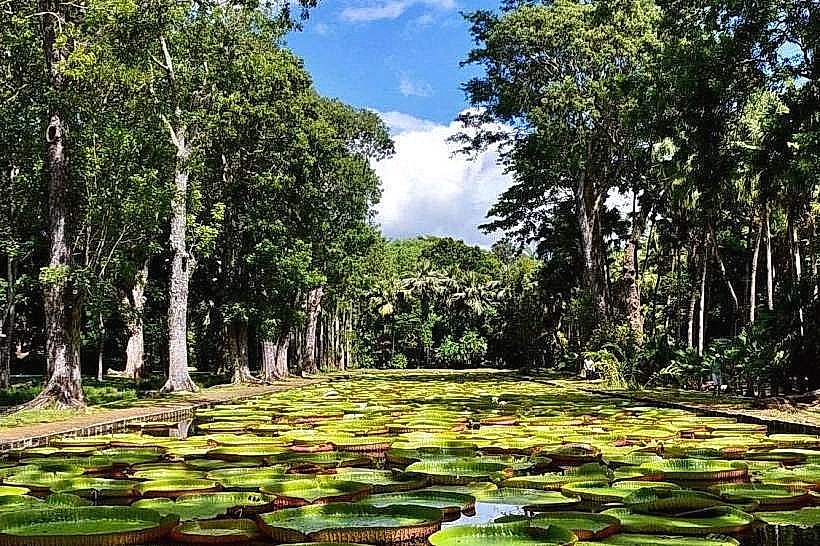
The town was established in 1735 by French Governor Mahé de La Bourdonnais, initially as a vegetable garden to supply ships. It transitioned through French colonial administration (1715–1810) and British rule (1810–1968) before becoming a key site for independent Mauritius. The primary event that shaped the current urban form was the 18th-century landscape engineering by Pierre Poivre, who transformed the area into a global center for spice acclimatization and botanical study.
Demographics & Population
The Pamplemousses District contains approximately 140,000 residents, with the village core housing roughly 9,000. The demographics are 68% Indo-Mauritian, 27% Creole, and 5% Sino-Mauritian and Franco-Mauritian. The median age is 36 years.
Urban Layout & Key Districts
The village is organized around the junction of the B11 and the M2 motorway. Key districts include the Botanical Core, containing the historical gardens and colonial administrative buildings; Beau Plan (Southwest), a modernized commercial and creative district; and the residential periphery, characterized by traditional low-density housing and sugarcane fields.
Top City Landmarks
Sir Seewoosagur Ramgoolam Botanical Garden
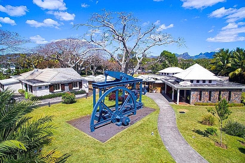
L'Aventure du Sucre (Sugar Museum)
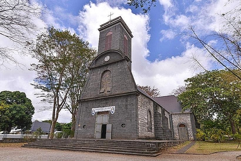
Saint Francis of Assisi Church (Oldest on the island)
Pamplemousses Cemetery (Historical burial ground)
Transportation Network
Movement is facilitated by a dense bus network connecting to the Northern Terminal in Port Louis and the coastal hubs of Grand Baie and Triolet. The Metro Express does not currently reach this district. Ride-sharing is available via the Yugo app. Official taxis are white with yellow signs and are primarily stationed near the Botanical Garden entrance. Traffic density is high during peak hours at the Beau Plan roundabout.
Safety & "Red Zones"
The safety level is very high during daylight hours. Avoid the unlit areas surrounding the cemetery and the periphery of the botanical gardens after 18:00. Common scams include unlicensed "tour guides" at the garden gates and overpricing for Manioc biscuits in the informal markets.
Digital & Financial Infrastructure
Average internet speed is 40-60 Mbps. Main carriers are my.t and Emtel. Card acceptance is high at major tourist sites and the Mahogany Shopping Promenade; cash (MUR) is required for small eateries and local transport. ATMs are concentrated in the Beau Plan commercial zone and near the village council.
Climate & Air Quality
Temperatures range from 17°C to 25°C in winter and 22°C to 31°C in summer. The region experiences high humidity and localized afternoon showers. Air quality is generally high due to the high density of vegetation, though localized exhaust concentrations occur near the M2 motorway.
Culture & Social Norms
A 10% tip is standard in restaurants. Handshakes are the common greeting, often followed by a polite "Bonjour." Dress code is conservative; beachwear is strictly prohibited in the village and religious sites. Smoking is banned in public gardens and transport hubs.
Accommodation Zones
Stay in Beau Plan for modern amenities, high-speed internet, and walking access to the Sugar Museum.
Stay in the nearby coastal zone of Trou aux Biches (15 minutes by car) for beach access while remaining close to the historical center.
Local Cost Index
1 Espresso: 105 MUR ($2.30 USD)
1 Standard Lunch (Crêperie/Local Cafe): 350 MUR ($7.65 USD)
1 Bus Ticket: 30-40 MUR ($0.65 - $0.90 USD)
Nearby Day Trips
Port Louis Waterfront: 11 km (15 minutes)
Trou aux Biches Beach: 9 km (15 minutes)
Cap Malheureux: 16 km (25 minutes)
Mont Choisy: 12 km (20 minutes)
Facts & Legends
Pamplemousses is the setting for the famous 1788 French novel Paul et Virginie by Bernardin de Saint-Pierre; local legend claims the protagonists are buried in the village cemetery, though they are fictional characters. A verified historical oddity is that the "Pamplemousses" name originates from the Dutch pompelmoes (pomelo), which was introduced to the area in the 17th century to prevent scurvy among sailors.