Information
City: Rio ClaroCountry: Trinidad and Tobago
Continent: North America
Rio Claro, Trinidad and Tobago, North America
Rio Claro serves as the commercial and administrative hub of southeastern Trinidad and the seat of the Mayaro–Rio Claro Regional Corporation. It functions as a critical inland junction connecting the energy-rich zones of Guayaguayare and Mayaro to the urban centers of the west.
Historical Timeline
The town’s name originated from the Spanish surveyors who named the "Clear River" that flows through the area. Founded in the late 18th century as a cocoa-producing outpost, the primary era of growth coincided with the expansion of the Trinidad Government Railway in 1914. Rio Claro served as the eastern terminus of the railway line, facilitating the movement of timber, cocoa, and later, personnel for the burgeoning oil industry. The railway closed in the 1960s, but the town maintained its role as a regional transit node.
Demographics & Population
The broader regional corporation has a population of approximately 36,000. The demographic is characterized by a high concentration of Indo-Trinidadian and Afro-Trinidadian populations, with a significant agricultural and labor-oriented workforce. It is considered a "middle-tier" urban center with a strong rural-agrarian identity.
Urban Layout & Key Districts
The town is organized around a central intersection where the Naparima–Mayaro Road meets the Tabaquite Road.
Town Center: The high-density commercial core containing the market, bus terminal, and administrative offices.
Clear Water: A residential area named after the original river.
Ecclesville: A sprawling agricultural and residential district to the south.
Tabaquite Road: The main artery leading toward the central interior and the Navet Dam.
Top Landmarks
Rio Claro Heritage Site: Location of the former railway station and terminus.
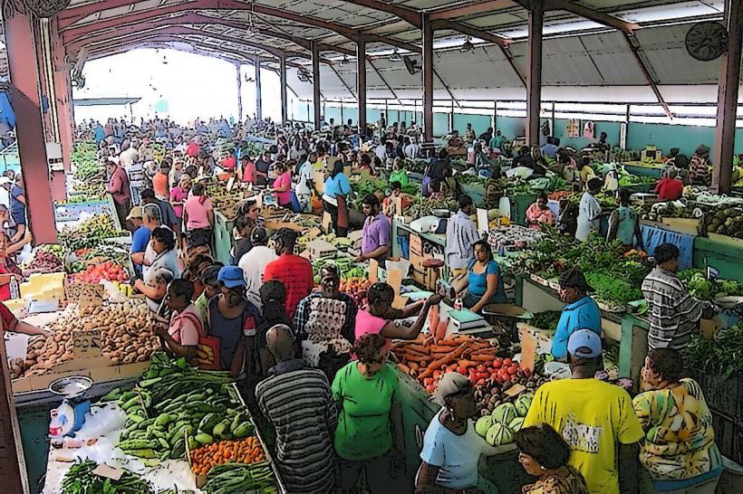
The Rio Claro Market: A vibrant hub for agricultural trade and local produce.
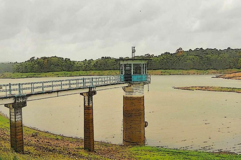
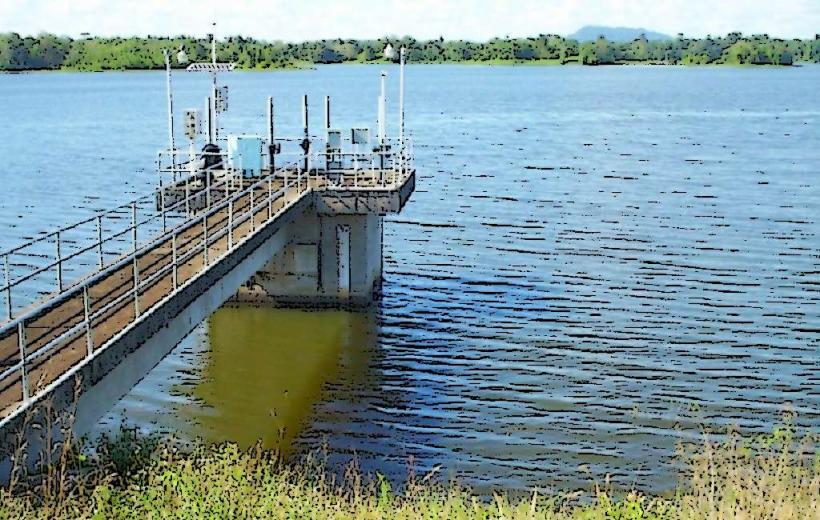
Navet Dam: Located to the northwest; the largest reservoir in Trinidad and a critical source of drinking water.
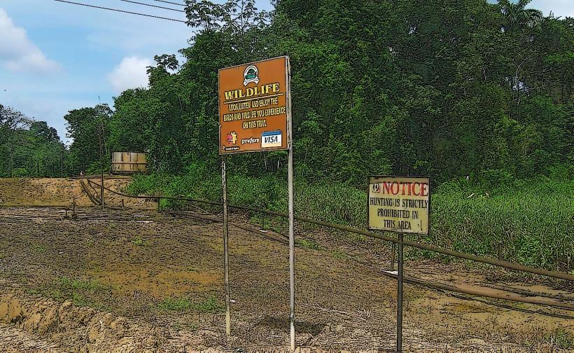
The "Lumber Core": Industrial zones on the outskirts dedicated to the region's historical timber industry.
Transportation Network
Rio Claro is a major transit interchange for the southern half of the island.
Maxi Taxis: Blue-banded maxis connect the town to San Fernando (approx. 45–60 minutes) and Mayaro (20 minutes).
Buses: PTSC operates routes from the central terminal toward Princes Town and Sangre Grande.
Road Infrastructure: Access relies heavily on the Naparima–Mayaro Road, which can be prone to landslides during the rainy season.
There is no railway or airport; travel is exclusively road-based.
Safety & "Red Zones"
Rio Claro is generally safe during daylight hours, but caution is advised in the central market area and the bus terminal late at night. Violent crime is lower than in the East-West Corridor but has seen localized increases in home invasions in remote agricultural areas. Use only "H" registered taxis. There are no officially designated "Red Zones," but the town desolates quickly after sunset.
Digital & Financial Infrastructure
4G/LTE mobile coverage is robust in the town center but degrades significantly in the forested interior and agricultural valleys. High-speed fiber is available in the main commercial district. The economy is heavily cash-reliant (Trinidad and Tobago Dollar - TTD). Major banks (Republic Bank, First Citizens) are located in the town center; ATMs are generally available but can experience shortages during month-end periods.
Climate & Air Quality
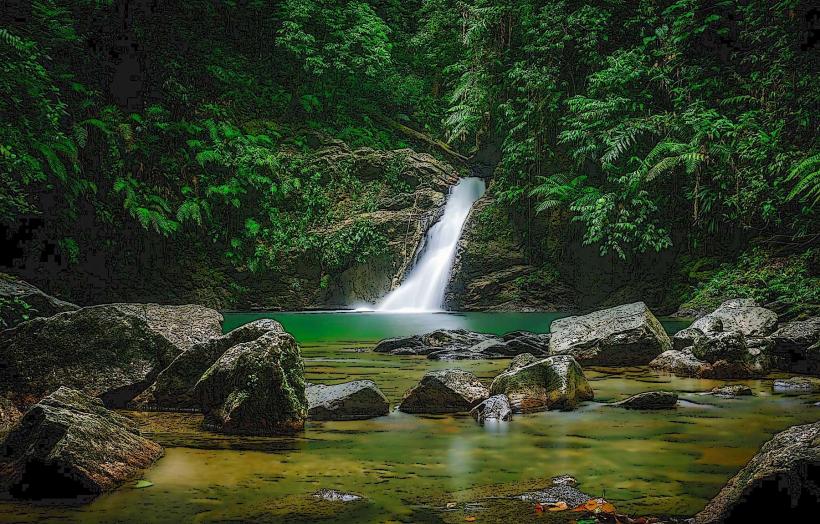
The area has a tropical monsoon climate with significantly higher humidity and rainfall than coastal regions. Temperatures range from 22°C to 32°C. Air quality is high due to the surrounding dense forests and lack of heavy manufacturing, though smoke from agricultural "slash and burn" clearing can affect visibility during the dry season.
Culture & Social Norms
The culture is a blend of "Old Trinidad" agrarian values and modern industrial work schedules. It is a major center for rural sports, including cricket and football. Tipping is 10%. Dress is practical and casual. Residents are noted for a distinct regional accent and a reputation for hospitality.
Accommodation Zones
Town Center: Limited small guesthouses for transient business travelers.
Ecclesville/Outskirts: Private agricultural estate stays and nature-oriented rentals.
Local Cost Index (TTD)
1 Espresso: 20–35 TTD (mostly instant coffee available locally)
1 Standard Lunch (Roti/Box lunch): 35–75 TTD
1 Taxi Ride (to Mayaro): 15–25 TTD
Nearby Day Trips
Mayaro Beach: 20 minutes east for swimming and recreational activities.
Devil’s Woodyard: 30 minutes west, featuring active mud volcanoes.
Navet Dam: 25 minutes northwest for nature walks and scenic views.
Facts & Legends
Rio Claro is often referred to as the "Gateway to the East" for those traveling from San Fernando. A local legend concerns "Papa Bois," the protector of the forest, who is said to roam the deep teak and mahogany plantations surrounding the town. Historically, the arrival of the first train in 1914 was celebrated as the most significant event in the town's history, as it effectively ended its geographical isolation.