Information
City: Saint AndrewCountry: Barbados
Continent: North America
Saint Andrew, Barbados, North America
Saint Andrew is a northern parish situated on the rugged windward coast of Barbados. Known as the "Scotland District," it is geologically distinct from the rest of the island, featuring high peaks, deep valleys, and sedimentary rock formations rather than the standard coral limestone cap.
Historical Timeline
1645: Established as one of the original six parishes.
1882–1937: Served by the Barbados Railway, which struggled with the parish's unstable, clay-heavy terrain.
1950s: The "Scotland District" was designated a protected area to combat severe soil erosion.
2023–2026: Extensive rehabilitation of the Scotland District road network following major damage from tropical weather systems.
Geography & Environment
Topography: The most mountainous region of Barbados. It contains Mount Hillaby, the island's highest point at 340m.
Geology: Unlike the rest of Barbados, which is coral-capped, Saint Andrew consists of folded and faulted layers of clay, shale, and sandstone.
Flora: Features the Turner's Hall Woods, the last remaining 50-acre stand of the original primary tropical forest that covered the island before colonization.
Top Landmarks & Attractions
Mount Hillaby: Offers the most comprehensive views of the island, including both the west and east coasts simultaneously on clear days.
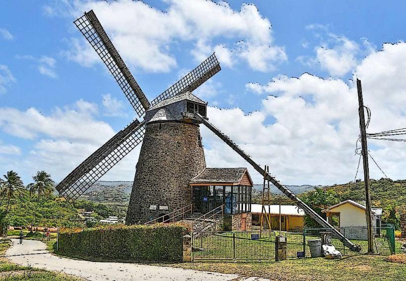
Morgan Lewis Windmill: One of only two intact and functional sugar windmills in the world. It is a National Trust property and an iconic example of 18th-century industrial technology.
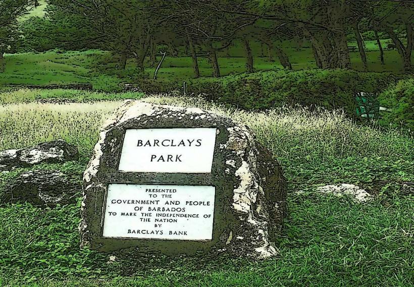
Barclays Park: A 50-acre seaside park gifted to the government by Barclays Bank, providing a popular spot for picnics overlooking the Atlantic.
St. Andrew's Parish Church: Located in the valley near Belleplaine; it is a historic structure that has survived multiple hurricanes and landslides.
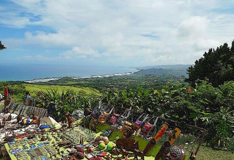
The Chalky Mount Potteries: A hillside village famous for its long tradition of pottery-making using local clay deposits found in the surrounding hills.
Transportation & Logistics
Road: Accessible via the Ermy Bourne Highway (East Coast Road) or through the central highlands via Highway 2.
Public Transport: Buses to Saint Andrew (Belleplaine/Shorey Village) depart from the Princess Alice Terminal in Bridgetown.
Driving: Roads in this parish are notoriously difficult. The soil is prone to "slippage," leading to frequent cracks, steep drops, and sudden road closures. High-clearance vehicles are recommended for the more remote interior tracks.
Safety & Health
Marine Safety: The Atlantic coast in Saint Andrew (Long Pond, Walkers) is extremely dangerous. The sea is characterized by massive swells, strong currents, and a lack of lifeguards. Swimming is not permitted.
Natural Hazards: During heavy rains, the parish is prone to landslides and flooding.
Health: This is a rural parish with limited medical facilities; the nearest major clinic is the St. Andrew Outpatients Clinic in Belleplaine.
Digital & Financial Infrastructure
4G coverage is available in major villages like Belleplaine but is highly unreliable in the deep valleys and on the slopes of Mount Hillaby. There are no ATMs in Saint Andrew. Visitors must carry cash (BBD) for local shops and potteries.
Local Cost Index
1 Guided Hike (Mount Hillaby): ~$50.00 – $80.00 BBD ($25.00 – $40.00 USD)
1 Handmade Chalky Mount Pot: ~$30.00 – $150.00 BBD ($15.00 – $75.00 USD)
1 Bus Fare: ~$3.50 BBD ($1.75 USD)
Facts & Legends
A verified geological fact is that the Scotland District is a part of the Accretionary Wedge of the Lesser Antilles subduction zone, making it one of the few places in the world where the seafloor has been pushed up to form land. Local legend speaks of "The Sleeping Giant," the silhouette of the hills as seen from certain angles, which is said to be an ancient guardian protecting the island's northern tip.