Information
City: SeydisfjordurCountry: Iceland
Continent: Europe
Seydisfjordur, Iceland, Europe
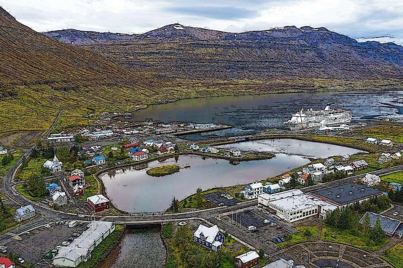
Seyðisfjörður serves as the primary maritime gateway for the Eastfjords and the cultural capital of the region. It functions as the sole international ferry terminal connecting Iceland to mainland Europe (Denmark and the Faroe Islands), characterized by its preserved 19th-century Norwegian wooden architecture and its isolation at the base of steep, waterfall-laden mountains.
Historical Timeline
Settlement flourished in the mid-19th century as a center for the herring fishing industry. The primary event shaping its current urban form was the Norwegian influence during the late 1800s, which introduced the iconic "Sveitserstil" (Swiss chalet style) buildings that define the town center. In December 2020, the town experienced a catastrophic landslide event following record rainfall, which destroyed several historic buildings; the town has since undergone a massive geological risk assessment and reconstruction project.
Demographics & Population
The population is approximately 670 (2026 estimate). The demographic is Icelandic, supplemented by a high concentration of artists and designers. The town hosts the Skaftfell Center for Visual Arts, attracting an international residency population that skews the median age lower than comparable rural villages.
Urban Layout & Key Districts
The village is situated at the innermost point of the Seyðisfjörður fjord. It is highly centralized and walkable. Key landmarks are clustered along the Norðurgata and Fjarðargata streets. The town is physically constrained by the sea and the towering mountains of Strandartindur and Bjólfur.
Top City Landmarks
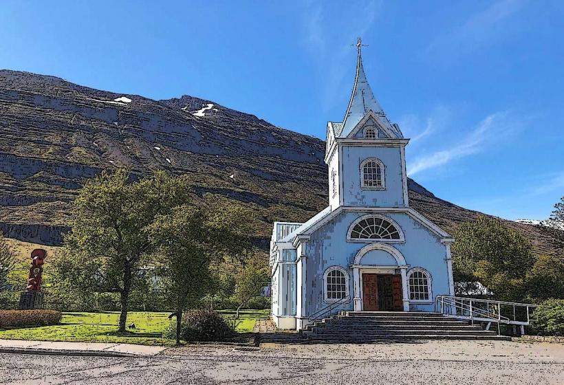
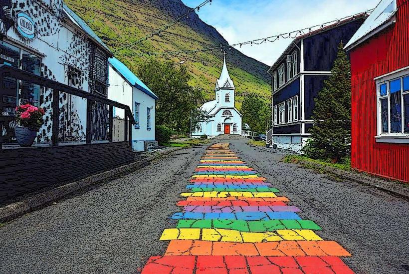
Seyðisfjarðarkirkja (The Blue Church): Famous for its light blue color and the "Rainbow Street" leading to its entrance.
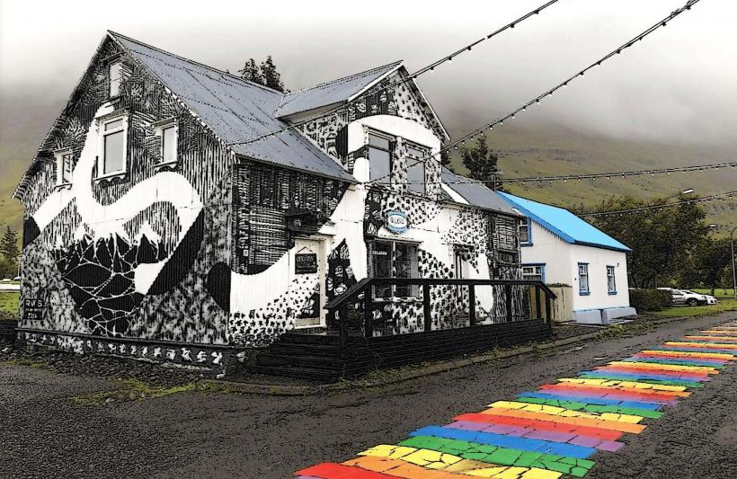
Rainbow Street: A permanent painted pavement leading through the commercial core.
Skaftfell Art Center: A hub for contemporary art and residencies.
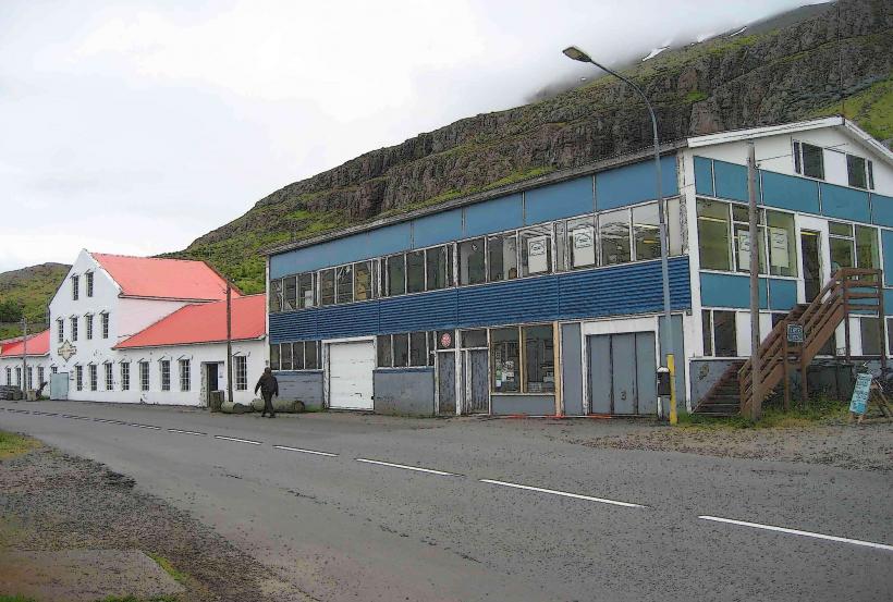
Technical Museum of East Iceland: Focused on the town's history as a hub for telegraphy and mechanics.
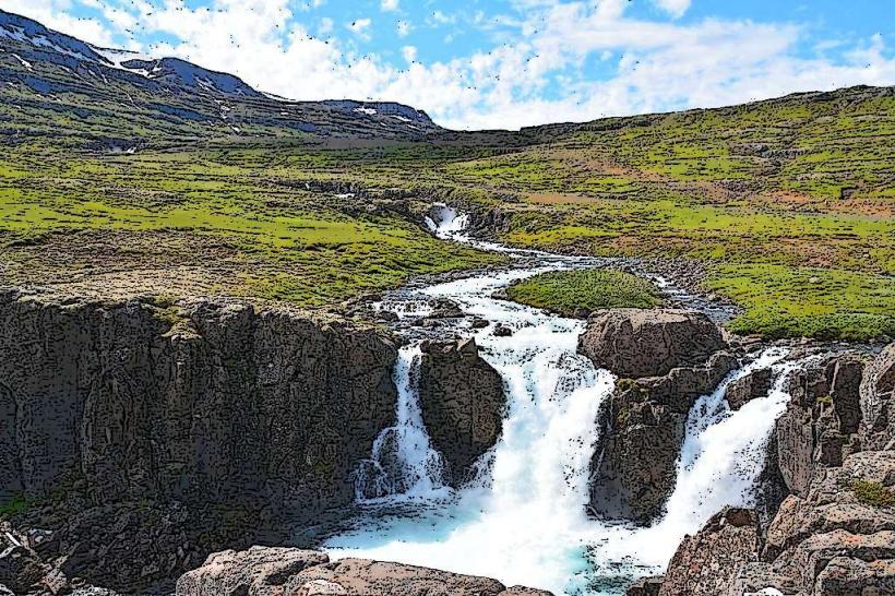
Gufufoss: A powerful waterfall located just above the town on the mountain pass.
Transportation Network
Movement is facilitated by the Fjarðarheiði mountain pass (Route 93), which connects the town to Egilsstaðir (27 km). There is no rail transit. The Smyril Line ferry Norröna docks here weekly, providing the only vehicle-ferry link to Europe. Public transport is limited to regional buses connecting to Egilsstaðir. During winter, the mountain pass is frequently closed due to heavy snow and wind; a tunnel project is currently under formal government evaluation to ensure year-round access.
Safety & "Red Zones"
The safety level is high regarding crime. The primary "red zones" are geological. Following the 2020 landslides, the town has implemented a strict early warning system for slope stability. Visitors must adhere to evacuation orders during periods of extreme rainfall. The mountain pass (Route 93) is notoriously dangerous in winter due to fog and ice; check umferdin.is before travel.
Digital & Financial Infrastructure
Average internet speed is 100–1000 Mbps via fiber-optic. Main carriers are Síminn and Nova. The town is 100% cashless. All cafes, the art center, and the ferry terminal accept international cards. There is one ATM located at the local bank branch.
Climate & Air Quality
Temperatures range from -4°C in winter to 13°C in summer. The town experiences long periods of shadow during winter months due to the surrounding mountains. Air quality is exceptional.
Culture & Social Norms
Tipping is not required. The culture is significantly more bohemian and arts-oriented than other Eastfjord villages. It hosts the LungA Art Festival every July. Respect for the natural silence of the fjord is expected.
Accommodation Zones
Stay in the Historic Center for access to the Blue Church and art galleries.
Stay at the Brimberg area for elevated views of the fjord and ferry traffic.
Local Cost Index
1 Espresso: 650 – 850 ISK
1 Standard Lunch (Sourdough Pizza/Fish): 3,500 – 4,800 ISK
1 Ferry Ticket (One-way to Denmark, with car): approx. €600 – €1,200 depending on season.
Nearby Day Trips
Egilsstaðir: 27 km (30 minutes)
Vök Baths (Geothermal floating pools): 35 km (40 minutes)
Hengifoss Waterfall: 60 km (1 hour)
Mjoifjordur: 70 km (1.5 hours)
Facts & Legends
Seyðisfjörður was the site of the first undersea telegraph cable connecting Iceland to Europe in 1906, ending the island's isolation. Local legend tells of a mountain spirit protecting the fjord, while a verified historical fact is that the town served as a base for US and British forces during WWII, and the wreckage of the oil tanker SS El Grillo, sunk by German aircraft in 1944, remains at the bottom of the fjord and is a popular site for technical divers.