Information
City: TarabaCountry: Nigeria
Continent: Africa
Taraba, Nigeria, Africa
Taraba State serves as the "Nature’s Gift to the Nation," functioning as a primary agricultural and hydroelectric hub in Northeast Nigeria. It is characterized by the Mambilla Plateau, the highest point in Nigeria, and is bordered by Cameroon to the east and the Benue River to the west.
Historical Timeline
Taraba State was created on August 27, 1991, carved out of the former Gongola State during the Ibrahim Babangida administration. The region's history is defined by the Jukun Empire (Kwararafa), which was a dominant power in the Middle Belt until the 18th century. The primary event shaping its current urban form was the 1991 designation of Jalingo as the state capital, transforming it from a rural settlement into a structured administrative city.
Demographics & Population
The state population is estimated at 3,800,000 as of 2026, with the capital, Jalingo, housing approximately 600,000 residents. The demographic is exceptionally diverse, featuring over 80 ethnic groups, including the Mumuye, Jukun, Fulani, Chamba, Kuteb, and Mambilla. The median age is 18.4 years.
Urban Layout & Key Districts
The state is organized around Jalingo (Administrative) and Wukari (Cultural/Historic). Key districts in Jalingo include the GRA, housing the state secretariat; Magami, the primary commercial axis; and Mile Six, the transit gateway. Development in the state is geographically fragmented by the massive mountain ranges and the Benue river system.
Top City Landmarks
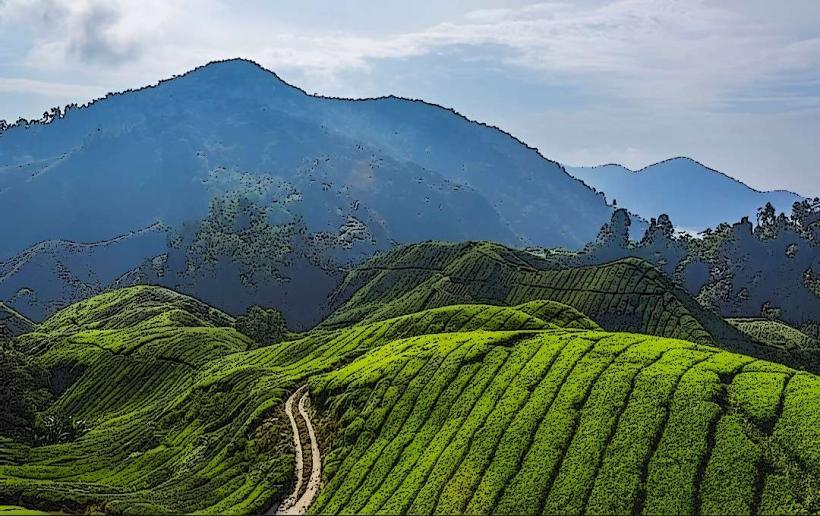
Mambilla Plateau (Highland coffee and tea estates)
Gashaka-Gumti National Park (Nigeria's largest national park)
The Jalingo Airport
Palace of the Aku Uka (Wukari)
Marmara Crocodile Pond (Wukari)
Transportation Network
Movement relies on the A4 federal highway. Internal transit in Jalingo is dominated by "Keke" (tricycles). There is no rail system. Air travel is serviced by the Jalingo Airport, which has seen increased regional connectivity for the tea and cattle industries. Traffic density is generally low, except at the Jalingo main market axis.
Safety & "Red Zones"
The general safety level is moderate to low. The state has experienced significant communal conflicts and banditry. Travelers should avoid the Wukari-Takum axis and the border regions with Benue State at night. High-security vigilance is required when traveling to the Mambilla Plateau due to the rugged terrain and isolated mountain passes.
Digital & Financial Infrastructure
Average internet speeds are 20–35 Mbps on 4G networks. Main carriers are MTN, Airtel, and Glo. Card acceptance is limited to major hotels in Jalingo; the state economy is heavily cash-dependent for agricultural and livestock trade. ATMs are concentrated along the Hammaruwa Way in Jalingo.
Climate & Air Quality
Taraba features the most varied climate in Nigeria. While Jalingo is hot (24°C to 38°C), the Mambilla Plateau stays temperate (15°C to 25°C) and can drop below 10°C. Air quality is high due to the lack of industrial clusters and high forest density.
Culture & Social Norms
Tipping is voluntary but appreciated (5–10%). Respect for traditional rulers, especially the Aku Uka of Wukari, is a primary social rule. The region is known for the "Nwonyo" Fishing Festival. Alcohol is available in Jalingo but restricted in conservative rural enclaves.
Accommodation Zones
Jalingo GRA: Recommended for high security and proximity to government offices.
Gembu (Mambilla): Recommended for tourism and access to the highland tea estates.
Local Cost Index
1 Espresso: ₦2,500 ($1.65)
1 Standard Lunch: ₦7,000 ($4.65)
1 Metro/Bus Ticket: ₦500 ($0.33) - Local Keke rate.
Nearby Day Trips
Barup Waterfall: 15 km from Gembu
Nguroje Highland Farms: Within Mambilla Plateau
Kashimbila Dam: 140 km from Jalingo
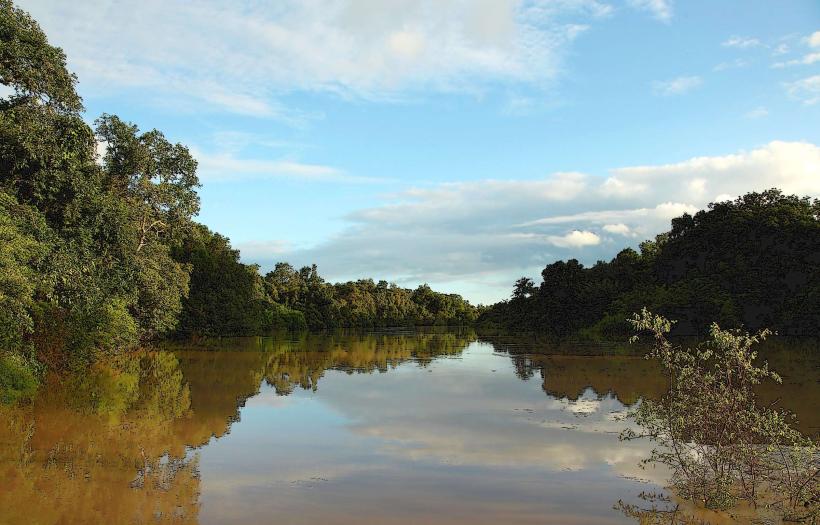
Dong River (Fishing sites): 50 km from Jalingo
Facts & Legends
Taraba contains the highest point in Nigeria, Chappal Waddi (2,419m). A local legend in Wukari surrounds the Marmara Crocodile Pond, where the crocodiles are believed to be the reincarnated souls of ancient Jukun warriors; they are said to appear only to those with "pure hearts" or during times of significant political transition in the Kwararafa kingdom.