Information
City: TaveuniCountry: Fiji
Continent: Australia
Taveuni, Fiji, Australia
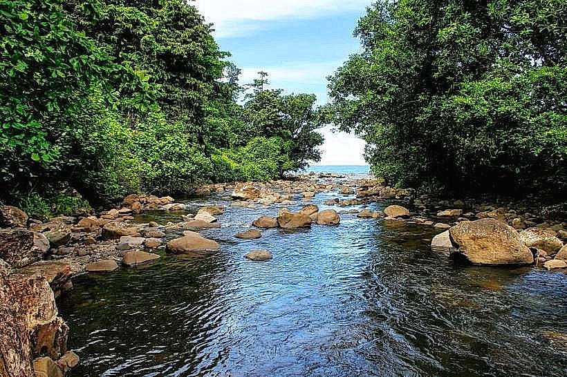
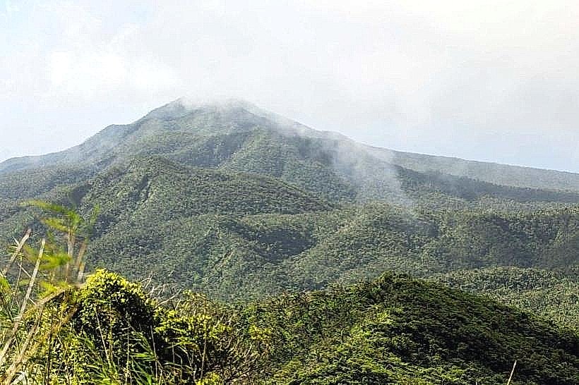
Taveuni serves as the "Garden Island" of Fiji and is the primary agricultural and eco-tourism hub for the Cakaudrove Province. It is situated off the southeast coast of Vanua Levu, separated by the Somosomo Strait, and consists of a massive shield volcano rising 1,241 meters above sea level.
Historical Timeline
Taveuni was historically governed by the Tui Cakau and served as the center of the powerful Cakaudrove Confederacy. The modern era of governance was established through the 1860s transition into a plantation economy, primarily for cotton and later coconut (copra). The primary architectural and political reconstruction occurred after the 1862 Battle of Wairiki, where Taveuni forces defeated Tongan invaders. The primary event shaping the current urban form was the 20th-century development of the West Coast road, which concentrated all commercial and administrative infrastructure along the leeward coast.
Demographics & Population
The total population of Taveuni is approximately 19,000. The demographics are overwhelmingly iTaukei (Indigenous Fijian) at approximately 75%, with a significant Indo-Fijian minority and a growing expatriate community concentrated in the north. The median age is 27.2 years.
Urban Layout & Key Districts
The island lacks a centralized city, operating instead through a series of coastal hubs. Somosomo serves as the traditional and chiefly capital. Naqara is the primary commercial district, containing the largest concentration of shops and services. Matei, located at the northern tip, serves as the tourism and aviation district. The island is bisected by the 180th Meridian, though the entire island utilizes a single time zone.
Top City Landmarks
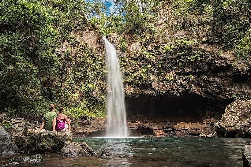
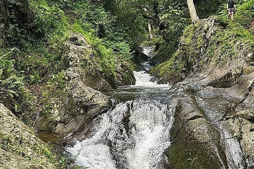
Bouma National Heritage Park: A vast preserve encompassing the Tavoro Waterfalls.
Waitavala Waterslide: A natural rock slide formed by a cascading stream near Garden Island Resort.
180th Meridian Sign: The geographic marker where the International Date Line traditionally passed.
Wairiki Catholic Mission: A prominent stone church built in 1907 to commemorate the defeat of Tongan forces.
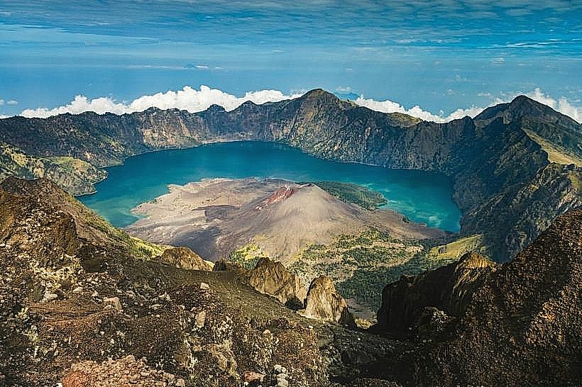
Des Voeux Peak: The second-highest point on the island, home to the rare Tagimoucia flower.
Transportation Network
Movement is restricted to the coastal road. There is no metro or tram system. Transport is facilitated by local buses and a fleet of white, unmetered taxis; fares for common routes (e.g., Matei to Naqara) are fixed and should be confirmed before departure. 4WD vehicles are required for interior access. Traffic density is negligible, though road conditions are poor in the south.
Safety & "Red Zones"
The general safety level is very high. Crime is statistically low and mostly limited to petty theft of unattended items on beaches. There are no specific "red zones." The primary safety hazards are environmental: strong currents in the Somosomo Strait and slippery terrain at the waterfalls.
Digital & Financial Infrastructure
Internet speeds average 10–20 Mbps. Vodafone and Digicel provide 4G coverage primarily on the western coast; the eastern "weather side" has frequent signal dropouts. Card acceptance is limited to major resorts and the largest supermarket in Naqara. ATMs are scarce; two BSP machines are located in Naqara, and there are no banks in Matei.
Climate & Air Quality
Taveuni has a tropical rainforest climate with extreme localized variation; the windward side receives over 6,000mm of rain annually. Temperatures range from 22°C–28°C in July to 25°C–31°C in January. Air quality is exceptional. The primary weather risks are flash floods and landslides during the monsoon season (December–April).
Culture & Social Norms
Tipping is not required. Social norms are strictly traditional. When entering villages like Somosomo, visitors must remove hats, cover shoulders and knees, and participate in a sevusevu (kava presentation) if staying overnight. It is considered a grave insult to walk through a village during the evening prayer hour (typically 18:00–19:00).
Accommodation Zones
Matei: Recommended for logistics; provides immediate access to the airport and the highest density of dining options.
Soqulu/Southern Coast: Recommended for quiet access to dive sites and the 180th Meridian marker.
Local Cost Index
1 Espresso: 8.50 FJD ($3.80 USD)
1 Standard Lunch: 15.00–25.00 FJD ($6.70–$11.15 USD)
1 Taxi (Matei to Naqara): 20.00–30.00 FJD ($8.95–$13.40 USD)
Nearby Day Trips
Rainbow Reef: 20-minute boat transfer from the west coast.
Qamea Island: 15-minute boat transfer from the eastern landings.
Matagi Island: 20-minute boat transfer.
Lavena Coastal Walk: Located at the road's end on the eastern coast.
Facts & Legends
Taveuni is the only place in the world where the rare Tagimoucia flower grows, specifically on the shores of a high-altitude volcanic lake. Local legend states the flowers are the red tears of a princess who fled into the mountains to escape an arranged marriage. Historically, Taveuni was the site of a unique "time" anomaly where, prior to the standardization of the International Date Line, neighbors on opposite sides of the 180th Meridian theoretically lived on different days.