Information
City: WheatlandCountry: USA Wyoming
Continent: North America
Wheatland, USA Wyoming, North America
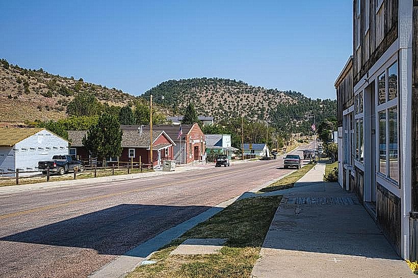
Wheatland is an incorporated town and the seat of Platte County, situated on the high plains of Southeast Wyoming along I-25. Defined by its status as the center of the largest privately financed irrigation district in the United States, it is a robust agricultural and energy hub. It serves as a primary service stop between Cheyenne and Casper.
Historical Timeline
Inhabited by the Arapaho, Cheyenne, and Lakota peoples. Founded in 1894, the town’s development was unique in Wyoming as it was spearheaded by the Wyoming Development Company, which constructed a massive system of canals and reservoirs to transform the arid plains into arable farmland. A critical historical event occurred in 1903 with the completion of the Wheatland Project, which solidified the town's role as an agricultural leader. In the 1970s, the construction of the Laramie River Power Station triggered a significant population and economic boom. In 2026, Wheatland remains a critical energy producer and a regional center for value-added agriculture.
Demographics & Population
The 2026 population is approximately 3,475. The demographics are White (81%), Hispanic or Latino (16%), and Two or more races (19%-reflecting shifting census reporting). The economy is driven by Agriculture, Energy Production (Basin Electric Power Cooperative), Retail, and Healthcare. The median household income is approximately $55,900.
Urban Layout & Key Districts
Wheatland is a grid-based town with a concentrated historic core.
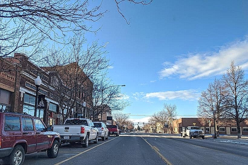
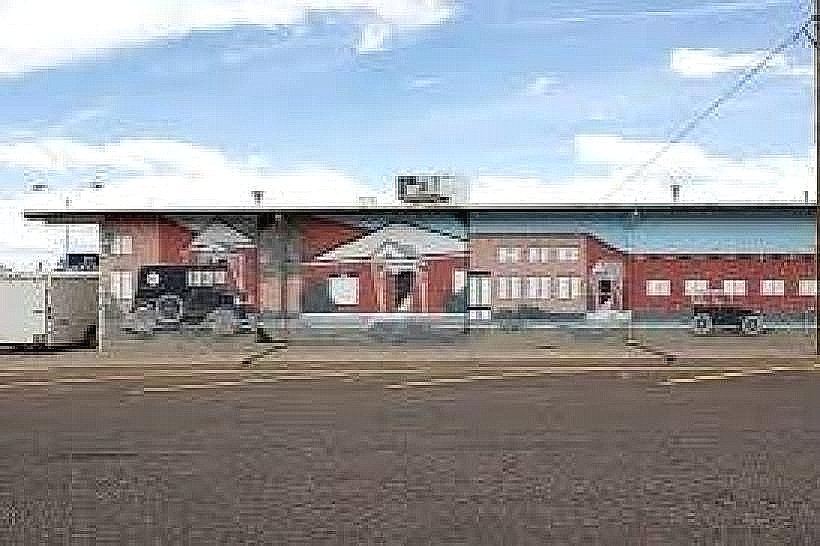
Downtown Historic District: A National Historic District along 8th and 9th Streets; features early 20th-century brick commercial buildings, numerous historical murals, and bronze sculptures.
Lewis Park Area: A central recreational zone known for its mature trees and community gathering spaces.
The I-25 Corridor: The eastern edge of town, dominated by traveler services, hospitality, and heavy equipment dealerships.
Residential Blocks: Characterized by wide, tree-lined streets with a mix of Victorian-era homes and mid-century bungalows.
Top City Landmarks
Laramie River Power Station: A massive 1,500-megawatt coal-fired plant that is a dominant feature of the northern horizon.
Laramie Peak Museum: Located in the old high school; houses extensive exhibits on the Wheatland irrigation project and local pioneer artifacts.
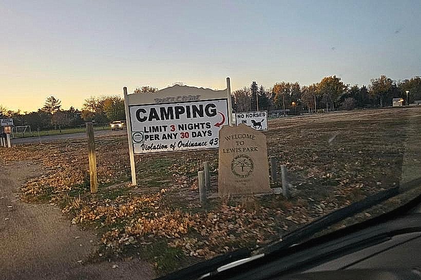
Lewis Park: A 16-acre park featuring a disc golf course, tennis courts, and a rare municipal policy allowing free short-term camping.
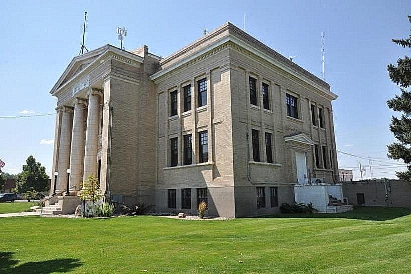
Platte County Courthouse: A historic 1917 Classical Revival building central to the downtown skyline.
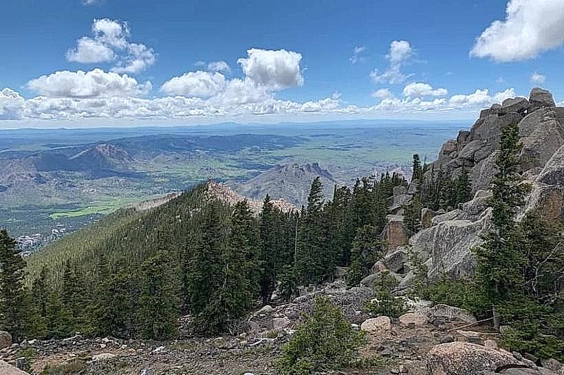
Laramie Peak: (Visible 65 km west); at 3,131 meters, it is the highest point in the Laramie Range and a primary destination for hikers.
Windy Peaks Brewery: A local social hub housed in a restored historic building, representing the town's modern commercial revitalization.
Transportation Network
Movement is automotive-centric. Wheatland is a major stop on I-25 and is served by US-87. Public transit is non-existent. Phifer Airfield (EAN) serves general aviation. There is no passenger rail service; BNSF operates heavy freight and coal lines through the eastern side of town.
Safety & "Red Zones"
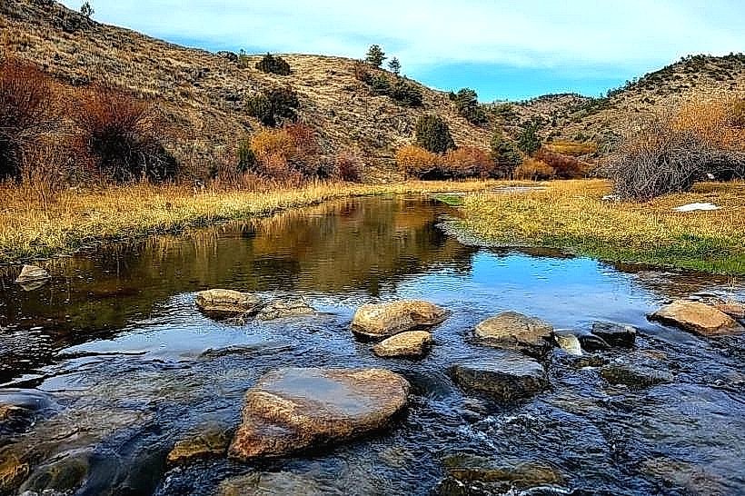
The general safety level is very high. Crime is significantly lower than the national average. Standard awareness is advised near unprotected canal crossings during high-water agricultural seasons. Environmental hazards include extreme wind speeds, severe summer hailstorms, and winter ground blizzards that frequently close I-25 to high-profile vehicles.
Digital & Financial Infrastructure
Internet speeds are high, with 1 Gbps fiber available via local providers like Vistabeam and Spectrum. Mobile service is robust within the city and along the interstate. Card acceptance is universal. Wyoming has no state income tax. Platte County levies a 6% total sales tax.
Climate & Air Quality
Temperatures range from -10°C to 3°C in winter and 12°C to 31°C in summer. The town is semi-arid and subject to intense sun. Air quality is pristine but can be affected by agricultural dust during the autumn harvest.
Culture & Social Norms
The standard tipping percentage is 20%. A "Practical-Neighborly" greeting is standard. Dress codes are "Ranch-Workwear" (utility clothing is standard for both social and business settings). The city is culturally defined by Irrigation Heritage, Energy Independence, and Self-Reliance.
Local Cost Index
1 Espresso: $4.25 (USD)
1 Standard Lunch: $14.50 (USD)
1 Museum Admission: Free (donations encouraged).
Nearby Day Trips
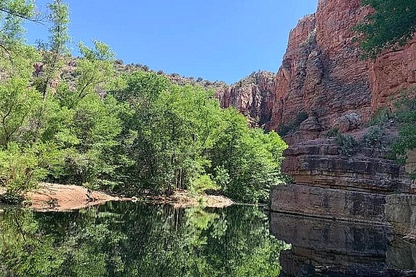
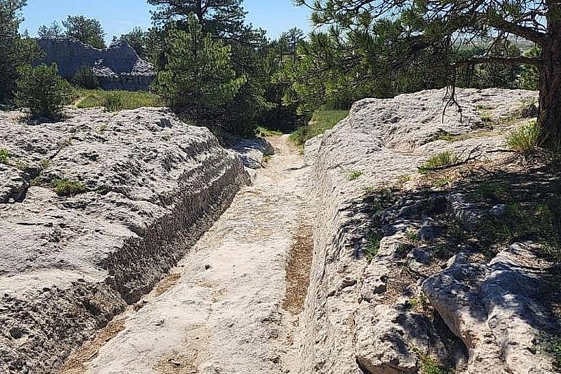
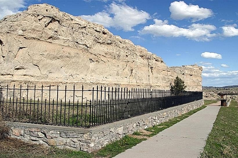
Guernsey State Park: (40 km northeast; featuring Civilian Conservation Corps architecture and the Oregon Trail Ruts).
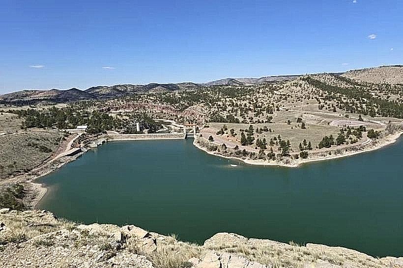
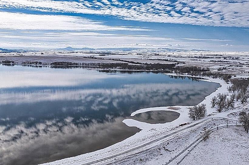
Glendo State Park: (50 km north; a premier destination for boating and walleye fishing).
Fort Laramie National Historic Site: (65 km northeast; a primary 19th-century military and fur-trading post).
Facts & Legends
Wheatland is located within the largest privately funded irrigation district in the nation. Historically, the town was the home of Jim Geringer, the 30th Governor of Wyoming. A local legend involves the "Irrigator and his Dog" statue, which is said to represent the spirit of the early settlers who hand-dug the canal systems. Another legend concerns Laramie Peak, which was used as a primary navigational landmark for over 500,000 pioneers on the Oregon Trail long before the town of Wheatland was established.