Information
Landmark: Mýrdalsjökull GlacierCity: Vik
Country: Iceland
Continent: Europe
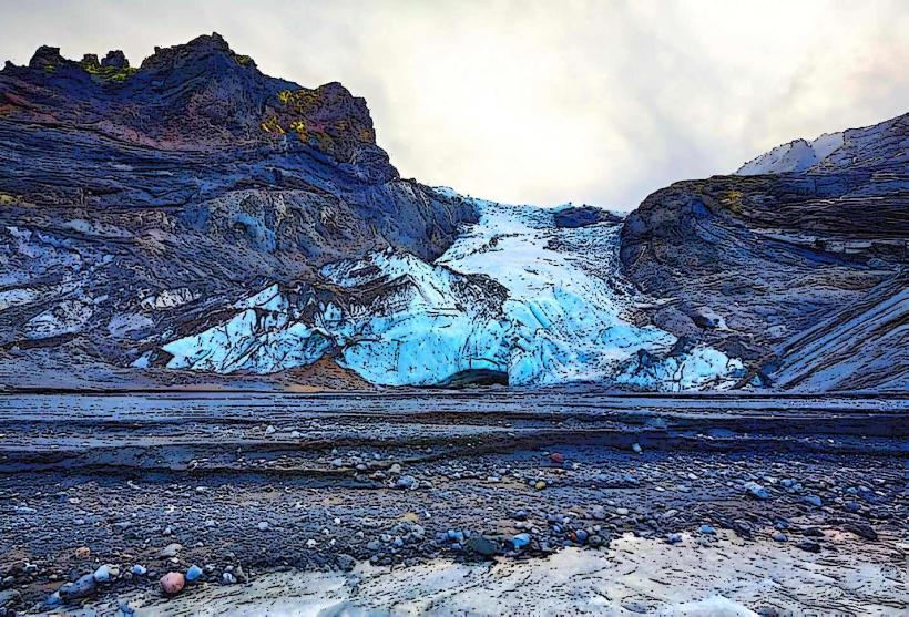
Mýrdalsjökull Glacier is one of Iceland's largest and most significant glaciers, located in the southern part of the island. It covers an area of about 595 square kilometers (230 square miles) and is the fourth-largest glacier in Iceland. The glacier sits atop Katla, one of Iceland's most active volcanoes, making it both a striking natural feature and a site of geological interest. Here's a detailed look at Mýrdalsjökull Glacier:
Geographical Location
- Position: Mýrdalsjökull is located in southern Iceland, approximately 150 kilometers (93 miles) southeast of Reykjavik. It lies to the north of the village of Vík í Mýrdal, covering much of the land between the town and the coast.
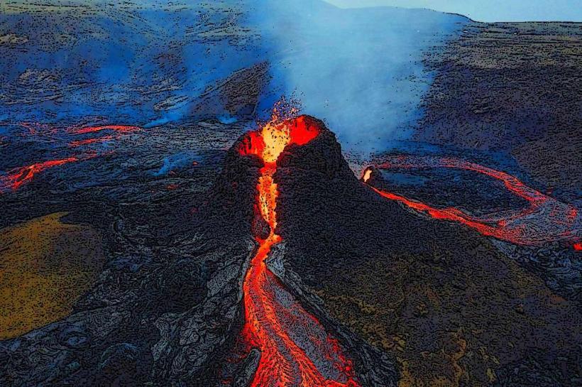
- Volcanic Activity: The glacier is situated over Katla Volcano, a large and active volcano that has erupted many times throughout Iceland's history. The ice cap of Mýrdalsjökull hides the volcano beneath it, and the geothermal activity beneath the glacier causes ongoing interaction between the ice and volcanic processes.
Physical Characteristics
- Size: As mentioned, Mýrdalsjökull covers an area of 595 square kilometers (230 square miles). It is a large ice cap with numerous outlet glaciers that descend down from the main ice field.
- Ice and Icefall: The glacier's ice is thick and moves slowly, which results in crevasses, icefalls, and other dramatic glacial features. The lower regions of the glacier are particularly notable for their striking appearance and serve as popular locations for glacier tours.
- Geological Features: Mýrdalsjökull is not only important because of its size but also due to the volcanic activity beneath it. The volcano beneath the glacier is known for its eruptions, which can lead to rapid melting and flooding, creating potential hazards.
Katla Volcano
- Volcanic Activity: Katla is one of Iceland's most active volcanoes, with a history of eruptions dating back to the 10th century. The volcano is particularly well known for its large eruptions, which often occur beneath the ice of Mýrdalsjökull.
- Hazardous Flooding: When Katla erupts, it can cause significant ice melt beneath Mýrdalsjökull, leading to glacial outburst floods, known as jökulhlaup. These floods have historically caused damage to infrastructure in the surrounding areas. In modern times, there are systems in place to monitor volcanic activity, including seismic activity, to provide early warnings for potential eruptions.
Glacier Features
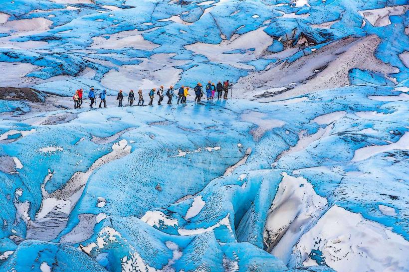
- Outlet Glaciers: Several outlet glaciers extend from the main ice cap, including Sólheimajökull, which is one of the most popular glaciers for hiking tours. These glaciers flow down from Mýrdalsjökull towards the coastal plains, providing a visual spectacle as they descend through the rugged landscape.
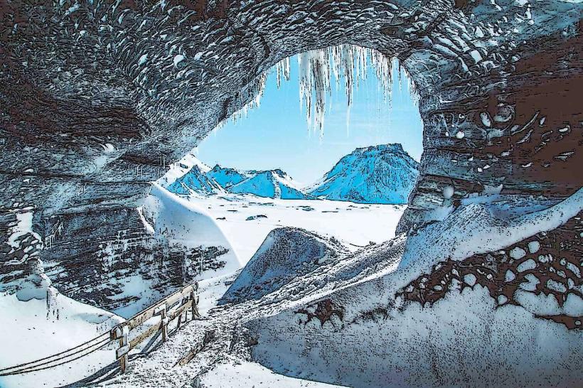
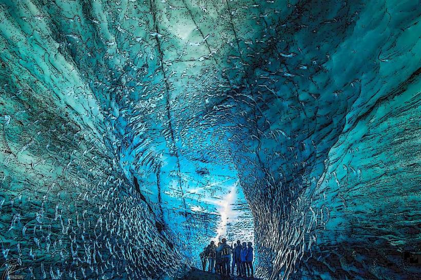
- Ice Caves and Crevasses: The glacier features spectacular ice formations, including crevasses and ice caves, which are of particular interest to visitors. Guided tours allow travelers to safely explore these features, providing an opportunity to walk inside ice caves or hike across the glacier’s surface.
- Meltwater Lakes: Due to the geothermal activity beneath the glacier, numerous meltwater lakes and streams form at the glacier’s edges. These lakes are a common feature around Mýrdalsjökull, and the water is often filled with chunks of ice that have broken off from the glacier.
Tourism and Activities
- Glacier Hiking: Mýrdalsjökull and its outlet glaciers, such as Sólheimajökull, are popular destinations for guided glacier hikes. Visitors can strap on crampons and trek across the glacier's surface, exploring ice ridges, crevasses, and other features. This activity is available year-round but is especially popular in the summer months when the weather is more stable.
- Snowmobiling: Snowmobile tours on Mýrdalsjökull are a thrilling way to experience the glacier’s vast ice fields. These tours typically cover the upper portions of the glacier and offer panoramic views of the surrounding landscape, including the volcanic terrain.
- Ice Caving: In winter, when conditions are right, ice caves form beneath Mýrdalsjökull. Visitors can join guided ice cave tours to explore these frozen wonders, with their crystal-clear blue ice and fascinating formations.
- Volcano Tours: Some tours focus on the Katla volcano itself, including visits to the volcano’s geothermal vents and surrounding landscape. These tours often highlight the interaction between volcanic activity and glacial ice, making for a fascinating geological exploration.
Nearby Attractions
Mýrdalsjökull is conveniently located near several other popular Icelandic landmarks:
- Sólheimajökull Glacier: An outlet glacier of Mýrdalsjökull, Sólheimajökull is one of the most visited glaciers in Iceland. Guided hikes, ice climbing, and other activities are available here, making it a popular destination for outdoor adventurers.
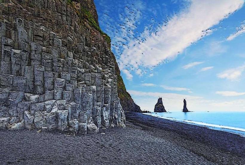
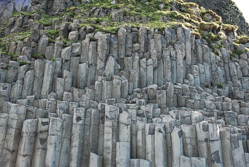
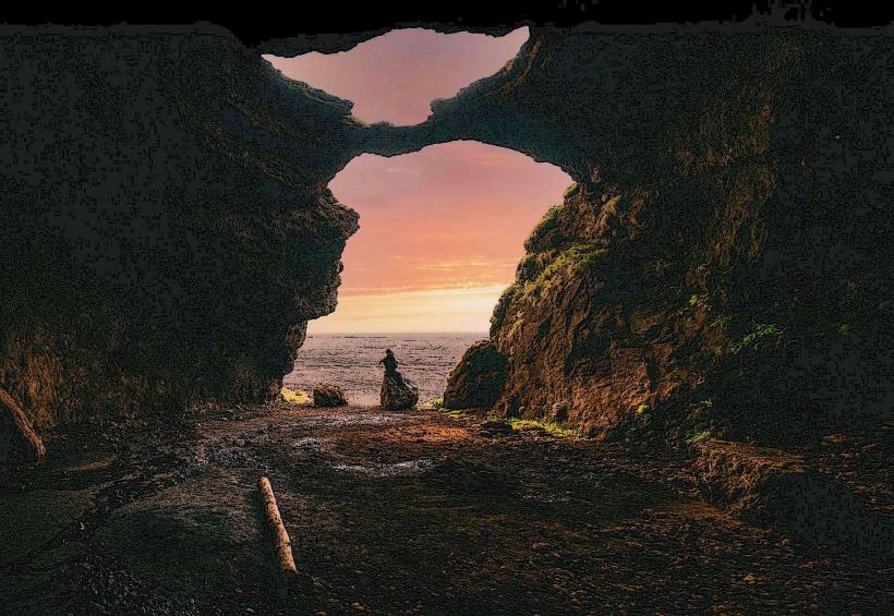
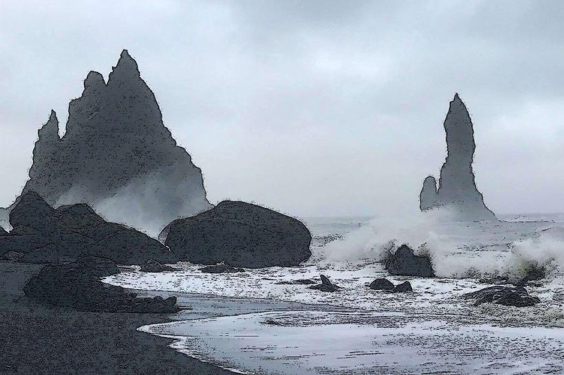
- Reynisfjara Beach: Located a short distance to the south of Vík, Reynisfjara is a stunning black sand beach with dramatic basalt columns and sea stacks. It is often included in tours of the southern coast.
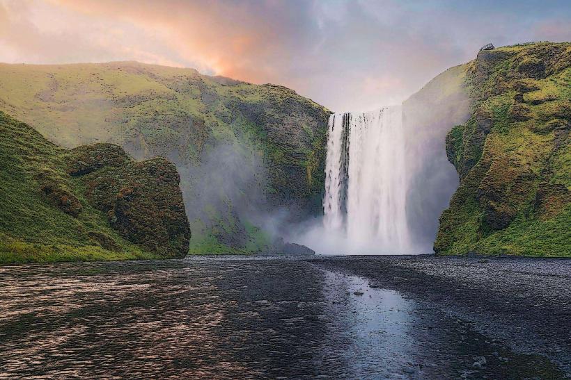
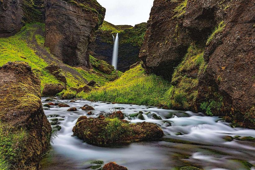
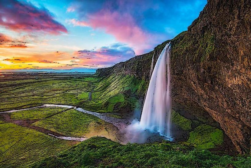
- Skogafoss Waterfall: About 40 kilometers (25 miles) to the west of Mýrdalsjökull, Skogafoss is one of Iceland's largest and most famous waterfalls. It is a popular stop for visitors traveling along the Ring Road.
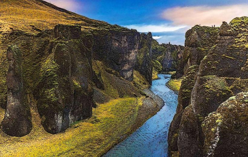
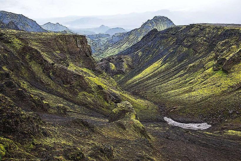
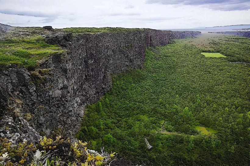
- Fjaðrárgljúfur Canyon: To the east of Mýrdalsjökull, Fjaðrárgljúfur is a picturesque canyon known for its lush green surroundings and winding river. It is a popular location for photography and hiking.
Climate and Best Time to Visit
- Weather: The weather in the Mýrdalsjökull region can be unpredictable, with frequent rain, strong winds, and rapidly changing conditions. The glacier itself is often cold, with temperatures often hovering just above freezing in summer and dropping well below freezing in winter.
- Best Time to Visit: The best time to visit Mýrdalsjökull for glacier hiking and outdoor activities is during the summer months (June to August), when the weather is milder and the glacier is more accessible. However, winter visits (November to March) offer opportunities for ice caving and snowmobiling, and the region is often quieter during this time.
Environmental and Climate Change Impact
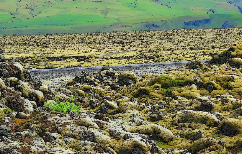
Like many glaciers in Iceland, Mýrdalsjökull is retreating due to climate change. The glacier has shrunk significantly in recent decades, and this retreat has had an impact on the surrounding landscape, including changes in water flow and the formation of new meltwater lakes. Conservation efforts are underway to monitor the glacier and its surroundings, ensuring that tourism remains sustainable while raising awareness about the effects of climate change.
Summary
Mýrdalsjökull Glacier is one of Iceland's most impressive and accessible glaciers, offering visitors a chance to explore a dynamic ice cap that sits atop a volcanic hotspot. Whether you’re interested in glacier hiking, ice caving, or snowmobiling, Mýrdalsjökull offers a variety of adventure activities in a stunning natural setting. Its proximity to other popular sites on the southern coast, including Sólheimajökull, Reynisfjara Beach, and Skogafoss, makes it a key part of any journey through southern Iceland.