Information
Landmark: Ambergris CayeCity: San Pedro
Country: Belize
Continent: North America
Ambergris Caye, San Pedro, Belize, North America
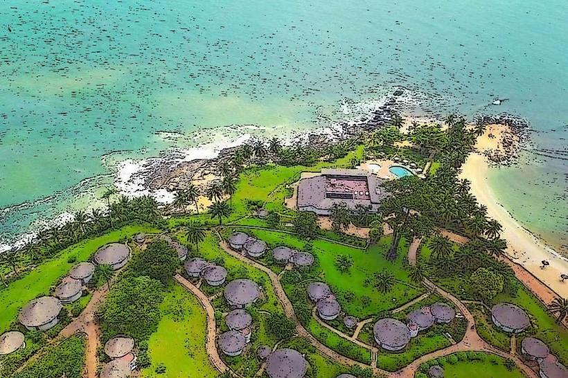
Ambergris Caye is the largest island in Belize, situated off the northeastern coast of the mainland. It is located approximately 56 kilometers (35 miles) northeast of Belize City.
Visual Characteristics
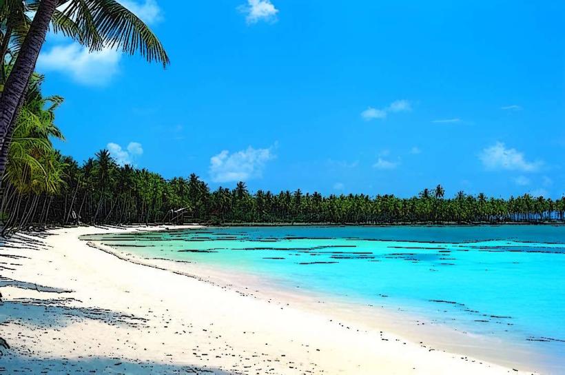
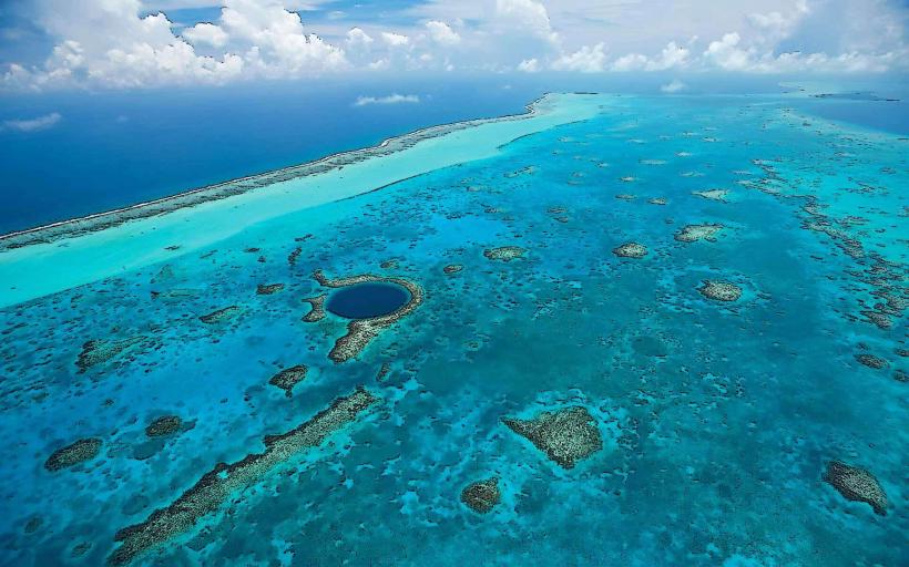
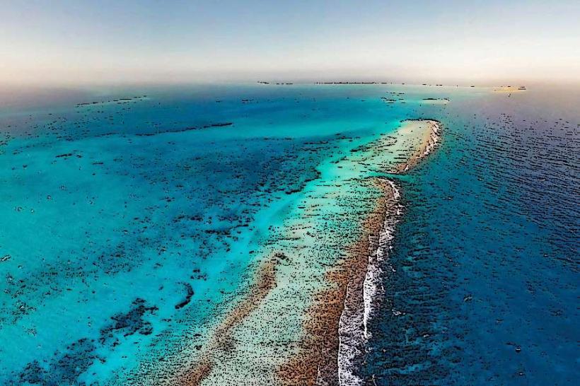
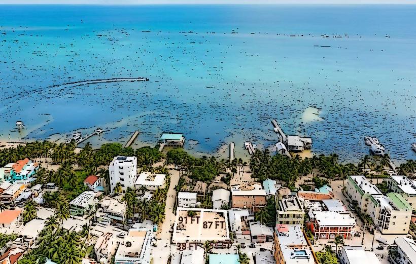
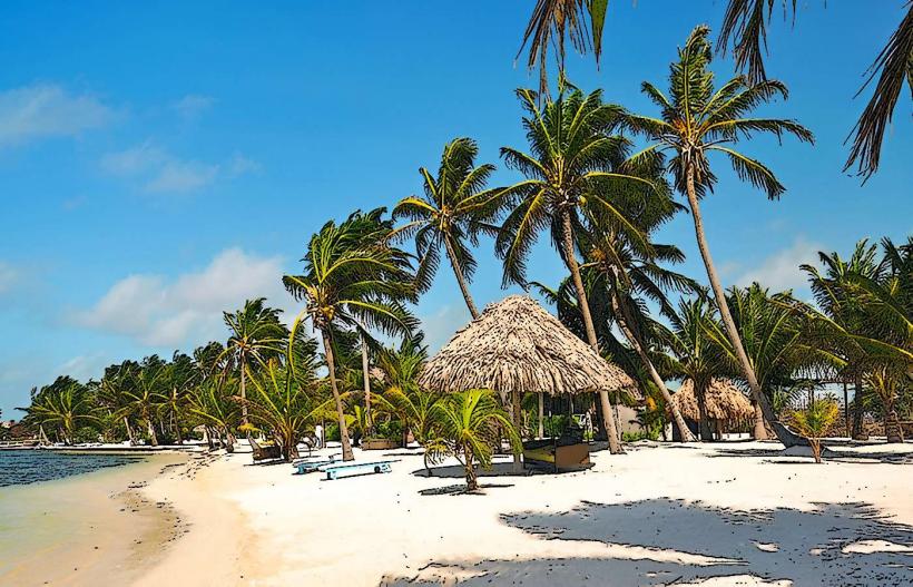
The island is characterized by its elongated shape, measuring approximately 40 kilometers (25 miles) in length and varying in width from 1.6 to 6.4 kilometers (1 to 4 miles). The western coast features mangrove forests and shallow lagoons, while the eastern coast faces the Caribbean Sea and is fringed by a coral reef. The land is generally low-lying, with sandy soil and sparse vegetation in some areas, transitioning to denser palm groves and tropical foliage inland. The water surrounding the island exhibits a range of blues and greens, with clear visibility near the reef.
Location & Access Logistics
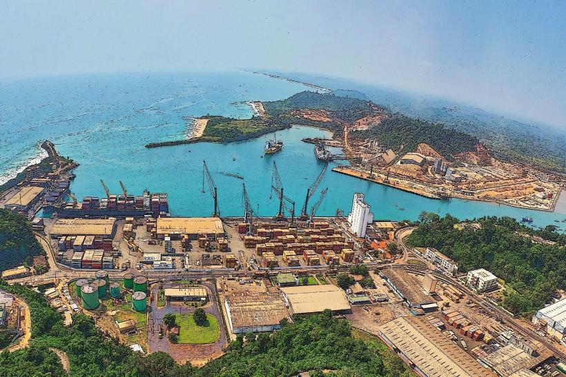
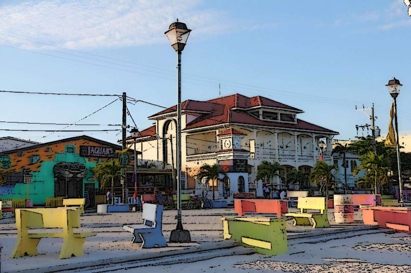
Access to Ambergris Caye is primarily via air or sea. The island is served by San Pedro Airport (SPR), with frequent domestic flights from Philip S. W. Goldson International Airport (BZE) in Belize City and other local airstrips. Alternatively, water taxis operate regularly between Belize City (from the Municipal Dock) and San Pedro Town, with a journey time of approximately 1.5 hours. Within San Pedro Town and across the island, transportation is mainly by golf cart, bicycle, or on foot. Limited taxi services are available.
Historical & Ecological Origin
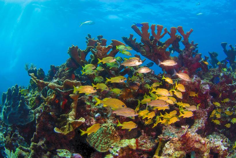
Ambergris Caye's geological origin is primarily a sandbar formed by the accumulation of marine sediments and coral debris over millennia, influenced by the Belize Barrier Reef. Historically, the island was inhabited by the Maya civilization, who utilized it for trade and fishing. European settlement began in the mid-19th century, with the island's economy later developing around fishing and, more recently, tourism. The island's ecosystem is intrinsically linked to the Belize Barrier Reef, a UNESCO World Heritage Site, supporting diverse marine life.
Key Highlights & Activities
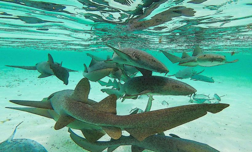
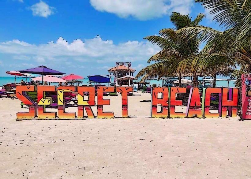
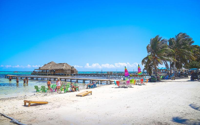
Snorkeling and diving at the Belize Barrier Reef, including sites like the Hol Chan Marine Reserve and Shark Ray Alley, are primary activities. Fishing charters are available. Kayaking and paddleboarding are possible in the calmer lagoon waters. Exploring San Pedro Town offers opportunities to observe local life and visit shops. Hiking trails are limited due to the island's terrain.
Infrastructure & Amenities
San Pedro Town provides a range of amenities including hotels, restaurants, bars, and shops. Restrooms are available at most establishments and public areas. Shade is provided by palm trees and constructed shelters in tourist areas. Cell phone signal (4G) is generally available in San Pedro Town and along the developed coastal areas, but can be intermittent on more remote parts of the island. Food vendors and restaurants are concentrated in San Pedro Town.
Best Time to Visit
The dry season, from December to May, offers the most favorable weather conditions with lower humidity and minimal rainfall. The best time of day for underwater photography is generally between 10:00 AM and 2:00 PM when sunlight penetration is optimal. High tide is preferable for accessing certain shallow reef areas.
Facts & Legends
The island's name, Ambergris Caye, is derived from "ambergris," a waxy substance produced in the digestive system of sperm whales, which was historically harvested from the island's shores and held significant value. A local legend suggests that the island was once connected to the mainland but was separated by a powerful storm.
Nearby Landmarks
- Caye Caulker (10km Southwest)
- Hol Chan Marine Reserve (8km Southwest)
- Shark Ray Alley (9km Southwest)
- Bacalar Chico National Park and Marine Reserve (25km North)