Information
Landmark: Blasket IslandsCity: Dingle
Country: Ireland
Continent: Europe
Blasket Islands, Dingle, Ireland, Europe
The Blasket Islands (Na Blascaodaí) are a group of six main islands located approximately 5km off the tip of the Dingle-peninsula_dingle" class="underline">Dingle Peninsula. They represent the westernmost point of Europe and are recognized for their significance in Irish linguistic and literary history.
Visual Characteristics
The archipelago is defined by steep, serrated cliffs, white sand beaches, and a high density of marine life.
The Great Blasket (An Blascaod Mór): The largest island, dominated by a central ridge (300m) and the abandoned village on its lower eastern slope.
Seascape: Surrounded by high-velocity Atlantic currents and jagged sea stacks.
Wildlife: Home to one of the largest grey seal colonies in Ireland and significant populations of puffins, Manx shearwaters, and storm petrels.
Location & Access Logistics
Access: Accessible only by seasonal ferry (April–September).
Ferry Points:
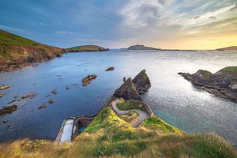
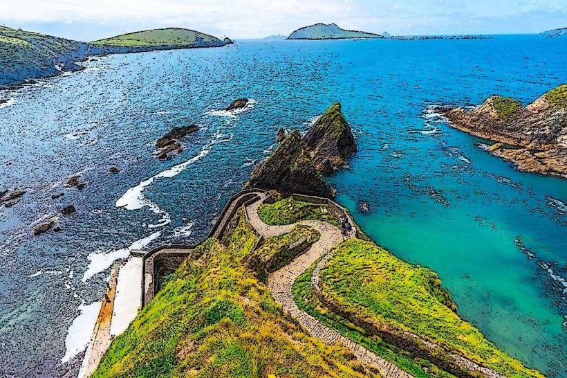
Dunquin Pier: The most direct route (20-minute crossing). Note: Requires traversing a steep, narrow pedestrian ramp.
Ventry/Dingle: Longer eco-tours and direct ferries (45–90 minutes).
Transit: Transfers from ferry to island often require a small inflatable dinghy (RIB) to reach the slipway.
Accessibility: Not suitable for mobility devices. The terrain is steep, uneven, and consists of grassy tracks.
Historical & Cultural Origin
Evacuation (1953): The islands were inhabited for centuries until the Irish government ordered an evacuation in 1953 due to extreme isolation, declining population, and the inability to provide emergency services.
Literary Legacy: Despite the small population, the islands produced three major Irish-language authors: Tomás Ó Criomhthain (The Islandman), Muiris Ó Súilleabháin (Twenty Years a-Growing), and Peig Sayers (Peig).
Language: The islands remained an untainted source of the Irish language, attracting scholars from across Europe in the early 20th century.
Key Highlights & Activities
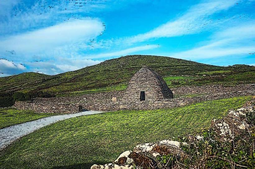
The Abandoned Village: Visitors can walk through the ruins of over 20 dry-stone cottages, including the restored home of Tomás Ó Criomhthain.
Trá Bán (The White Strand): A sheltered beach on the Great Blasket frequented by hundreds of grey seals.
Hiking: A circular trail around the Great Blasket offers views of the Skellig Islands and the "Dead Man" island (Inishtooskert).
The Blasket Centre (Ionad an Bhlascaoid): Located on the mainland in Dunquin; provides high-fidelity exhibits on island life and literature.
Infrastructure & Amenities
On-Island: Minimal. There is a small seasonal café and basic hostel accommodation in restored cottages.
Sanitation: Very limited public facilities on the island; use mainland facilities in Dunquin.
Connectivity: 4G signal is intermittent and weather-dependent. No public Wi-Fi.
Best Time to Visit
Timing: Calm sea conditions are mandatory. Ferries are frequently cancelled due to swell.
Photography: The view from the village looking back toward the mainland (Dunquin) provides the most iconic perspective of the "zigzag" pier.
Facts & Legends
A verified technical detail: The islands are composed of Old Red Sandstone and Silurian siltstones, which are highly resistant to the abrasive force of the Atlantic. Legend states the islands were formed from the scales of a giant sea serpent defeated by a local saint.
Nearby Landmarks
Dunquin Pier – 5km East (Mainland)
Slea Head Drive – Nearest coastal road
Skellig Michael – 30km South
The Blasket Centre – Dunquin (Mainland)