Information
Landmark: Dingle PeninsulaCity: Dingle
Country: Ireland
Continent: Europe
Dingle Peninsula, Dingle, Ireland, Europe
The Dingle Peninsula (Corca Dhuibhne) is the northernmost of the major peninsulas in County Kerry, extending 48km into the Atlantic Ocean. It is a designated Gaeltacht (Irish-speaking) region and is characterized by a high density of archaeological sites and rugged coastal topography.
Visual Characteristics
The peninsula is dominated by the Slieve Mish mountain range and the central massif of Mount Brandon.
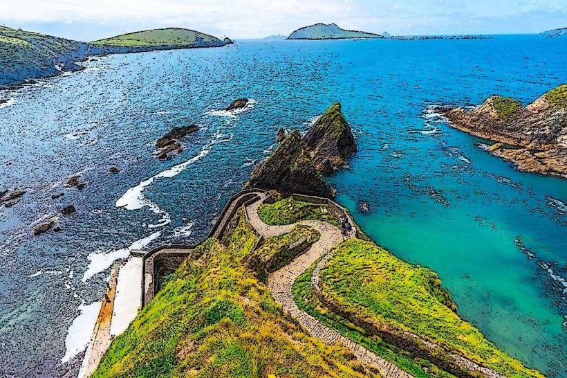
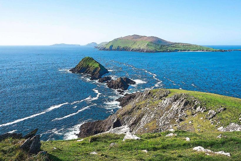
Coastline: Features dramatic sea cliffs at Dunmore Head, expansive sandy beaches like Inch Strand, and the jagged Blasket Islands.
Flora: Primarily Atlantic blanket bog, mountain heath, and coastal machair.
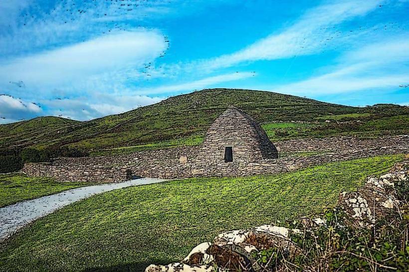
Architecture: Noted for "clocháns" (beehive huts)-dry-stone medieval monastic dwellings.
Location & Access Logistics
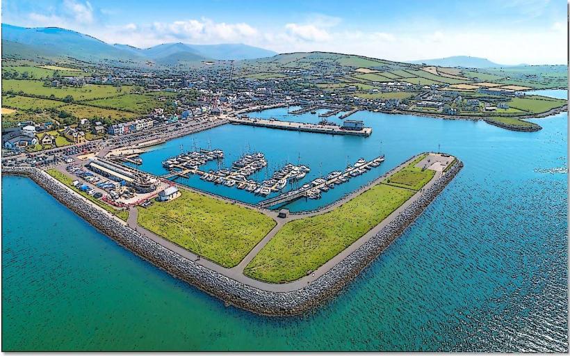
Primary Hub: Dingle Town (An Daingean), located on the southern coast.
Transit: The R559 (Slea Head Drive) is the primary coastal loop. The N86 connects Dingle to Tralee.
Conor Pass: A narrow, high-altitude mountain pass connecting the north and south coasts. Note: Large vehicles (caravans, buses) are prohibited due to extreme narrowness and overhanging rock.
Accessibility: Most major archaeological sites involve walking over uneven, grassy, or gravel terrain.
Historical & Archaeological Origin
Prehistoric Sites: Contains over 2,000 monuments, including the Dunbeg Promontory Fort (Iron Age).
Early Christian Period: Home to the Gallarus Oratory, a perfectly preserved 7th-8th century dry-stone chapel, and the Kilmalkedar Church.
Maritime History: Dingle was a major medieval trading port for wine and skins with continental Europe.
Key Highlights & Activities
Slea Head Drive: A 47km circular route starting and ending in Dingle; considered one of the most scenic drives in Ireland.
Mount Brandon: Ireland’s ninth-highest peak ($952$m), named after St. Brendan the Navigator. It is a major pilgrimage site.
The Blasket Islands: Abandoned in 1953; accessible by seasonal ferry from Dunquin Pier. The Great Blasket Centre provides historical context on island literature and life.
Inch Strand: A 5km spit of sand dunes popular for surfing and birdwatching.
Infrastructure & Amenities
Commercial: Dingle Town provides full services, including supermarkets, marine suppliers, and pharmacies.
Dining: Highly concentrated in Dingle Town, noted for fresh seafood and artisan food producers.
Sanitation: Public restrooms are available in Dingle Town, at the Blasket Centre, and seasonally at Inch Strand.
Connectivity: 5G/4G is reliable in Dingle Town and Bantry, but signal is frequently lost in the mountain passes and along the western cliffs.
Best Time to Visit
Seasonality: May to September for island ferries and milder hiking conditions.
Photography: Dunmore Head (the westernmost point of mainland Ireland) provides optimal lighting at sunset.
Weather: The peninsula is highly exposed. Rapid Atlantic depressions bring high winds and heavy rainfall. Visibility in the Conor Pass can drop to <10m during sea mists.
Facts & Legends
A verified technical detail: The peninsula is a major filming location, including Ryan's Daughter (1970) and Star Wars: The Last Jedi (2017) at Sybil Head. Legend attributes the creation of the landscape to the battle of Ventry (Cath Fionntrágha), where Fionn Mac Cumhaill defended Ireland against the "King of the World."
Nearby Landmarks
Slea Head – 15km West of Dingle
Gallarus Oratory – 8km Northwest of Dingle
Inch Beach – 23km East of Dingle
Dunquin Pier – 16km West of Dingle