Information
Landmark: Bocas de CenizaCity: Barranquilla
Country: Colombia
Continent: South America
Bocas de Ceniza, Barranquilla, Colombia, South America
Bocas de Ceniza is a natural estuary located at the mouth of the Magdalena River where it meets the Caribbean Sea, situated in the western sector of Barranquilla, Colombia.
Visual Characteristics
The area is characterized by a wide channel of murky, brown river water mixing with the blue-green of the sea. The banks are lined with dense mangrove vegetation, primarily red mangroves (Rhizophora mangle), with exposed prop roots. Sandbars and mudflats are visible, particularly during lower tides. The sky is typically clear or partly cloudy, with a consistent sea breeze.
Location & Access Logistics
Bocas de Ceniza is approximately 15 kilometers west of Barranquilla's city center. Access is primarily via the Vía 40, which leads to the industrial port area. From the end of Vía 40, follow signs for Bocas de Ceniza. Parking is available in designated lots near the river mouth, though it can be informal and subject to availability. Public transport options are limited to taxis or private vehicles. Bus routes do not directly serve the immediate vicinity of the estuary.
Historical & Ecological Origin
The formation of Bocas de Ceniza is a natural process of riverine sediment deposition meeting oceanic currents. The Magdalena River, Colombia's principal river, carries a significant sediment load, which has shaped this deltaic environment over millennia. The mangrove ecosystems are crucial for coastal protection and biodiversity, acting as nurseries for marine life.
Key Highlights & Activities
Boat tours are available, offering close-up views of the mangrove channels and the confluence of the river and sea. Visitors can observe marine birds, including pelicans and frigatebirds. Fishing is a common activity for local residents. Viewing the sunset over the water is a notable experience.
Infrastructure & Amenities
Basic amenities are present. Small food stalls and informal vendors operate near the main access points, offering local snacks and beverages. Restrooms are available but may be rudimentary. Shade is provided by natural vegetation and some covered seating areas. Cell phone signal (4G) is generally available.
Best Time to Visit
The best time of day for photography is late afternoon, approximately one hour before sunset, for optimal lighting conditions. The dry season, from December to April, offers more stable weather. High tide can obscure some of the mudflats, while low tide exposes them more extensively.
Facts & Legends
A local legend suggests that the swirling patterns of the river and sea at Bocas de Ceniza are the result of a mythical sea serpent's movements. Historically, this location was a significant point for early colonial exploration and trade due to the Magdalena River's navigability.
Nearby Landmarks
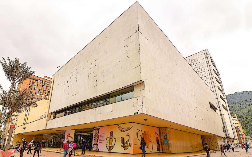
- Museo del Caribe (0.8km East)
- Estadio Metropolitano Roberto Meléndez (2.5km Southeast)
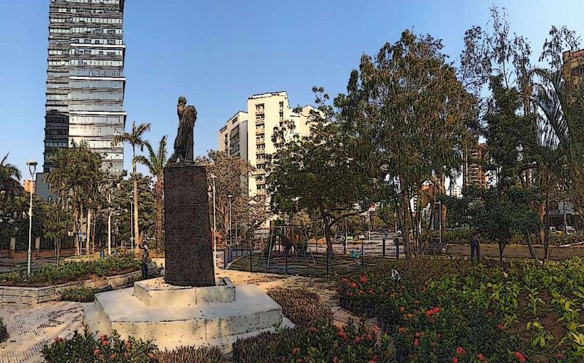
- Parque de la Cultura del Caribe (0.9km East)
- Centro de Convenciones Puerta de Oro (1.2km East)
- Gran Malecón del Río (1.5km East)