Information
Landmark: Bongoyo IslandCity: Dar es Salaam
Country: Tanzania
Continent: Africa
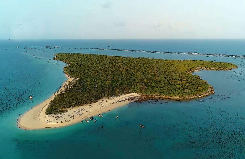
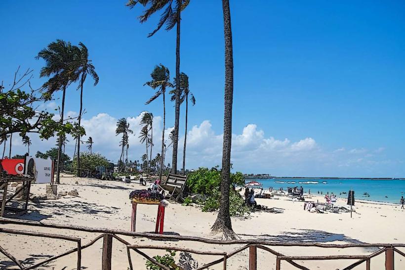
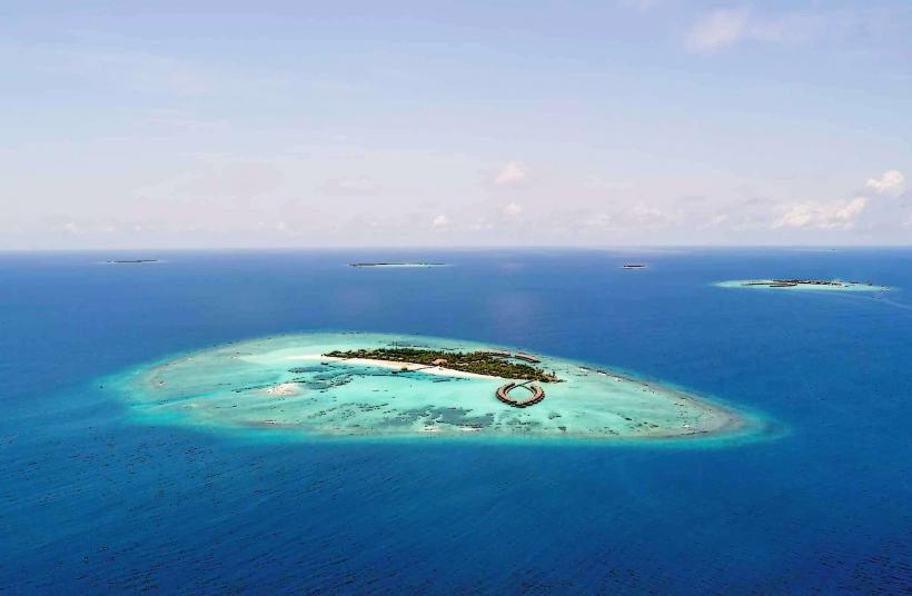
Bongoyo Island, Dar es Salaam, Tanzania, Africa
Bongoyo Island is a protected marine reserve located off the coast of Dar es Salaam, Tanzania.
It is the northernmost of the Dar es Salaam Marine Reserve System islands.
Visual Characteristics
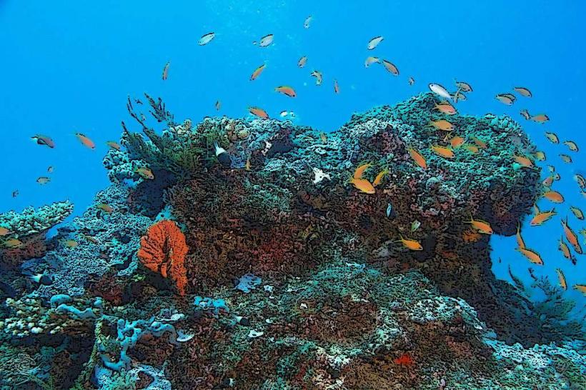
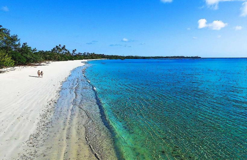
The island features a coastline of coarse, light-colored sand. Inland, vegetation consists of dense coastal bush and scattered palm trees. The surrounding waters are clear, with visible coral formations in shallower areas.
Location & Access Logistics
Bongoyo Island is situated approximately 5 kilometers north of Dar es Salaam's mainland. Access is exclusively via boat from the Dar es Salaam Yacht Club or the Kunduchi Marine Resort. Boat transfers typically take 20-30 minutes. There is no vehicle access to the island; a small landing jetty is available for disembarking.
Historical & Ecological Origin
Bongoyo Island is a natural landform, part of the larger archipelago formed by tectonic activity and sea-level changes in the Indian Ocean. It is classified as a coral island and serves as a critical breeding ground for marine life.
Key Highlights & Activities
Activities include snorkeling in designated areas, swimming, and walking the island's perimeter. A marked trail leads to a small beach on the western side. Visitors can observe various fish species and coastal birds.
Infrastructure & Amenities
Basic facilities include a small, open-air restaurant serving seafood and drinks. Restrooms are available near the restaurant. Shade is provided by thatched structures and natural tree cover. Cell phone signal (2G/3G) is generally available but can be intermittent.
Best Time to Visit
The best time for clear water visibility and calm seas is during the dry season, from June to October. Mornings offer softer light for photography. High tide is preferable for swimming and accessing certain snorkeling spots.
Facts & Legends
Bongoyo Island is a designated protected area, and fishing is prohibited to preserve its marine ecosystem. A unique feature is the presence of fruit bats that roost in the island's dense foliage.
Nearby Landmarks
- Mbudya Island (1.5km North)
- Kunduchi Ruins (3km South)
- Dar es Salaam Yacht Club (4.5km Southwest)
- Msasani Peninsula (5km Southwest)