Information
Landmark: Canal des PangalanesCity: Manakara
Country: Madagascar
Continent: Africa
Canal des Pangalanes, Manakara, Madagascar, Africa
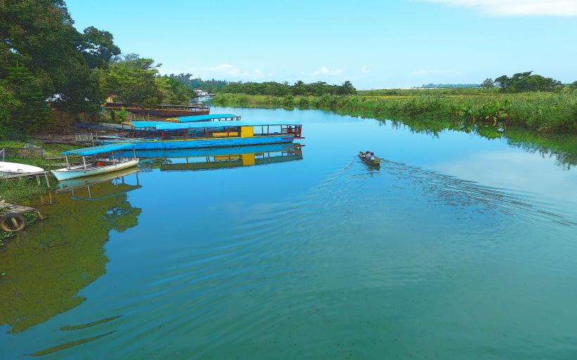
The Canal des Pangalanes is a 645-kilometer long chain of natural rivers, lagoons, and artificial channels running parallel to the east coast of Madagascar, with a prominent section accessible from the city of Manakara.
Visual Characteristics
The canal typically presents a brownish-green water hue due to sediment and vegetation. Its width varies, ranging from narrow passages to wider lagoon-like sections. The banks are characterized by dense tropical vegetation, including palm trees, mangroves, and reeds, interspersed with small fishing villages and cultivated plots. Traditional pirogues and larger cargo barges are common sights on the water.
Location & Access Logistics
The canal runs directly adjacent to Manakara, a coastal city approximately 695 kilometers southeast of Antananarivo. Access to the canal is primarily from various points within Manakara, particularly near the port area or local boat docks. No specific road names lead directly to canal access points; rather, local roads within Manakara provide access to the waterfront. Parking is generally informal street parking in the city. Public transport within Manakara consists of local taxis or pousse-pousse (rickshaws) that can transport visitors to boat departure points. Boat transfers are the primary method of navigating the canal.
Historical & Ecological Origin
The Canal des Pangalanes was largely constructed and improved during the French colonial period, primarily between 1896 and 1904, under the direction of General Joseph Gallieni. Its original purpose was to create a safe inland waterway for the transport of goods and people, bypassing the treacherous conditions of the Indian Ocean along the east coast. Ecologically, it connects numerous natural freshwater lagoons and estuaries, forming a unique aquatic ecosystem.
Key Highlights & Activities
Boat excursions are the primary activity, offering views of local life along the banks. Visitors can observe traditional fishing methods, local villages, and diverse birdlife. Longer trips can extend to other towns like Mananjary or Mahanoro. Photography of the landscape and local culture is a common pursuit. Some sections allow for swimming in designated areas, though caution is advised due to boat traffic.
Infrastructure & Amenities
Infrastructure along the canal itself is minimal. Restrooms are generally available in larger villages or towns along the route, not directly on the canal banks. Shade is provided by the dense vegetation along the banks and by boat canopies. Cell phone signal (4G/5G) is intermittent and unreliable outside of major towns like Manakara. Food vendors are present in the villages along the canal, offering local snacks and meals, but dedicated restaurants are scarce.
Best Time to Visit
The dry season, from April to November, offers the most favorable weather conditions with less rainfall and lower humidity. Early mornings or late afternoons are ideal for boat trips, providing softer light for photography and cooler temperatures. There are no specific high/low tide requirements for canal navigation, as it is largely an inland waterway.
Facts & Legends
The Canal des Pangalanes is the longest artificial waterway in Madagascar. A local tip for visitors is to arrange boat trips directly with local boatmen at the port rather than through intermediaries, often resulting in a more authentic experience and better pricing. The canal serves as a vital economic artery for communities along its length, transporting goods such as vanilla, coffee, and timber.
Nearby Landmarks
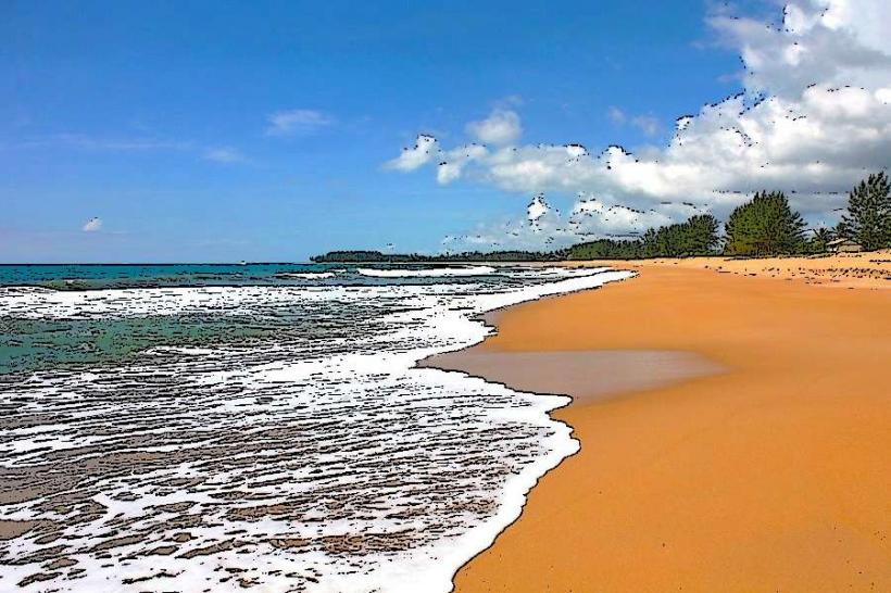
- Manakara Beach: 1.5km East
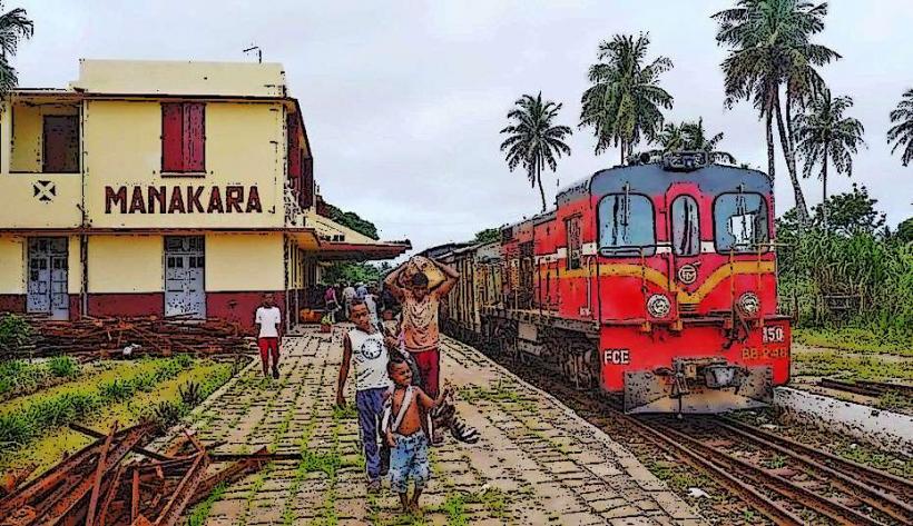
- Manakara Train Station: 0.8km West (terminus of the Fianarantsoa-Côte Est railway)
- Manakara Market: 0.6km North
- Lac Anosy: 2km North (a large lagoon connected to the canal)