Information
Landmark: Nosy VarikaCity: Manakara
Country: Madagascar
Continent: Africa
Nosy Varika, Manakara, Madagascar, Africa
Nosy Varika is a coastal town and a significant port situated on the southeastern coast of Madagascar. It is located approximately 150 kilometers north of Manakara, serving as a regional administrative center.
Visual Characteristics
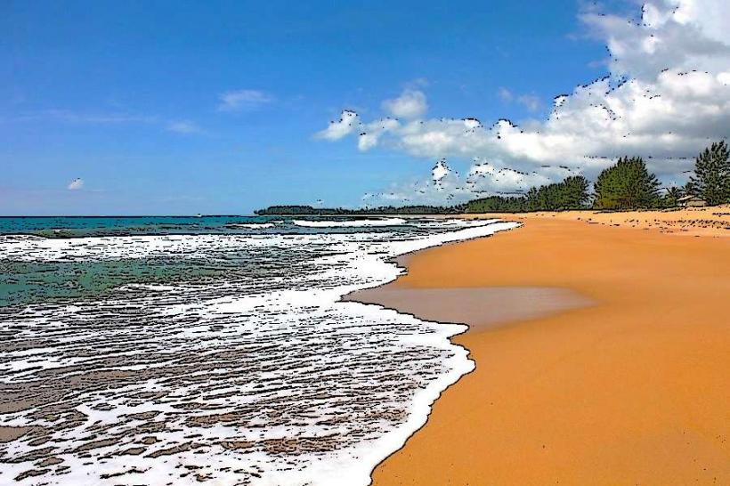
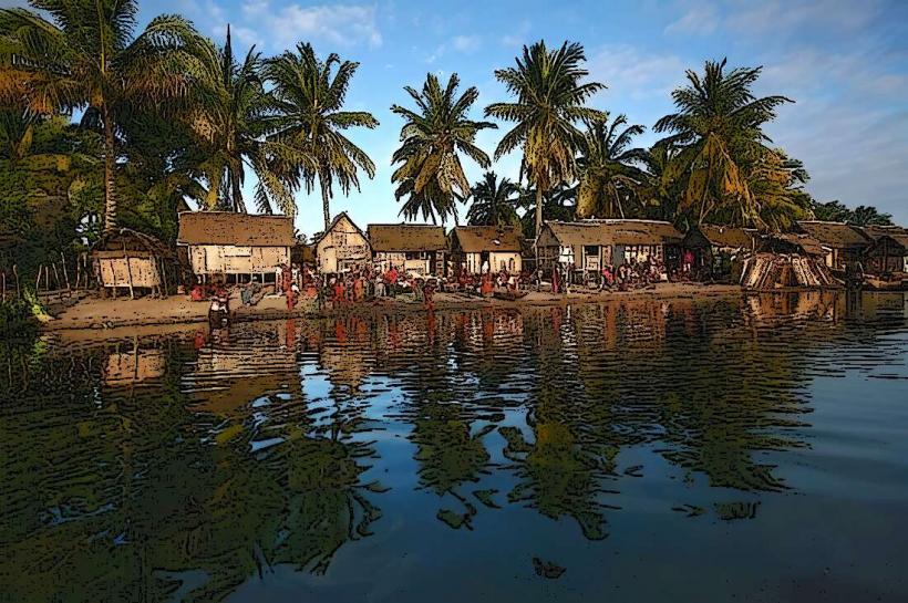
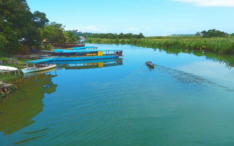
The town of Nosy Varika is characterized by its coastal setting, featuring a mix of traditional Malagasy wooden and brick structures with corrugated iron roofs. The immediate coastline includes sandy stretches and areas influenced by the mouth of the Sakaleona River. Vegetation is typical of the eastern Malagasy littoral, with palm trees and dense tropical foliage. The port area consists of basic docking facilities for smaller vessels and pirogues.
Location & Access Logistics
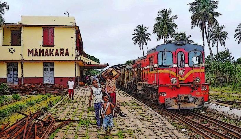
Nosy Varika is located on Madagascar's eastern coast, approximately 150 kilometers north of Manakara. Access is primarily via National Road 12 (RN12), which runs along the coast. The road condition can be challenging, particularly during the rainy season, often requiring 4x4 vehicles. Travel time from Manakara can exceed 5-7 hours due to road conditions. Limited public transport, such as bush taxis (taxi-brousse), operates irregularly between Manakara and Nosy Varika. Parking is informal and available within the town center.
Historical & Ecological Origin
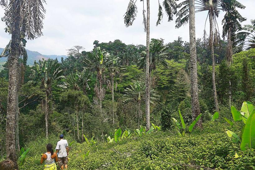
Nosy Varika developed as a strategic port town due to its location at the mouth of the Sakaleona River, facilitating trade and transport along the eastern coast. Its establishment as a significant settlement dates back to the colonial era, serving as an administrative and commercial hub for the surrounding agricultural region. Ecologically, the area is part of Madagascar's eastern humid forest biome, transitioning into coastal ecosystems with mangrove patches near the river mouth and sandy beaches.
Key Highlights & Activities
Visitors can observe daily port activities, including the loading and unloading of goods and the movement of traditional pirogues. The local market offers an insight into regional commerce and agricultural products. Exploring the immediate coastal areas and the mouth of the Sakaleona River is possible, often involving local boatmen. Walking through the town provides an opportunity to experience local life.
Infrastructure & Amenities
Basic infrastructure is present in Nosy Varika. Restrooms are typically found in guesthouses or local eateries. Shade is provided by natural vegetation and building overhangs. Cell phone signal (2G/3G, with limited 4G) is generally available in the town center. Several small local restaurants and food stalls offer Malagasy cuisine. There are a few basic guesthouses for accommodation.
Best Time to Visit
The dry season, from April to November, is the best time to visit Nosy Varika due to more favorable road conditions and less rainfall. Temperatures are generally warm year-round. Early mornings offer cooler temperatures and good light for photography, particularly around the port and river mouth. No specific tide requirements significantly impact general town activities.
Facts & Legends
The name "Nosy Varika" translates to "Island of Lemurs," though lemurs are not typically found within the immediate town area today. This name likely refers to historical populations on nearby riverine islands or forested areas. A local tip for visitors is to engage with local fishermen for fresh seafood, often available directly from their catches at the port.
Nearby Landmarks
- Mananjary: Approximately 60km North-Northeast
- Vohipeno: Approximately 100km South-Southwest
- Farafangana: Approximately 180km South
- Kianjavato Research Center: Approximately 70km West (inland)