Information
Landmark: Catskill Forest PreserveCity: Albany
Country: USA New York
Continent: North America
Catskill Forest Preserve, Albany, USA New York, North America
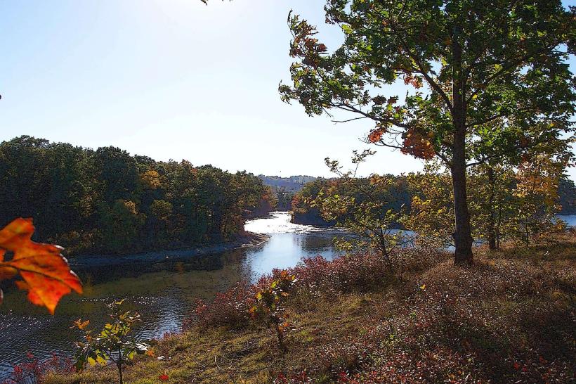
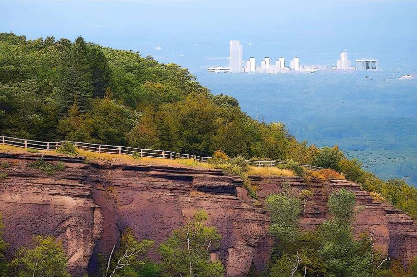
The Catskill Forest Preserve is a protected area located in the Catskill Mountains of New York State, west of Albany.
This extensive preserve encompasses a significant portion of the Catskill Mountain region, offering varied terrain and natural features.
Visual Characteristics
The preserve features deciduous and coniferous forests, with elevations ranging from approximately 1,000 feet to over 4,000 feet. Rock outcrops, including granite and sandstone formations, are common. Numerous streams and rivers, such as the Esopus Creek and the Schoharie Creek, flow through the area. Lake topography includes glacial lakes and reservoirs. Vegetation density varies with elevation, with denser growth at lower altitudes and sparser, more alpine-like conditions at higher peaks.
Location & Access Logistics
The Catskill Forest Preserve is accessible via multiple routes. State Route 28 runs through the central portion of the preserve. State Route 17 (future I-86) provides access from the south. Albany International Airport (ALB) is approximately 60 miles east. Major trailheads are located near towns such as Phoenicia, Hunter, and Woodstock. Parking is available at designated trailheads and day-use areas; capacity varies. Public transportation options are limited within the preserve itself, with bus services generally terminating in gateway towns. The closest Amtrak station is in Hudson, approximately 40 miles east.
Historical & Ecological Origin
The Catskill Forest Preserve was established in 1885 by the State of New York to protect the headwaters of the state's major rivers and to preserve the natural beauty of the Catskill Mountains. It is part of the larger Adirondack Park Agency system, though managed separately. Ecologically, the region is characterized by a temperate deciduous forest biome, with remnants of glacial activity evident in its topography and water bodies. The area is a critical watershed for the Hudson River.
Key Highlights & Activities
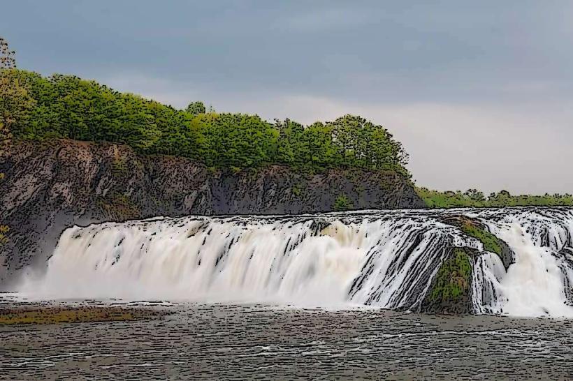
Hiking is a primary activity, with over 200 miles of marked trails. Specific trails include the Overlook Mountain Trail (summit elevation 3,151 feet) and the Kaaterskill Falls Trail. Rock climbing is permitted in designated areas. Fishing is available in lakes and streams, subject to New York State fishing regulations. Camping is allowed at designated campsites and lean-tos, requiring permits for overnight stays. Wildlife observation is possible, with common species including white-tailed deer, black bears, and various bird species.
Infrastructure & Amenities
Restrooms are available at major trailheads and visitor centers. Sheltered picnic areas are present in some day-use zones. Cell phone signal is intermittent and generally unavailable in remote areas of the preserve. Food vendors and restaurants are located in surrounding towns, not within the preserve itself.
Best Time to Visit
For hiking and general exploration, the months of May through October offer the most favorable weather. Autumn (September-October) provides clear air and fall foliage. Summer (June-August) is suitable for water-based activities but can be humid. Winter conditions can be severe, with snow and ice making many trails impassable without specialized equipment. For photography, early morning and late afternoon light provides optimal illumination on rock formations and forest landscapes.
Facts & Legends
The Catskill Mountains are often cited as the inspiration for the Hudson River School of landscape painting, a 19th-century American art movement. A specific geological feature, the "Devil's Path," is a challenging 24-mile trail known for its rugged terrain and steep ascents, rumored to be named for its difficulty.
Nearby Landmarks
- Hunter Mountain Ski Resort (2.5km West)
- Kaaterskill Falls (4.0km Southeast)
- Opus 40 Sculpture Park (6.0km Southwest)
- Woodstock, NY (8.0km East)
- Catskill Mountains Visitor Center (10.0km Northeast)