Information
Landmark: El Chaco CentralCity: Chaco Region
Country: Paraguay
Continent: South America
El Chaco Central, Chaco Region, Paraguay, South America
El Chaco Central is a geographical region located in the western part of Paraguay. It is characterized by its extensive plains and semi-arid climate.
Visual Characteristics
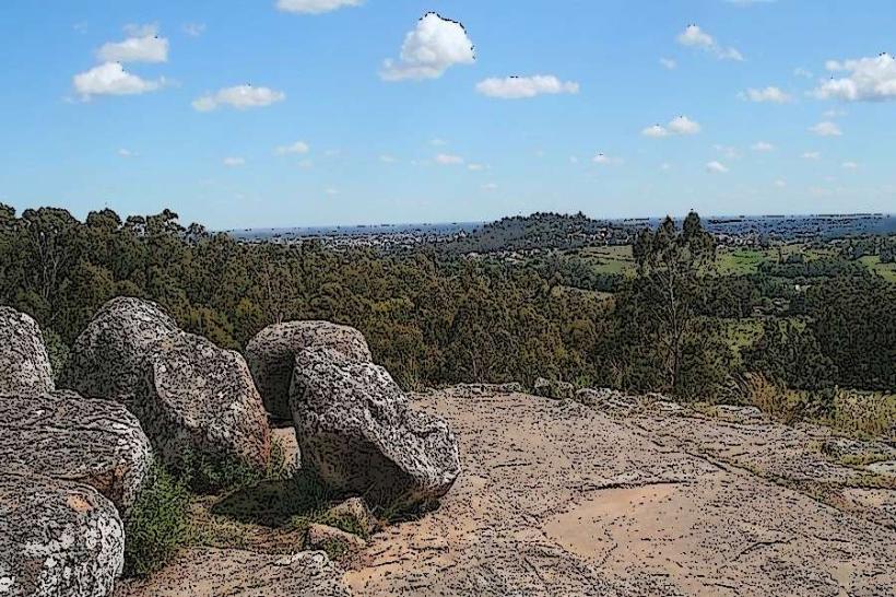
The landscape consists primarily of flat to gently rolling terrain covered by dry forests, savannas, and wetlands. Vegetation is sparse in many areas, featuring thorny shrubs, scattered trees like quebracho and algarrobo, and grasses adapted to arid conditions. Water bodies are seasonal, often appearing as shallow lagoons or temporary streams.
Location & Access Logistics
El Chaco Central is situated west of the Paraguay River. Access is typically via Route 9 (Transchaco Highway), which runs through the region. The nearest major city is Asunción, approximately 300 km east of the central Chaco area. Road conditions on Route 9 are generally paved, but secondary roads can be unpaved and challenging, especially during the rainy season. Limited public transport operates within the region; private vehicles or organized tours are the most common means of access. Parking is generally available at established settlements or tourist lodges.
Historical & Ecological Origin
Ecologically, El Chaco Central is classified as a dry forest and savanna biome, part of the larger Gran Chaco ecoregion. This area formed through geological processes over millennia, shaped by erosion and deposition. Historically, the region was inhabited by indigenous Guaycuru peoples before European colonization. The modern settlement and development of the Chaco began in the late 19th and early 20th centuries, with significant agricultural and cattle ranching expansion.
Key Highlights & Activities
Activities include wildlife observation, focusing on species adapted to arid environments such as capybaras, peccaries, and various bird species. Guided nature walks and horseback riding are available in certain areas. Visiting Mennonite colonies, such as Filadelfia, offers insight into the region's agricultural history and unique cultural practices. Photography of the distinct flora and fauna is a primary activity.
Infrastructure & Amenities
Infrastructure is limited. Basic accommodations, including lodges and guesthouses, are found in settlements like Filadelfia and Loma Plata. Restrooms are available at these establishments and some roadside stops. Shade is provided by natural tree cover in forested areas and by structures in settlements. Cell phone signal (4G/5G) is inconsistent and generally only available in larger towns. Food vendors are scarce outside of established towns; visitors should plan to carry supplies.
Best Time to Visit
The dry season, from May to October, offers the most favorable weather conditions with lower humidity and less rainfall. Daytime temperatures can still be high, averaging 25-35°C. The best time of day for photography is early morning or late afternoon to avoid harsh midday light and to observe wildlife activity. There are no specific tide requirements as the region is landlocked.
Facts & Legends
A notable historical oddity is the presence of large Mennonite communities established in the 20th century, which have significantly impacted the region's agricultural development and cultural landscape. These communities maintain distinct traditions and farming methods.
Nearby Landmarks
- Filadelfia (0.5km West)
- Loma Plata (25km Southwest)
- Fortín Toledo (40km North)
- Defensores del Chaco National Park (150km Northwest)