Information
Landmark: El MorroCity: Montecristi
Country: Dominican Republic
Continent: North America
El Morro, Montecristi, Dominican Republic, North America
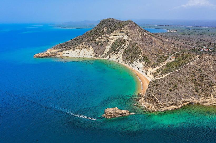
El Morro is a distinctive flat-topped mesa located on the northwestern coast of the Dominican Republic, immediately north of the city of Montecristi.
Visual Characteristics
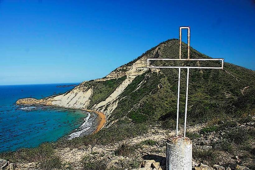
El Morro is characterized by its prominent, flat summit and steep, eroded cliffs composed primarily of reddish-brown limestone. It rises approximately 242 meters (794 feet) above sea level. The mesa's sides are sparsely vegetated with arid scrub and cacti, contrasting with the deep blue of the Atlantic Ocean it overlooks.
Location & Access Logistics
El Morro is situated approximately 5 kilometers north of Montecristi city center. Access is via a paved road, Carretera El Morro, which branches off from the main highway leading into Montecristi. Parking is available at the base of the mesa near the trailheads and the lighthouse. Public transportation directly to the summit is not available; visitors typically use private vehicles, taxis, or local motoconchos to reach the base.
Historical & Ecological Origin
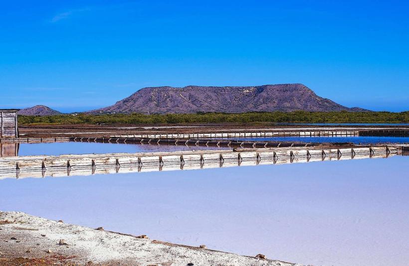
El Morro is a natural geological formation, specifically a limestone mesa. It formed through a combination of tectonic uplift and subsequent erosion by wind and water over millions of years. The mesa is an integral part of the Montecristi National Park, an ecological classification protecting its unique dry forest ecosystem and coastal marine environment.
Key Highlights & Activities
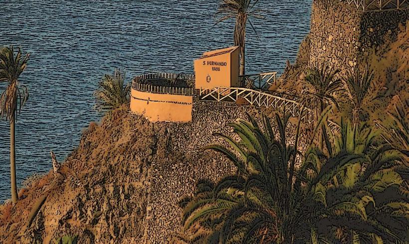
Hiking to the summit of El Morro is a primary activity, offering panoramic views of the Montecristi Bay, the city, and the Seven Brothers Cays. Visitors can explore the historic lighthouse located on the mesa's peak. Photography is a popular pursuit due to the dramatic coastal scenery. Birdwatching is also possible, observing species adapted to the arid coastal environment.
Infrastructure & Amenities
Infrastructure on El Morro itself is minimal. There are no dedicated restrooms or food vendors directly on the mesa; these services are available in nearby Montecristi. Shade is limited along the hiking trails. Cell phone signal (4G/5G) is generally available at the summit and surrounding areas.
Best Time to Visit
The best time to visit El Morro is during the cooler, drier months from December to April. Early morning or late afternoon are recommended for hiking to avoid the midday heat and to capture optimal lighting for photography, particularly during sunrise or sunset.
Facts & Legends
The distinctive shape of El Morro, with its flat top and steep sides, has led to it being locally referred to as "the camel's hump." It served as a significant navigational landmark for sailors for centuries. A verified historical oddity is its strategic importance during various conflicts, including its use as a lookout point against pirates and foreign invaders.
Nearby Landmarks
- Montecristi City Center: 5km South
- Reloj de Montecristi (Clock Tower): 5.5km South
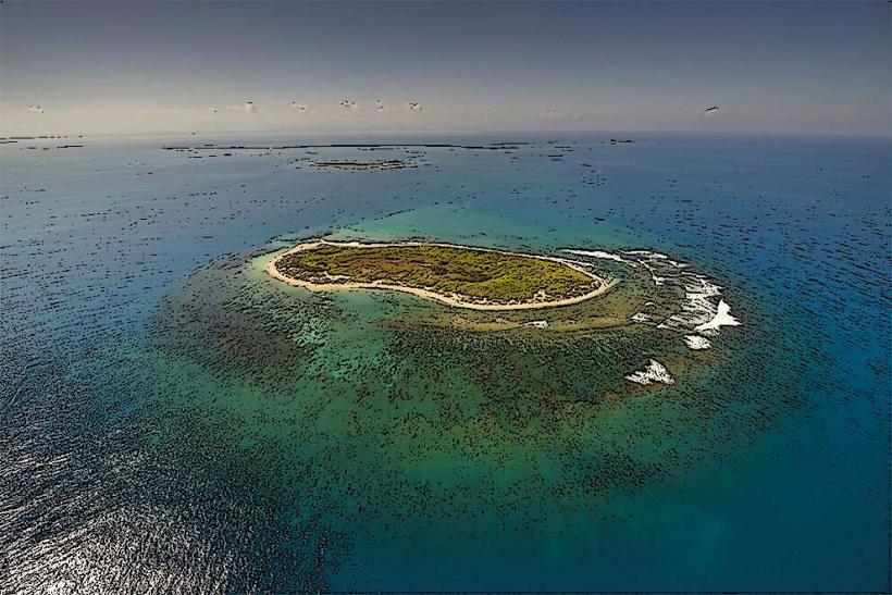
- Los Cayos Siete Hermanos (Seven Brothers Cays): 10-20km Northwest (offshore)
- Parque Nacional Montecristi (Mangrove areas): 2-10km East and South
- Isla Cabra: 2km West (across the bay)