Information
Landmark: Fort Boreman ParkCity: Parkersburg
Country: USA West Virginia
Continent: North America
Fort Boreman Park, Parkersburg, USA West Virginia, North America
Fort Boreman Park is a historical park located in Parkersburg, West Virginia. It preserves a Civil War-era fortification.
Visual Characteristics
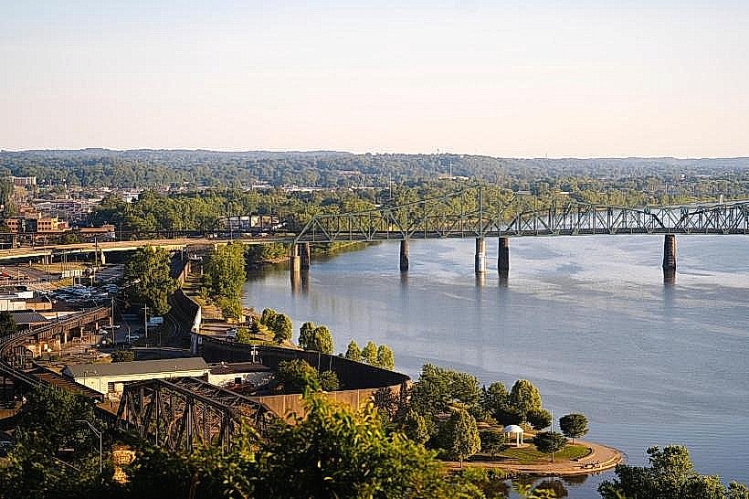
The park features earthen ramparts and trenches, remnants of the original fort's construction. Vegetation consists of mature deciduous trees, primarily oak and maple, with an understory of ferns and native shrubs. The terrain is gently rolling, with the Ohio River visible from higher elevations.
Location & Access Logistics
Fort Boreman Park is situated approximately 5 kilometers north of downtown Parkersburg, West Virginia. Access is via Fort Boreman Road, which connects to US Route 50. The park entrance is clearly marked. Ample free parking is available in a designated lot near the main interpretive center. No public transport directly serves the park; private vehicle is the primary access method.
Historical & Ecological Origin
The fort was constructed in 1863 by Union soldiers during the American Civil War. Its purpose was to defend the strategically important Ohio River and the city of Parkersburg from Confederate incursions. The site is a natural bluff overlooking the river, chosen for its defensive advantages.
Key Highlights & Activities
Visitors can walk the perimeter of the earthworks, observing the preserved trench lines and ramparts. Interpretive signage details the fort's history and military significance. Hiking trails wind through the wooded areas of the park. Observation points offer views of the Ohio River.
Infrastructure & Amenities
Restrooms are available near the parking area. Several picnic tables are provided, some with overhead shade structures. Cell phone signal (4G) is generally available within the park. No food vendors operate within the park; nearest options are in Parkersburg.
Best Time to Visit
For optimal lighting for photography of the earthworks and river views, early morning or late afternoon is recommended. The months of April through October offer the most pleasant weather for outdoor exploration. No specific tide considerations apply.
Facts & Legends
A local anecdote suggests that during the fort's construction, soldiers would use the river's currents to dispose of waste, a practice that contributed to the river's pollution downstream. The fort was never directly attacked, serving primarily as a deterrent.
Nearby Landmarks
- Blennerhassett Island Historical State Park (3.5km Southwest)
- Parkersburg Art Center (4.8km South)
- Ohio River Museum (5.0km South)
- Mount Olivet Cemetery (4.0km South)