Information
Landmark: Galinakopf RidgeCity: Vaduz
Country: Liechtenstein
Continent: Europe
Galinakopf Ridge, Vaduz, Liechtenstein, Europe
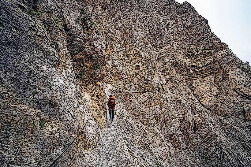
The Galinakopf Ridge is a mountain ridge situated in the Rätikon range, forming part of the eastern border of Liechtenstein near Vaduz. It is a significant geological feature offering extensive views of the Rhine Valley and the surrounding Alps.
Visual Characteristics
The ridge is characterized by its rugged limestone formations, typical of the Rätikon Alps. Its slopes are primarily composed of grey and white rock, interspersed with alpine meadows and sparse vegetation at lower elevations. The summit reaches an elevation of 2,198 meters above sea level, presenting a sharp, exposed profile.
Location & Access Logistics
The Galinakopf Ridge is located approximately 15 kilometers east of Vaduz. Access is primarily via hiking trails originating from the villages of Malbun or Steg. From Vaduz, take Route 28 to Triesenberg, then continue on Route 28 to Steg or Malbun. Parking is available in designated lots in both Malbun and Steg. Public transport includes bus line 21 from Vaduz Post to Malbun Zentrum or Steg, with a journey time of approximately 30-40 minutes.
Historical & Ecological Origin
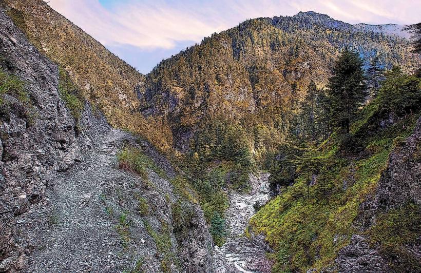
The Galinakopf Ridge is part of the Rätikon mountain range, which is predominantly composed of Mesozoic limestone and dolomite. Its geological formation is a result of the Alpine orogeny, involving significant tectonic uplift and folding over millions of years. Ecologically, it is classified as an alpine and subalpine environment, supporting resilient flora adapted to high altitudes and rocky terrain.
Key Highlights & Activities
Hiking is the primary activity, with marked trails leading to the summit. The ascent from Malbun typically takes 2.5 to 3 hours. The ridge offers panoramic views suitable for photography. Specific trails include connections to the Fürstensteig, a challenging alpine path, and routes towards Augstenberg.
Infrastructure & Amenities
There are no permanent infrastructure or amenities directly on the Galinakopf Ridge. Restrooms and food vendors are available in the nearby villages of Malbun and Steg. Shade is minimal on the exposed ridge. Cell phone signal (4G/5G) can be intermittent, particularly in certain sections of the ascent.
Best Time to Visit
The best time to visit for hiking is from late June to early October, when snow has melted and trails are clear. Early mornings are recommended for clear visibility and optimal lighting for photography, especially for views towards the Rhine Valley. Visiting during winter months is not advised due to snow, ice, and avalanche risk.
Facts & Legends
The name "Galinakopf" is derived from the Rhaeto-Romanic word "galina," meaning hen, possibly referring to the shape of the peak or local wildlife. A verified historical oddity is its position directly on the border between Liechtenstein and Austria, marked by boundary stones along the ridge line.
Nearby Landmarks
- Malbun (Village) - 3.0km East
- Sareis Chairlift - 3.5km East
- Augstenberg (Peak) - 2.5km North-East
- Fürstensteig (Hiking Trail) - 1.5km North-West (starting point)
- Alp Gaflei - 4.0km West