Information
Landmark: Rappenstein MountainCity: Vaduz
Country: Liechtenstein
Continent: Europe
Rappenstein Mountain, Vaduz, Liechtenstein, Europe
Rappenstein Mountain is a limestone peak within the Rätikon range of the Eastern Alps, located east of Vaduz, Liechtenstein. It forms part of the natural boundary between Liechtenstein and Austria.
Visual Characteristics
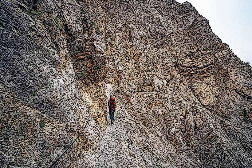
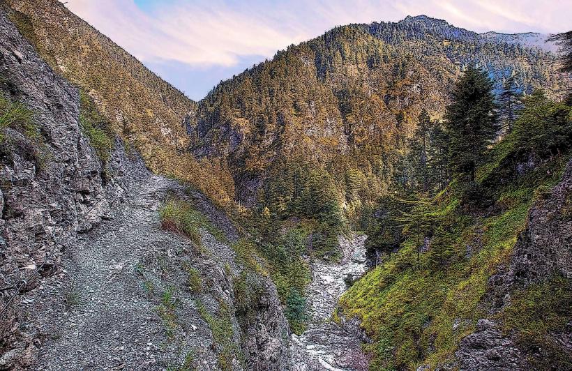
The mountain reaches an elevation of 2,221 meters above sea level. Its upper slopes consist of exposed grey limestone rock formations, characteristic of the Rätikon massif. Below the treeline, the mountain is covered by coniferous forests, primarily spruce and fir, transitioning to alpine meadows at higher altitudes. The overall appearance is rugged and steep, particularly on its eastern and northern faces.
Location & Access Logistics
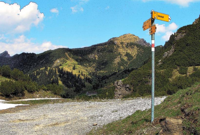
Rappenstein Mountain is situated approximately 10 kilometers east of Vaduz city center. Access typically involves driving to the village of Malbun or Steg. From Vaduz, take Landstrasse 28 (Triesenbergstrasse) towards Triesenberg, then continue on Malbunstrasse to Malbun. Parking is available in designated lots in Malbun, such as near the Sareis chairlift station. Public transport includes bus line 21 from Vaduz Post to Malbun Zentrum, with a journey time of approximately 30 minutes. From Malbun, hiking trails lead towards the mountain.
Historical & Ecological Origin
Rappenstein Mountain is a product of the Alpine orogeny, formed primarily from Mesozoic limestone and dolomite through tectonic uplift and folding over millions of years. It is part of the Helvetic nappe system, characterized by its sedimentary rock composition. The ecological classification is alpine and subalpine, supporting flora and fauna adapted to high-altitude environments, including various alpine flowers and chamois.
Key Highlights & Activities
Hiking is the primary activity, with marked trails leading to the summit. The ascent from Malbun typically takes 3-4 hours. Mountaineering routes exist on more challenging faces. Panoramic views of the Rhine Valley, the Swiss Alps, and the Austrian Vorarlberg region are available from the summit. Photography of the alpine landscape is a common pursuit.
Infrastructure & Amenities
There are no permanent infrastructure or amenities directly on Rappenstein Mountain. Basic restrooms and food vendors are available in the nearby villages of Malbun and Steg. Cell phone signal (4G/5G) is generally available in the lower sections and often intermittent or absent on the higher slopes and summit. There is no natural shade on the exposed upper sections of the mountain.
Best Time to Visit
The best time to visit for hiking is from late June to early October, when snow has melted and trails are clear. Early morning is ideal for photography, offering clear light and fewer clouds, especially for views towards the west. Avoid visiting during winter months due to heavy snow cover and avalanche risk. Check local weather forecasts for clear conditions before planning an ascent.
Facts & Legends
A local legend suggests that the mountain's name, "Rappenstein," derives from the dark, raven-like appearance of its rock faces under certain lighting conditions. The mountain is a popular training ground for local mountaineers due to its accessible yet challenging terrain, offering various routes of differing difficulty.
Nearby Landmarks
- Malbun: 3km South-West
- Sareis (Chairlift & Restaurant): 3.5km South-West
- Augstenberg: 4km South
- Gaflei: 6km West
- Alpspitz: 4.5km North-West