Information
Landmark: Galtee MountainsCity: Tipperary
Country: Ireland
Continent: Europe
Galtee Mountains, Tipperary, Ireland, Europe
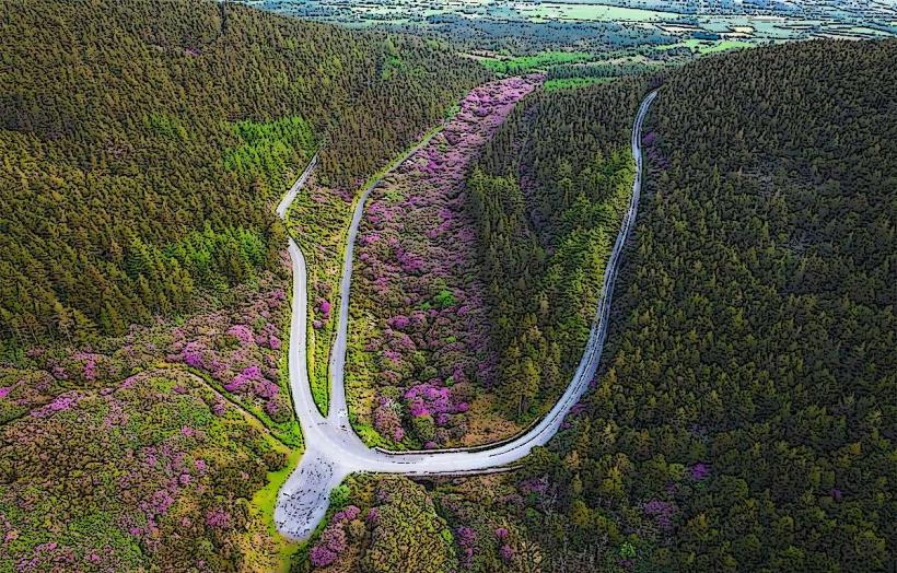
The Galtee Mountains (Na Gaillte) are Ireland’s highest inland mountain range, stretching approximately $30$ km east-to-west across the borders of counties Tipperary, Limerick, and Cork. The range is characterized by steep northern faces, glacial corrie lakes, and a high-altitude sandstone plateau.
Visual and Geological Characteristics
The range consists primarily of Old Red Sandstone overlying a Silurian core.
Topography: The northern slopes are rugged and precipitous, carved by glacial action, while the southern slopes descend more gradually toward the Mitchelstown Valley.
Peaks: Contains several peaks exceeding $700$ meters, dominated by Galtymore.
Glacial Features: The range features five major corrie lakes, most notably Lough Curra and Lough Diheen, tucked into deep north-facing hollows.
Location & Access Logistics
Primary Access Points: * King's Yard: Southern access near Galty Road, providing a popular route for Galtymore.
Clydagh Bridge: Northern access point for the "Black Road" and North-Face climbs.
Glengarra Wood: Provides sheltered forest paths leading to the higher open mountain.
Transit: Private vehicle is required. Trailheads are located on local roads off the N8/M8 and R663.
Parking: Managed parking is available at King's Yard (private, small fee) and Glengarra Wood (public).
Accessibility: Higher elevations are restricted to experienced hillwalkers. Forest tracks in Glengarra Wood offer some limited mobility access, but the open mountain is steep, boggy, and unmarked.
Key Peaks
| Peak | Elevation (m) | Elevation (ft) |
|---|---|---|
| Galtymore | $919$ | $3,015$ |
| Galtybeg | $799$ | $2,621$ |
| Lyracappul | $825$ | $2,707$ |
| Temple Hill | $783$ | $2,569$ |
Historical & Archaeological Origin
The Galtee Castle: Formerly the mountain seat of the Earls of Kingston; the castle was demolished in the 1940s, but the surrounding Glengarra Wood remains as a recreational forest.
Cairns: The summit of Galtymore is marked by a large trig point and a Neolithic passage tomb (often obscured by the modern cairn).
Boundary: The range traditionally served as the boundary between the ancient kingdoms of Munster.
Key Activities & Trails
Galtymore Ascent: Usually approached via the "Black Road" (easier gradient) or the "Attychrair" route.
The Galtee Crossing: A challenging $32$ km long-distance trek covering the entire length of the ridge, typically completed in one or two days.
Cahir to Galtee Walk: A trail connecting the historic town of Cahir to the eastern foothills of the range.
Infrastructure & Amenities
Facilities: Minimal. There are no visitor centers or staffed stations on the mountain.
Sanitation: No facilities on the open mountain. Restrooms are available in Cahir ($15$ km) or Mitchelstown ($12$ km).
Connectivity: 4G signal is available on most peaks with line-of-sight to the valleys, but signal is frequently lost in the deep northern corries.
Safety: The range is notorious for rapid weather shifts and "white-out" conditions. Full navigation equipment (map and compass) is mandatory.
Technical Details
The Galtees are an "anticline" structure, where the rock layers were folded upward into an arch. During the last Ice Age, local glaciers sat in the northern hollows, eroding the sandstone to create vertical cliffs that drop nearly $300$ meters into the lakes below.
Nearby Landmarks
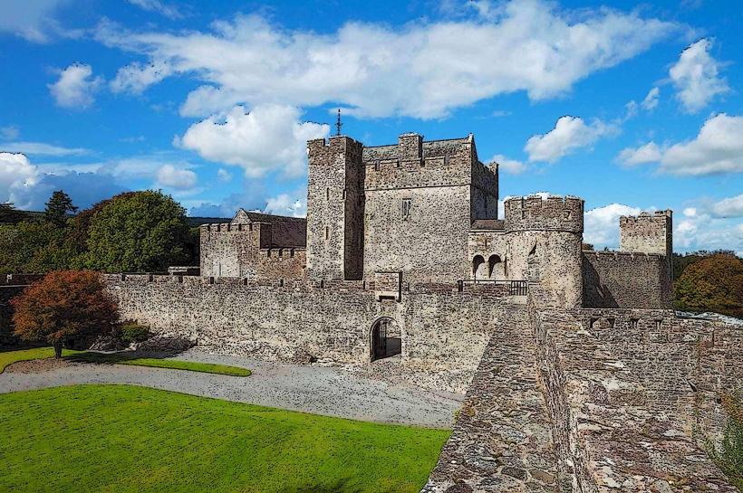
Cahir Castle – $15$ km East
Mitchelstown Caves – $10$ km South
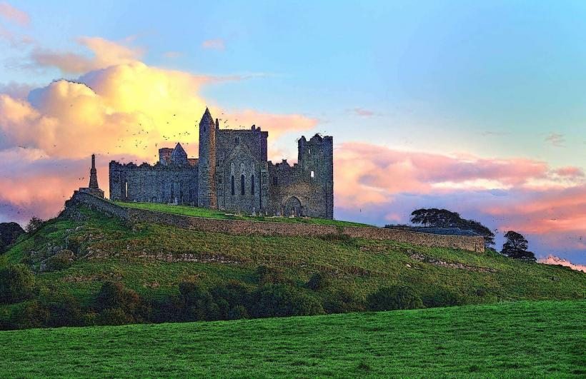
Rock of Cashel – $25$ km Northeast
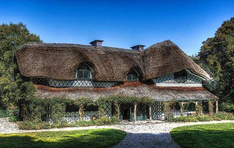
Swiss Cottage – $16$ km East