Information
Landmark: Gandoca-Manzanillo Wildlife RefugeCity: Limon
Country: Costa Rica
Continent: North America
Gandoca-Manzanillo Wildlife Refuge, Limon, Costa Rica, North America
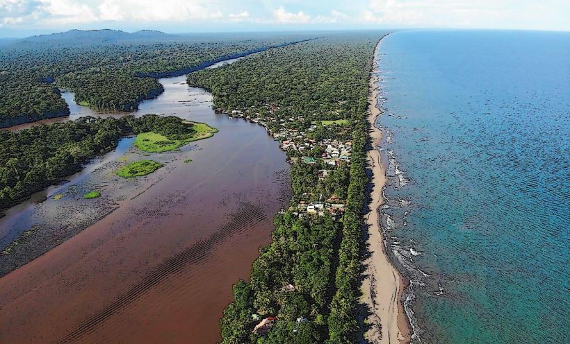
The Gandoca-Manzanillo Wildlife Refuge is a protected coastal area located on the Caribbean coast of Costa Rica, within the Limón Province.
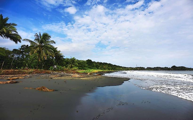
This refuge encompasses a significant portion of the Caribbean coastline, featuring diverse ecosystems including rainforest, coral reefs, and mangrove swamps.
Visual Characteristics
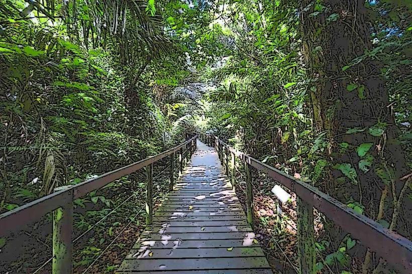
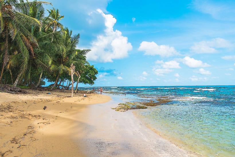
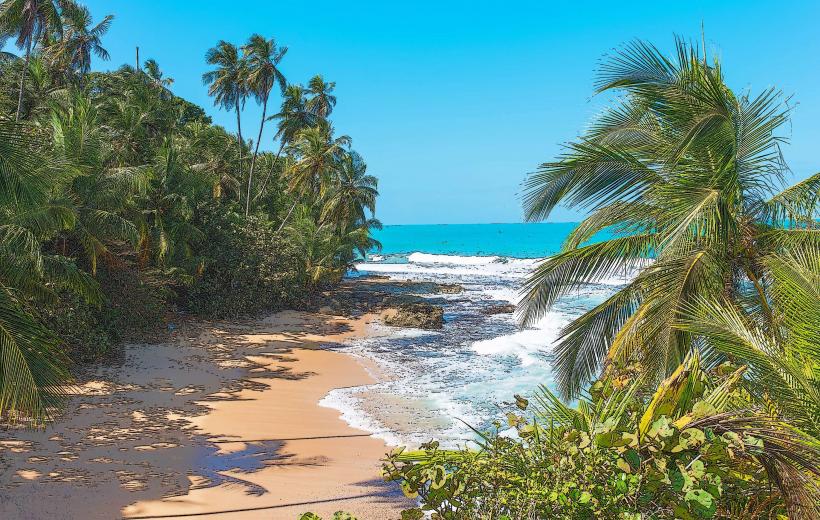
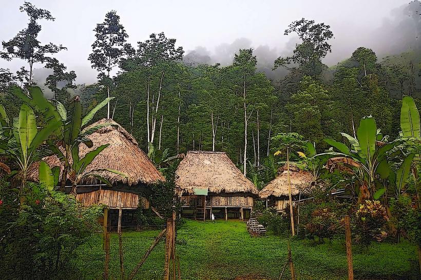
The refuge's terrestrial areas are characterized by dense tropical rainforest vegetation, with a canopy reaching up to 40 meters. Dominant tree species include Almendro (Dipteryx panamensis) and Ceiba (Ceiba pentandra). The coastline consists of sandy beaches interspersed with rocky outcrops. The marine environment includes coral reefs composed of species such as Brain coral (Diploria labyrinthiformis) and Elkhorn coral (Acropora palmata). Water clarity varies, with visibility typically ranging from 5 to 15 meters, depending on wave action and sediment runoff. Mangrove areas feature Rhizophora mangle and Avicennia germinans.
Location & Access Logistics
The Gandoca-Manzanillo Wildlife Refuge is situated approximately 25 kilometers southeast of Puerto Viejo de Talamanca. Access is primarily via the coastal road (Route 256), which is largely unpaved and can be challenging for standard vehicles, especially during the rainy season. Four-wheel-drive vehicles are recommended. The main access points are near the villages of Manzanillo and Gandoca. Limited parking is available at designated points. Public transport options are infrequent, with local buses operating between Puerto Viejo and Manzanillo, requiring a walk to specific trailheads or beach access points.
Historical & Ecological Origin
The Gandoca-Manzanillo Wildlife Refuge was established in 1985 to protect its unique biodiversity and ecological processes. Ecologically, it represents a transition zone between the tropical rainforests of Central America and the marine ecosystems of the Caribbean Sea. The coral reefs are a significant feature, supporting a rich marine life. The refuge also protects important nesting sites for sea turtles, including the Leatherback (Dermochelys coriacea) and Green sea turtle (Chelonia mydas).
Key Highlights & Activities
Activities include hiking designated trails through the rainforest, such as the trail to Punta Mona. Snorkeling and diving are possible within the coral reef areas, particularly around Isla Uvita. Birdwatching is a primary activity, with opportunities to observe species like toucans, parrots, and various migratory birds. Kayaking along the coast and through mangrove channels is also feasible. Wildlife observation, including monkeys, sloths, and reptiles, is common.
Infrastructure & Amenities
Basic infrastructure is limited. Restrooms are available at the visitor center near Manzanillo and at some private lodges outside the refuge boundaries. Shade is provided by the forest canopy in terrestrial areas. Cell phone signal (4G/5G) is intermittent and generally unreliable within the refuge. Food vendors are typically found in the village of Manzanillo, offering local cuisine. No amenities are present within the core protected areas.
Best Time to Visit
The best time for visiting is during the dry seasons, which generally occur from February to April and from September to November. These periods offer more stable weather conditions for outdoor activities. For marine activities like snorkeling and diving, visibility is often better during the calmer months. High tide is generally preferred for accessing certain coastal areas and observing marine life near the shore. The best time of day for photography, particularly for wildlife, is early morning or late afternoon when light is softer and animals are more active.
Facts & Legends
A significant geological feature within the refuge is Isla Uvita, a small island believed to be the westernmost point of the Caribbean plate. Local folklore speaks of a submerged city off the coast of Isla Uvita, though no archaeological evidence supports this claim. A practical tip for visitors is to carry insect repellent, as mosquitoes and sandflies can be prevalent, especially in the early morning and late afternoon.
Nearby Landmarks
- Puerto Viejo de Talamanca (15km Northwest)
- Cahuita National Park (30km Northwest)
- Jaguar Rescue Center (18km Northwest)
- Playa Chiquita (10km Northwest)
- Punta Uva (8km Northwest)