Information
Landmark: Gau IslandCity: Lomaiviti Group
Country: Fiji
Continent: Australia
Gau Island, Lomaiviti Group, Fiji, Australia
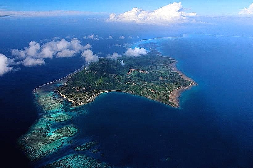
Gau Island is the fifth-largest island in Fiji, encompassing 136 square kilometers within the Lomaiviti Archipelago. It is a volcanic island characterized by a rugged, mountainous interior and a vast barrier reef system.
Geography and Topography
The island's landscape is defined by the central mountain range, which reaches its highest point at Mount Delaico (715m).
Forestry: The interior contains some of Fiji's most pristine primary rainforest, part of the Gau Highlands.
Coastline: The island is almost entirely encircled by the Gau Barrier Reef, which creates a massive lagoon.
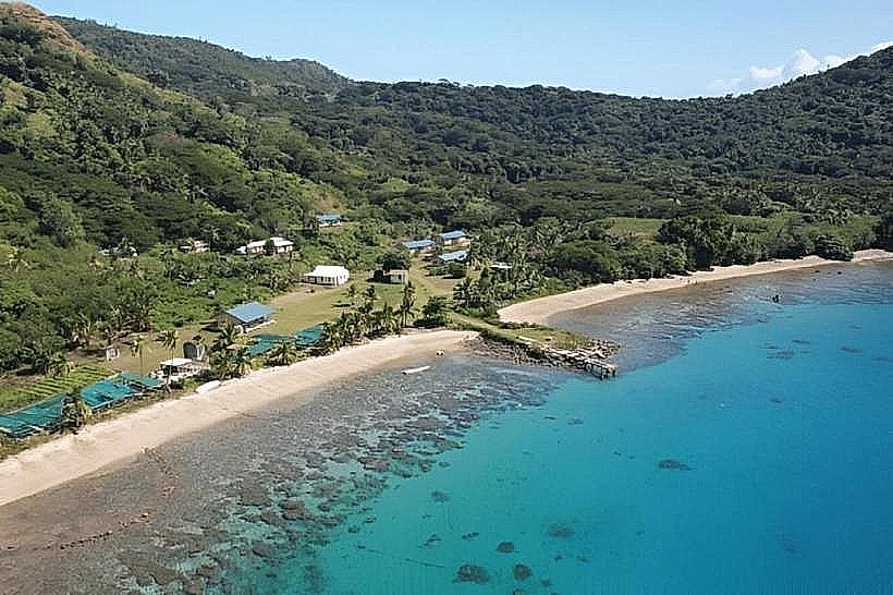
Hydrography: Numerous freshwater streams originate in the highlands, supporting the island's 16 coastal villages.
Ecological Significance
Gau is the only known nesting site for the Fiji Petrel (Pseudobulweria macgillivrayi), one of the world's rarest seabirds.
Conservation: Much of the highland forest is a community-protected area to safeguard the nesting burrows of the petrel.
Marine Life: The reef system, particularly the Shark Fin Point, is internationally recognized for high concentrations of grey reef sharks, eagle rays, and schooling barracuda.
Social and Economic Structure
The island is divided into three districts: Navakasiga, Sawaieke, and Lekutu.
Demographics: The population resides in traditional coastal villages such as Sawaieke (the chiefly seat), Lovu, and Qarani.
Economy: Subsistence agriculture (taro, yams, and kava) and artisanal fishing are the primary livelihoods. Copra production remains a secondary income source.
Culture: Gau maintains a rigid traditional hierarchy; the Takala-i-Gau is the paramount chief of the island.
Logistics and Access
Transport: * Air: Gau Airport (NGI) is located on the southern tip near Lovu. Domestic flights from Suva (Nausori) operate on a limited weekly schedule.
Sea: Irregular inter-island ferries and "carriers" (small wooden boats) connect Gau to Suva and Levuka.
Infrastructure: There are no hotels or commercial resorts; visitors typically stay in village guest houses or through arranged homestays.
Communications: Cellular coverage is available via towers in major villages but is inconsistent in the interior highlands.
Nearby Landmarks
Nairai Island: 30km North
Batiki Island: 40km Northwest
Moala Island: 100km Southeast
Suva: 90km West