Information
Landmark: Ham Rong MountainCity: Sapa
Country: Vietnam
Continent: Asia
Ham Rong Mountain, Sapa, Vietnam, Asia
Ham Rong Mountain is a geological formation located in Sapa, Vietnam. It is a prominent peak offering panoramic views of the surrounding landscape.
Visual Characteristics
The mountain features limestone rock formations with varying gradients. Vegetation density is high, primarily consisting of tropical and subtropical flora, including pine trees and various flowering plants. The summit area is characterized by exposed rock faces and sparse vegetation.
Location & Access Logistics
Ham Rong Mountain is situated directly adjacent to Sapa town. Access is via a paved pathway starting from the town center, approximately 0.5km North. Parking is available at designated lots near the entrance to the mountain path. Public transport to Sapa town includes inter-provincial buses and private car services. From Sapa town, the mountain is accessible on foot.
Historical & Ecological Origin
Ham Rong Mountain is a natural geological formation, primarily composed of limestone. Its current ecological state is influenced by human intervention, with cultivated gardens and pathways integrated into the natural landscape. The mountain's name, translating to "Dragon Jaw," refers to its distinctive ridgeline shape.
Key Highlights & Activities
Visitors can ascend the mountain via a network of stone steps and paved trails. Specific points of interest include the Orchid Garden, the Heaven's Gate viewpoint, and the Dragon's Back ridge. Photography is a common activity due to the elevated vantage points.
Infrastructure & Amenities
Restrooms are available at the base and at intervals along the main path. Shade is provided by the natural tree canopy in lower sections and by constructed shelters at viewpoints. Cell phone signal (4G/5G) is generally available at higher elevations. Food vendors are present at the base of the mountain and within Sapa town.
Best Time to Visit
The best time of day for photography is typically in the morning (07:00-09:00) or late afternoon (16:00-17:30) for optimal lighting conditions. The dry season, from October to April, offers clearer skies and more stable weather. There are no tide-dependent activities.
Facts & Legends
A local legend states that the mountain was formed from the petrified body of a dragon. A practical tip for visitors is to wear sturdy footwear, as the ascent involves numerous steps and can be steep in sections.
Nearby Landmarks
- Sapa Church (0.3km West)
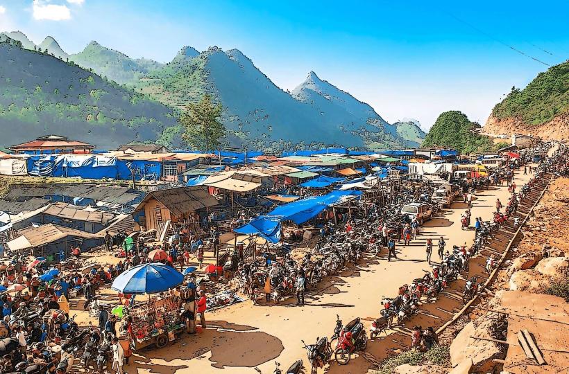
- Sapa Market (0.6km Southwest)
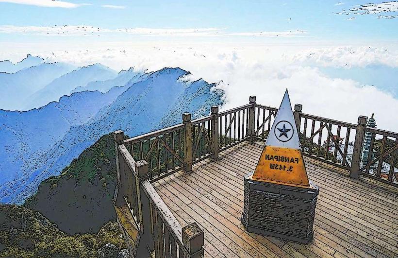
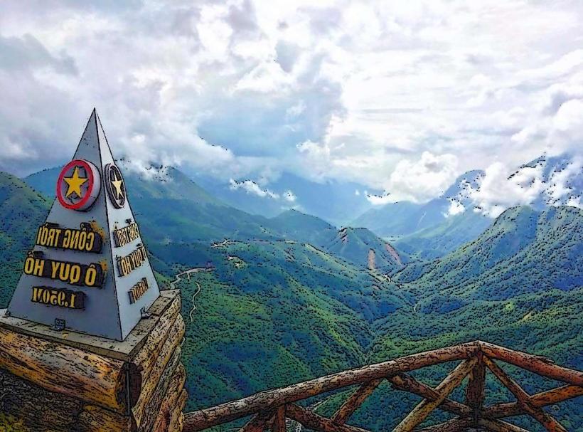
- Fansipan Mountain (10km Southwest)
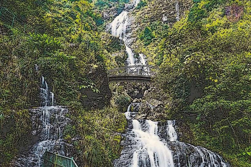
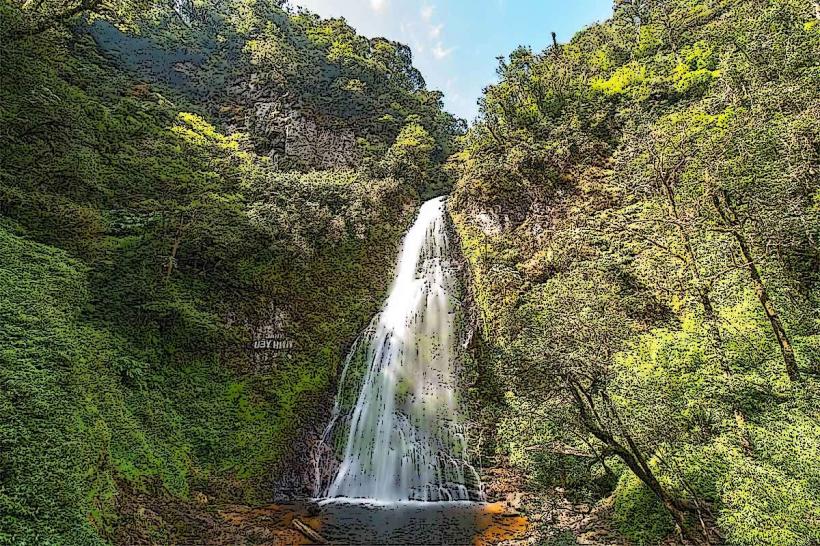
- Silver Waterfall (12km West)
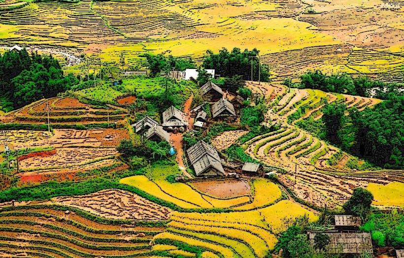
- Ta Van Village (8km Southeast)