Information
Landmark: Kasprowy WierchCity: Zakopane
Country: Poland
Continent: Europe
Kasprowy Wierch, Zakopane, Poland, Europe
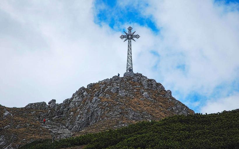
Kasprowy Wierch (1,987 m) is one of the most famous and accessible peaks in the Western Tatras. Located on the border between Poland and Slovakia, it serves as the primary hub for high-altitude skiing and alpine tourism in the region.
Visual Characteristics
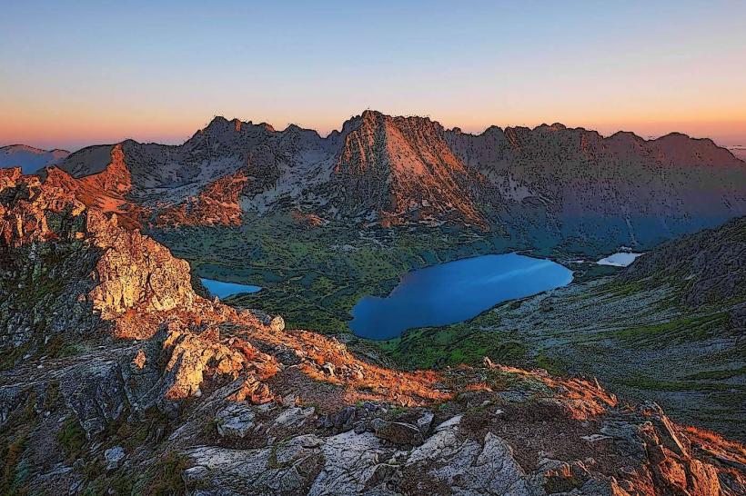
The summit is characterized by a rounded, granite-and-grass ridge that offers a 360-degree panorama of both the High Tatras (to the east) and the Western Tatras (to the west). It is dominated by a large stone building housing the upper cable car station, a restaurant, and Poland’s highest meteorological observatory.
Logistics & Access
Cable Car (Kolej Linowa): The most popular access method is the aerial tramway from Kuźnice. It is a two-stage journey with a transfer at Myślenickie Turnie.
Booking: Tickets for the cable car should be purchased online in advance (Górewnik/PKL website) to avoid queues that can exceed 3–4 hours during peak season.
Hiking Trails: * Green Trail: From Kuźnice via Myślenickie Turnie (approx. 3 h).
Yellow Trail: From Kuźnice via Dolina Gąsienicowa (approx. 3.5 h).
Slovakia Side: No direct mechanical access; trails lead up from the Tichá Valley.
Skiing & Winter Sports
Kasprowy Wierch is the only "alpine" ski area in Poland, relying entirely on natural snow.
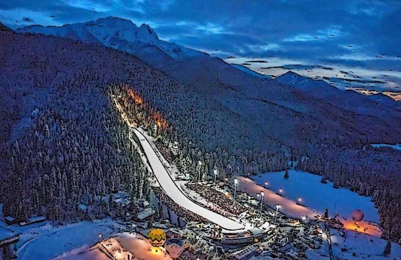
Gąsienicowa Cauldron: Features a modern 4-person chairlift and a wide, steep slope.
Goryczkowa Cauldron: Features a historic 2-person chairlift and a long, demanding run back toward Kuźnice.
Difficulty: These are strictly advanced (black/red) slopes. There are no beginner areas on the summit.
Key Highlights
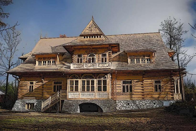
Meteorological Observatory: Built in 1938, it is the highest inhabited building in Poland.
The Ridge Trail: From the summit, hikers can follow the red trail along the border ridge toward Czerwone Wierchy (Red Peaks) or Świnica.
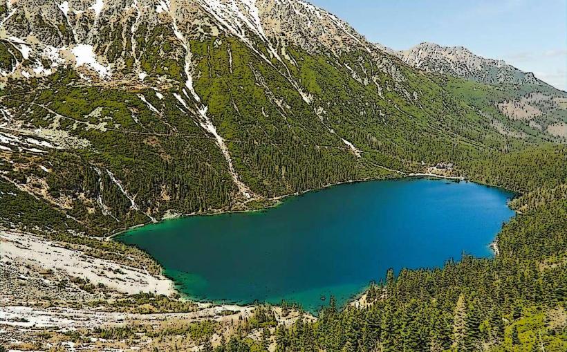
Dolina Gąsienicowa: Accessible via a descent from the peak; home to the "Murowaniec" mountain hut and several glacial lakes.
Infrastructure & Amenities
Dining: "Poziom 1987" is the highest restaurant in Poland, located in the upper station.
Connectivity: 5G/LTE signal is exceptionally strong at the summit due to the presence of telecommunications infrastructure.
Accessibility: The cable car makes the summit accessible to seniors and people with limited mobility, though the immediate terrain outside the station is rocky and uneven.
Safety & Seasonal Notes
Weather: Conditions change rapidly. The summit is often shrouded in cloud ("mleko") even when Zakopane is sunny. High winds frequently cause the cable car to be grounded.
Winter: The ridge trails require crampons and ice axes; the area is prone to significant avalanche risk.
Nearby Landmarks
Kuźnice (Lower Station): 0.0 km (Start point)
Świnica Peak: 2.5 km East (via ridge trail)
Murowaniec Hostel: 2.0 km Northeast (via walking trail)