Information
Landmark: KnocknareaCity: Sligo
Country: Ireland
Continent: Europe
Knocknarea, Sligo, Ireland, Europe
Knocknarea is a prominent limestone hill located on the Cúil Irra Peninsula in County Sligo, Ireland. It is a monolithic plateau rising to an elevation of 327 meters, capped by a massive Neolithic cairn.
Visual Characteristics
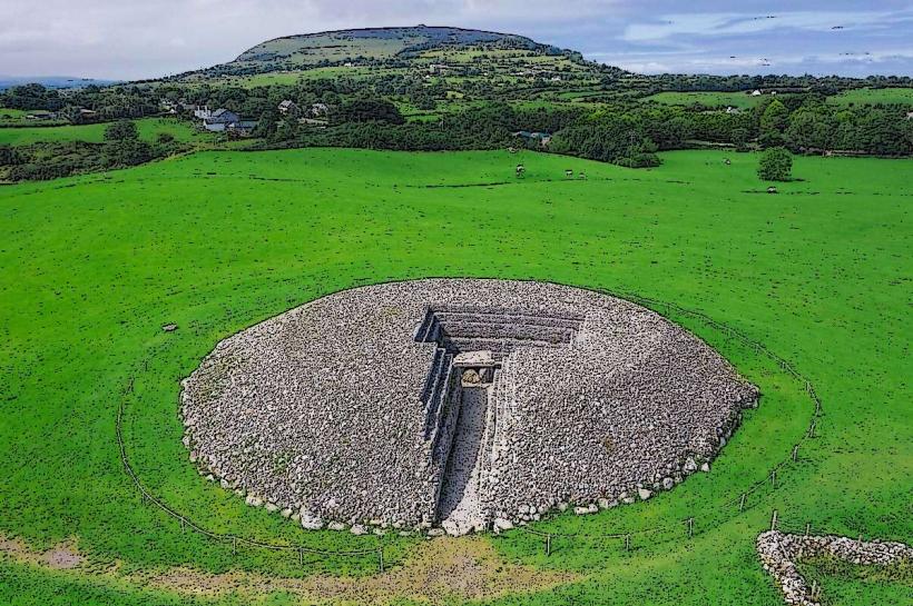
The hill is a steep-sided limestone cuesta with a distinct flat summit. The upper plateau is covered in heathland and peat, while the base features dense hazel scrub and limestone pavement. The summit is dominated by Miosgán Meadhbha, a cairn measuring 55 meters in diameter and 10 meters in height, constructed from loose limestone rubble.
Location & Access Logistics
The site is situated 6km west of Sligo Town. Primary access is via two trailheads: the Glen Road (west side) and the newer, more gradual path from Rathcarrick (east side) off the R292. Parking is available at both trailheads. There is no direct public transport to the base; visitors must use private vehicles, bicycles, or taxis from Sligo Town.
Historical & Ecological Origin
The hill was formed during the Carboniferous period from Dartry Limestone. The central cairn, Queen Maeve’s Cairn, dates to approximately 3400 BCE. While unexcavated, it is classified as a Neolithic passage tomb. The surrounding plateau contains smaller satellite tombs and hut sites, marking it as a major prehistoric ritual landscape.
Key Highlights & Activities
Hiking is the primary activity, with the ascent taking 40–60 minutes. The summit offers 360-degree views of Sligo Bay, Benbulben, and the Ox Mountains. Visitors can walk the perimeter of the cairn; however, climbing on the monument itself is strictly prohibited to prevent structural erosion.
Infrastructure & Amenities
There are no restrooms, water stations, or food vendors on the hill or at the trailheads. The summit is fully exposed with no shade or shelter from Atlantic winds. 4G and 5G cellular signals are generally strong across the plateau. Information boards are located at the start of the Rathcarrick and Glen Road paths.
Best Time to Visit
The best months are May through September for stable footing and visibility. Sunset provides optimal lighting for views over the Atlantic and the town of Strandhill. Hiking in heavy mist is discouraged due to the risk of disorientation on the plateau and steep drops on the western face.
Facts & Legends
According to Irish mythology, the central cairn is the burial place of Maeve, the Iron Age Queen of Connacht, who is said to be buried standing up and facing her enemies in Ulster. A local custom involves carrying a stone from the bottom of the hill to the top, though modern conservation guidelines request that visitors do not add stones to the ancient monument.
Nearby Landmarks
Carrowmore Megalithic Cemetery – 3.2km East
Strandhill Beach – 2.5km West
The Glen (Knocknarea) – 1.2km South
Coney Island – 4.0km North
Voya Seaweed Baths – 2.8km West