Information
Landmark: Lowell National Historical ParkCity: Lowell
Country: USA Massachusetts
Continent: North America
Lowell National Historical Park, Lowell, USA Massachusetts, North America
Lowell National Historical Park, located in Lowell, Massachusetts, preserves and interprets the city’s rich history as one of America’s earliest industrial centers. Established in 1978, the park offers an immersive glimpse into the textile revolution, the lives of mill workers, and the development of industrial technology in the 19th and early 20th centuries.
Key Features and Attractions
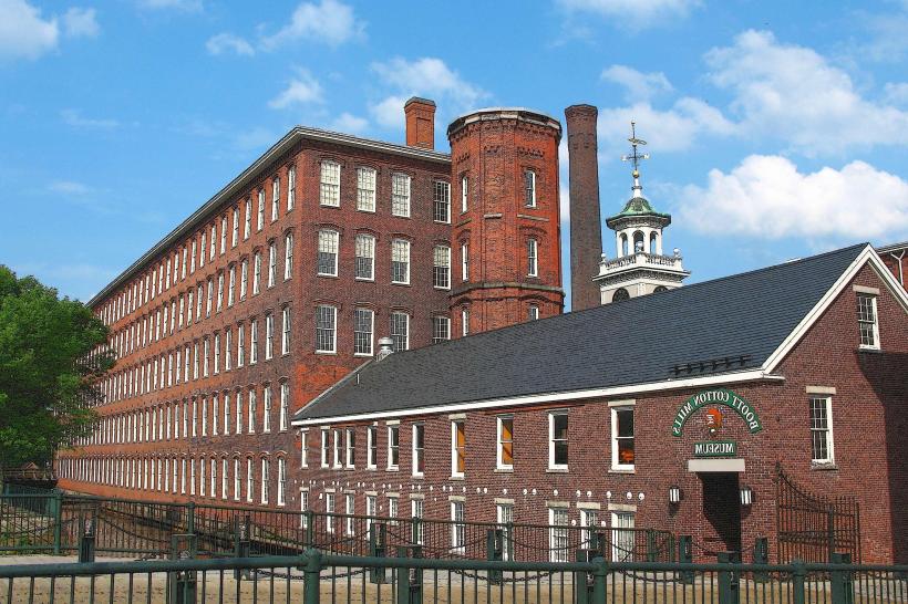
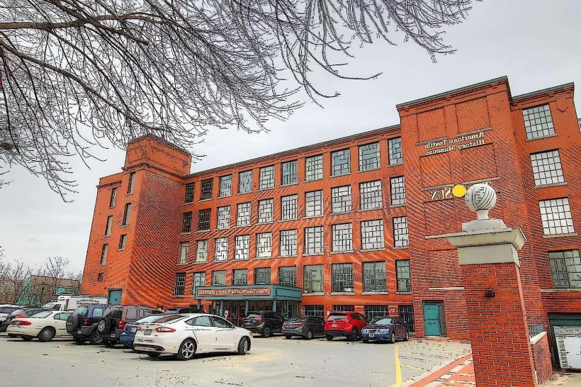
Boott Cotton Mills Museum
Housed in a restored 19th-century mill, the Boott Cotton Mills Museum showcases the machinery and processes used in textile production. Visitors can see functioning looms and spinning machines, offering a tactile and visual understanding of how cotton was transformed into fabric. Historic photos, artifacts, and interpretive displays detail the lives of the mill workers and the innovations that shaped Lowell’s economy.
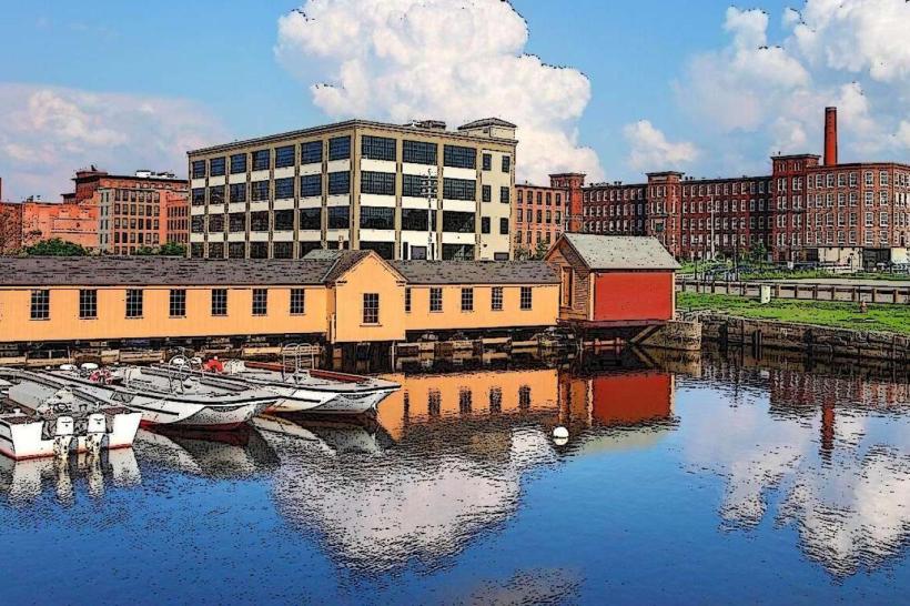
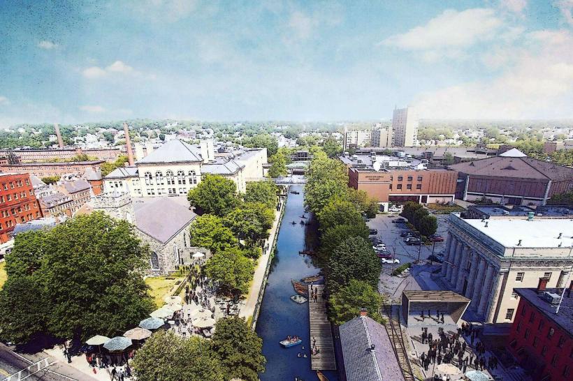
Lowell Canal System
The park preserves a network of canals that powered the city’s mills, providing both energy and transportation. Visitors can walk along the scenic canal walkways, where interpretive panels explain how waterpower drove industrial growth. Boat tours on the canals offer a unique perspective of the city’s industrial landscape, highlighting the engineering ingenuity of the era.
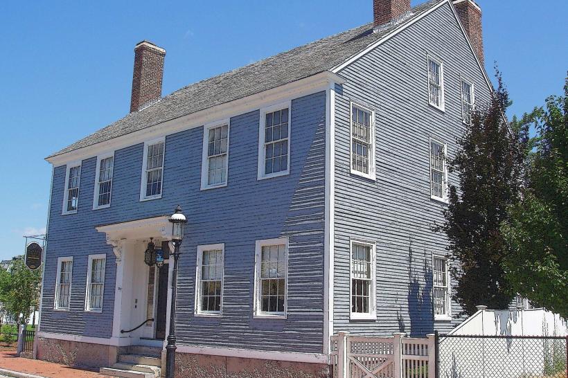
Boarding Houses and Worker Life
The park includes several restored boarding houses where mill workers, particularly young women known as “Lowell mill girls,” lived during the 19th century. Guided tours offer insights into daily routines, social life, and the challenges of living in a tightly structured industrial environment. Exhibits highlight education, labor organizing, and the cultural impact of the workforce on the city.
National Historical Park Visitor Center
The visitor center provides an orientation to the park with interactive exhibits, multimedia presentations, and educational programs. Rangers and staff offer guided tours, talks, and workshops to help visitors understand the broader significance of Lowell’s industrial history, labor movements, and urban development.
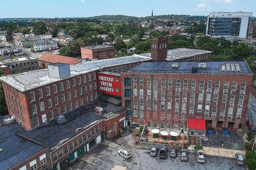
Boott Cotton Mills Historic District
The district encompasses the original mill buildings, worker housing, and industrial infrastructure, all preserved to reflect the city’s peak industrial period. Visitors can explore textile production areas, watch demonstrations, and experience immersive storytelling about Lowell’s transformation from a rural town to a bustling industrial city.
Community and Cultural Programs
The park hosts festivals, lectures, and educational programs that celebrate Lowell’s diverse heritage, including its immigrant communities who contributed to the city’s growth. Special exhibits often focus on labor history, industrial innovation, and local arts, connecting past and present.
Visitor Experience
Walking through Lowell National Historical Park offers a layered experience of history, industry, and human stories. The combination of restored architecture, operational exhibits, canals, and interpretive programs allows visitors to engage with the industrial era in a tangible and memorable way. The park provides a vivid sense of how technological progress and labor shaped not only Lowell but also the broader development of American industry.