Information
Landmark: Manuel Antonio National ParkCity: Puntarenas
Country: Costa Rica
Continent: North America
Manuel Antonio National Park, Puntarenas, Costa Rica, North America
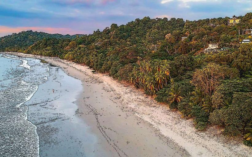
Manuel Antonio National Park is a protected area located on the Pacific coast of Costa Rica, within the Puntarenas province.
This park encompasses a significant portion of tropical rainforest and a coastline featuring several beaches.
Visual Characteristics
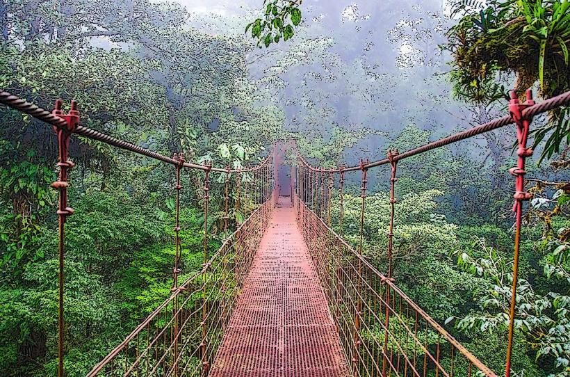
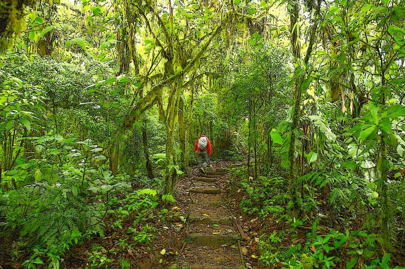
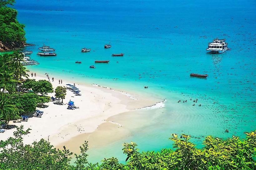
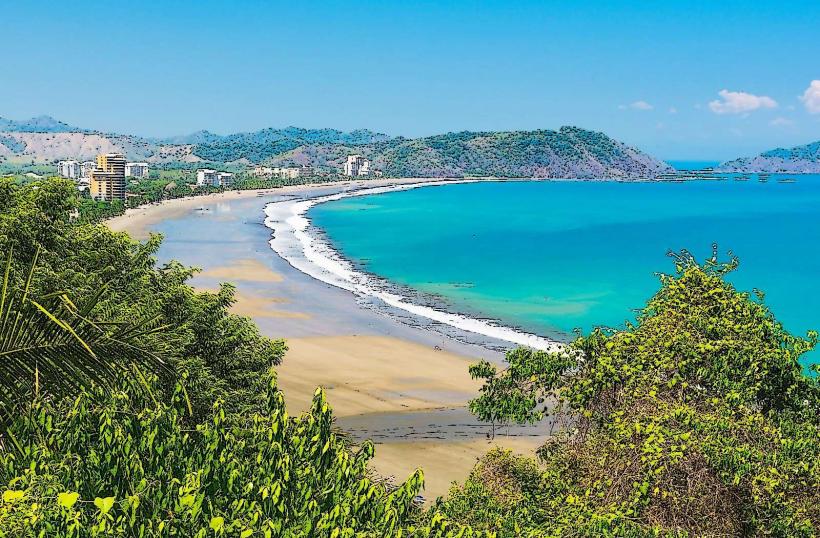
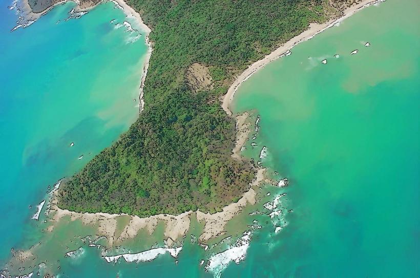
The park's coastline is characterized by white sand beaches, some with fine grain and others with coarser sand. Offshore, the water color ranges from turquoise to deep blue depending on depth and light conditions. The terrestrial environment consists of dense tropical rainforest with a canopy reaching up to 30 meters. Common tree species include Cecropia, Ceiba, and various palm varieties. Rock formations are present along the shoreline, particularly at the headlands separating the beaches.
Location & Access Logistics
Manuel Antonio National Park is situated approximately 7 kilometers south of the city of Quepos. Access is via Route 171, a paved road. From San José, the capital, it is approximately a 3-hour drive (157 km). Parking is available at designated lots outside the park entrance, with fees typically charged. Public bus services operate from Quepos to the park entrance, with departures every 30-60 minutes. The closest international airport is Juan Santamaría International Airport (SJO) near San José.
Historical & Ecological Origin
Manuel Antonio National Park was established on February 11, 1972, as a biological reserve and later designated a national park. Its primary purpose was to protect the region's biodiversity and coastal ecosystems. Ecologically, the park is classified as a tropical wet forest and coastal marine ecosystem. The geological formations are primarily sedimentary rocks of volcanic origin, shaped by coastal erosion.
Key Highlights & Activities
Activities include hiking on marked trails such as the Sloth Trail and the Waterfall Trail. Wildlife observation is a primary activity, with opportunities to see white-faced capuchin monkeys, howler monkeys, sloths, iguanas, and numerous bird species. Swimming and sunbathing are permitted on the park's beaches, including Playa Manuel Antonio and Playa Espadilla Sur. Snorkeling is possible in designated areas, particularly during calm sea conditions.
Infrastructure & Amenities
Restrooms are available at the park entrance and at key points along the main trails. Shade is provided by the forest canopy and some designated picnic areas. Cell phone signal (4G/5G) is generally available within the park, though it can be intermittent in denser forest areas. Food vendors and restaurants are located outside the park entrance and in the town of Manuel Antonio, but food is not permitted inside the park itself.
Best Time to Visit
The best time of day for wildlife viewing is typically early morning or late afternoon when animals are most active. The dry season, from December to April, offers the most favorable weather conditions with less rainfall. The wet season, from May to November, can bring afternoon showers but also results in lusher vegetation. High tide can affect access to certain beach areas.
Facts & Legends
A local legend suggests the park is named after a Spanish conquistador named Manuel Antonio, who supposedly owned the land and used it as a refuge. However, historical records do not confirm this individual's existence or ownership. A verified fact is that the park's coastline was once a significant site for indigenous populations, with archaeological evidence found in the vicinity.
Nearby Landmarks
- Quepos Marina (2.5km Northwest)
- Playa Espadilla Norte (0.3km West)
- Rainmaker Conservation Park (15km Northeast)
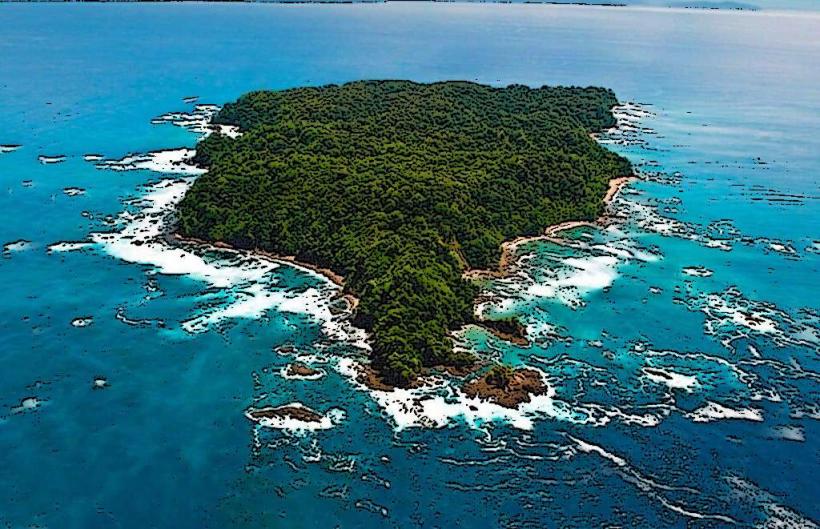
- Damas Island Estuary (8km Northwest)