Information
Landmark: Mnazi Bay Ruvuma Estuary Marine ParkCity: Mtwara
Country: Tanzania
Continent: Africa
Mnazi Bay Ruvuma Estuary Marine Park, Mtwara, Tanzania, Africa
Mnazi Bay Ruvuma Estuary Marine Park is a protected marine area situated in the Mtwara Region of Tanzania. It encompasses a significant portion of the coastline and estuarine environment along the Ruvuma River.
Visual Characteristics
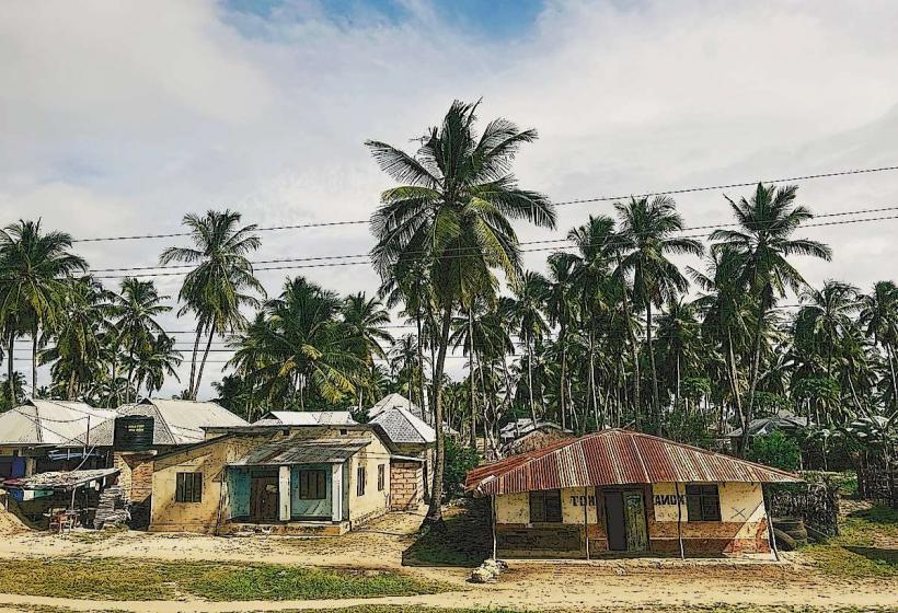
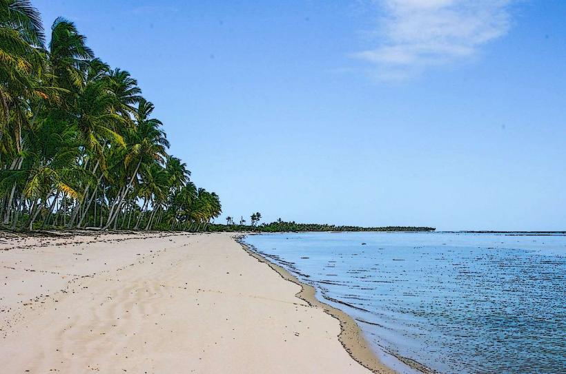
The park features a coastline with sandy beaches and mangrove forests. The waters within the bay are generally clear, with visibility varying based on tidal conditions and sediment runoff from the Ruvuma River. Coral reefs are present in offshore areas. Vegetation is dominated by mangrove species such as Rhizophora mucronata and Ceriops tagal along the intertidal zones.
Location & Access Logistics
The park is located approximately 10 kilometers south of Mtwara town. Access is primarily via the Mtwara-Newala road (T18). Turn off onto local tracks leading to the coast. Parking is available at designated points near fishing villages such as Msimbati. Public transport options include daladalas (minibuses) from Mtwara to Msimbati, followed by a short walk or local boat hire.
Historical & Ecological Origin
Mnazi Bay Ruvuma Estuary Marine Park was established in 2013 to conserve marine biodiversity and support sustainable livelihoods. Ecologically, it represents a transition zone between marine and estuarine environments, supporting a diverse range of species adapted to varying salinity levels. The mangrove forests are crucial nurseries for fish and protect the coastline from erosion.
Key Highlights & Activities
Snorkeling and diving are possible in areas with coral reefs, particularly offshore. Boat tours are available for observing marine life and navigating the estuary. Birdwatching is a significant activity, with numerous resident and migratory species present. Kayaking within the mangrove channels is also an option.
Infrastructure & Amenities
Basic amenities are limited within the park boundaries. Small local eateries may be found in nearby villages. Restrooms are not consistently available at all access points. Cell phone signal (2G/3G) is generally present in coastal villages but can be intermittent within the park itself. Shade is provided by mangrove canopies in certain areas.
Best Time to Visit
The dry season, from June to October, offers the most favorable weather conditions with reduced rainfall and clearer waters. For optimal snorkeling and diving visibility, visits during the neap tides are recommended. Early morning and late afternoon provide the best lighting for photography.
Facts & Legends
The Ruvuma River estuary is known for its significant mangrove coverage, which plays a vital role in coastal protection and fisheries productivity. Local folklore speaks of ancient spirits guarding the mangrove roots, believed to influence the abundance of marine life.
Nearby Landmarks
- Msimbati Beach (0.8km South)
- Ruvuma River Estuary Mouth (2.5km East)
- Mtwara Port (12km North)
- Mikindani Old Town (15km North)