Information
Landmark: Mtwara CoastlineCity: Mtwara
Country: Tanzania
Continent: Africa
Mtwara Coastline, Mtwara, Tanzania, Africa
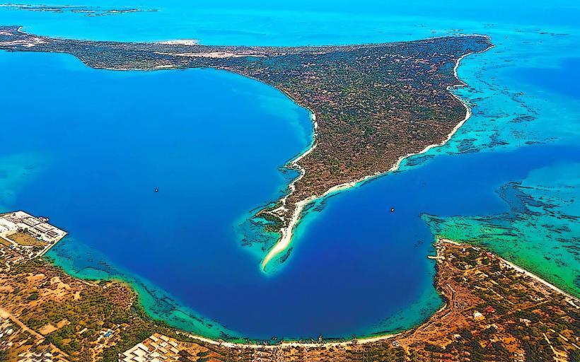
The Mtwara Coastline is a stretch of Indian Ocean shoreline located in the Mtwara Region of southeastern Tanzania. It encompasses a diverse range of coastal features, including beaches, mangrove forests, and rocky outcrops.
Visual Characteristics
The coastline features sandy beaches with varying grain sizes, from fine to coarse. Offshore, the water color ranges from turquoise in shallow areas to deep blue in deeper channels. Mangrove forests, characterized by dense, salt-tolerant trees with exposed root systems, line many of the estuarine sections. Rocky headlands and cliffs are present in certain areas, composed of sedimentary rock formations.
Location & Access Logistics
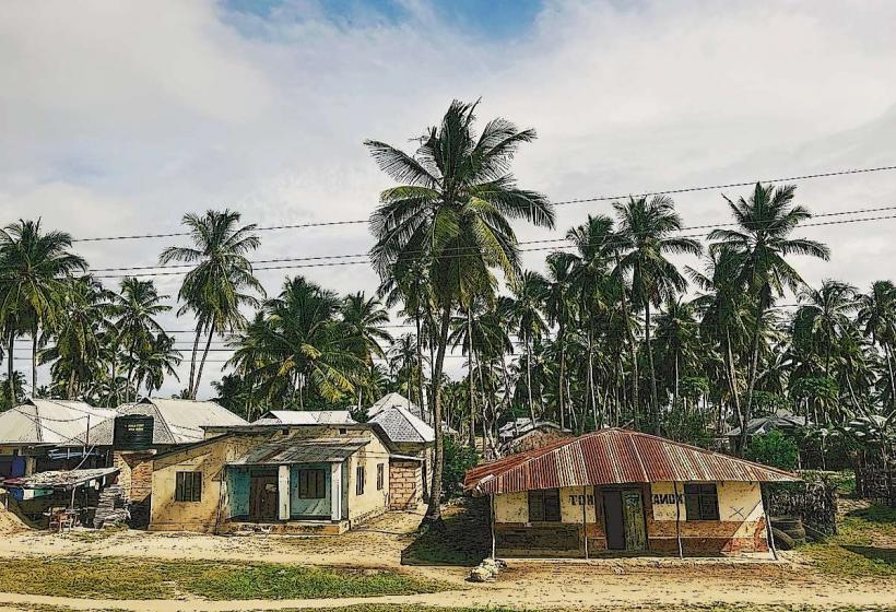
The Mtwara Coastline is accessible from the city of Mtwara. The main access point is via the Mtwara-Newala Road (T18), which runs parallel to the coast in sections. Several unpaved local roads branch off the T18, leading to specific beach access points and fishing villages. Parking is generally available on unpaved areas near access points, though it is informal. Public transport options are limited to daladalas (minibuses) that operate between Mtwara and surrounding villages; specific stops for coastal access require local arrangement or walking from the nearest daladala route.
Historical & Ecological Origin
The geological formations of the Mtwara Coastline are primarily sedimentary, deposited over millions of years. The mangrove ecosystems are a result of the interaction between freshwater river systems and the saline Indian Ocean, creating intertidal zones crucial for biodiversity. Historically, the coastline has been utilized by local communities for fishing and trade for centuries.
Key Highlights & Activities
Activities include walking along the beaches, observing local fishing practices, and exploring mangrove areas. Boat trips can be arranged with local fishermen for coastal exploration. Swimming is possible in designated calm areas, particularly during low tide when some sandbars are exposed.
Infrastructure & Amenities
Basic amenities are scarce directly on the coastline. Restrooms are generally not available at most access points. Shade is provided by natural vegetation in some areas. Cell phone signal (2G/3G) is intermittent and depends on proximity to Mtwara town. Food vendors are typically found in nearby villages rather than directly on the beaches.
Best Time to Visit
The best time for clear visibility and calmer seas is during the dry season, from June to October. The early morning and late afternoon offer optimal lighting conditions for photography due to the angle of the sun. Tidal patterns influence access to certain areas; checking local tide charts is advisable for exploring exposed sandbars or navigating shallow channels.
Facts & Legends
Local folklore speaks of ancient trade routes that passed along this coastline, with tales of dhows carrying goods from distant lands. A specific point of interest is the presence of fossilized marine life found in some of the coastal rock formations, indicating past sea levels.
Nearby Landmarks
- Mtwara City Center (2km Northwest)
- Mnazi Bay-Ruvuma Estuaries Marine Park (15km Southeast)
- Mikindani Old Town (25km Northwest)
- Ndanda Mission Hospital (40km West)